
North Slope by Fat-Bike or The White Gas For White Guys Expedition

Deadhorse to Trailhead
Over 20 years ago, my friend and mentor, Roger Cowles, told me a story about being in Utqiagvik (Barrow) and being able to ski to Wainwright in one continuous push – a distance of over 100 miles. Roger had been in Utqiagvik to help with a bowhead whale survey. The snow, while he was there, underwent a thaw and freeze cycle, making the surface rock hard; he saw an opportunity to ski far and fast. Roger’s story infected me all those years ago. Since then I have hoped to be available to attempt something similar on the Arctic Slope of Alaska with a fat-bike.
Early in the morning on the 6th of May, after pouring my first cup of coffee, I checked my Facebook and saw photos from my friend Qaiyaan, an Utqiagvik buddy. He’d been out on the country traveling by snowmachine and his images revealed what looked like ideal conditions for fast travel on snow over great distances. I immediately messaged him to confirm. “Yea dude, this is right snow conditions, u could have bikes for miles and Fucken miles,” came his response.
Now all I needed was a partner willing to drop everything and join me on a fools adventure. Hey, want to cross a couple hundred miles of the loneliest region of Alaska? No one has tried it on bike before, the snow may melt out at any minute, there are bears, we have to get past the hyper-secure-industrial-oil-lease-lands with a firearm and once we are underway we won’t see a soul. And we need to leave day after tomorrow. It should be fun.
Chief steward of the RV Sikuliaq and my long-time BFF, Mark Teckenbrock, was home in Seward with a couple weeks remaining between hitches. He took the bait and enthusiastically accepted the quixotic invitation.
Two days later we were on an Alaska Airlines jet to Prudhoe Bay with our loaded bikes and tummies full of butterflies.
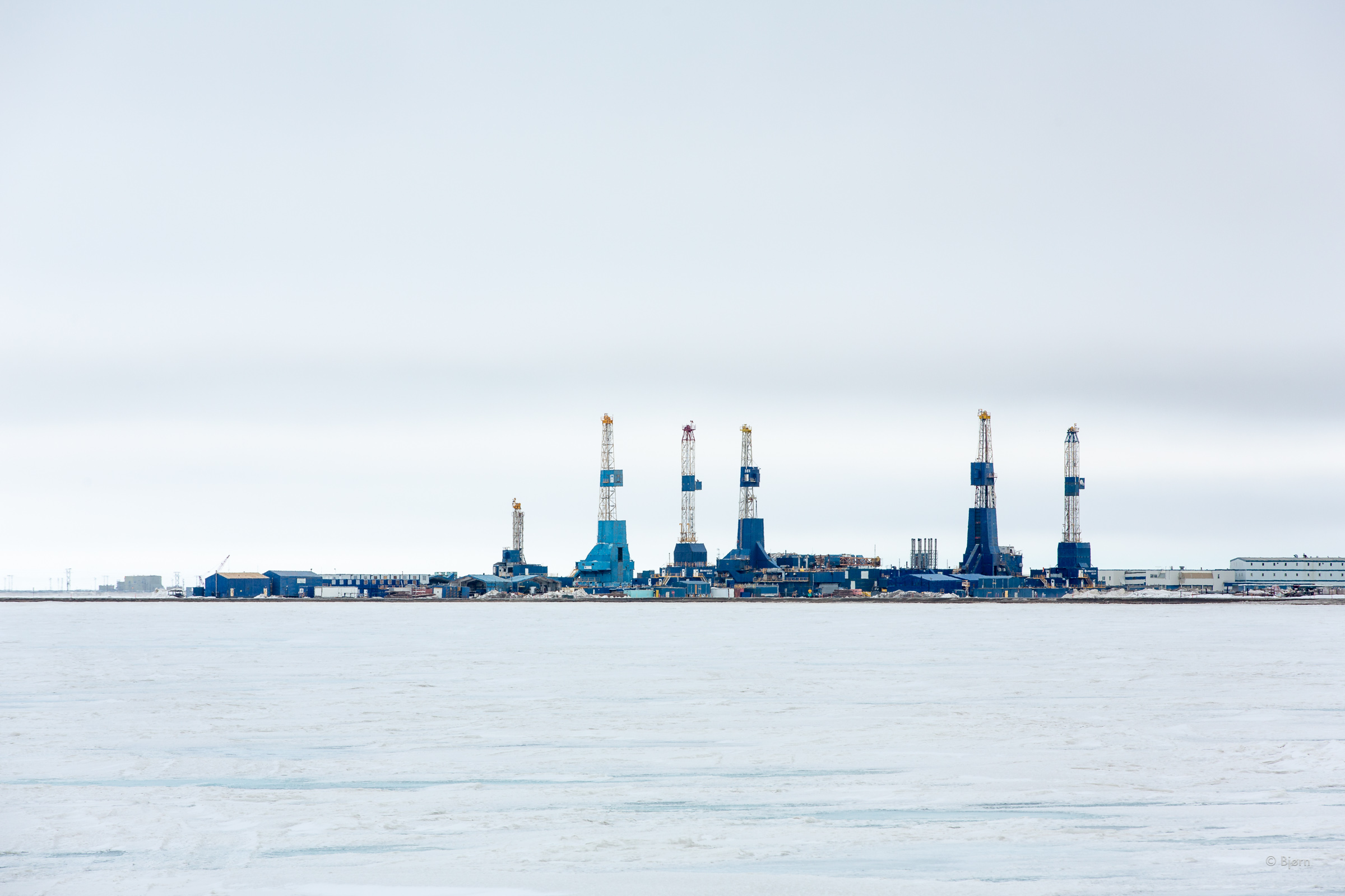
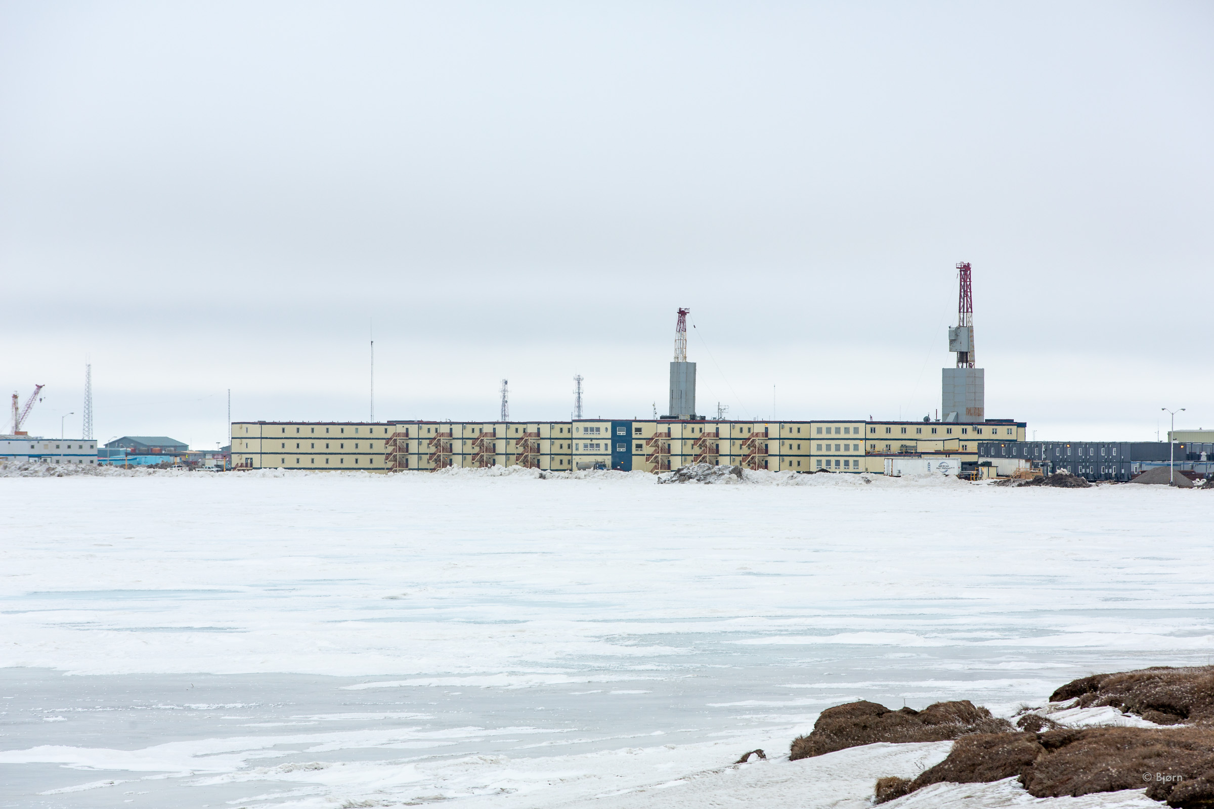
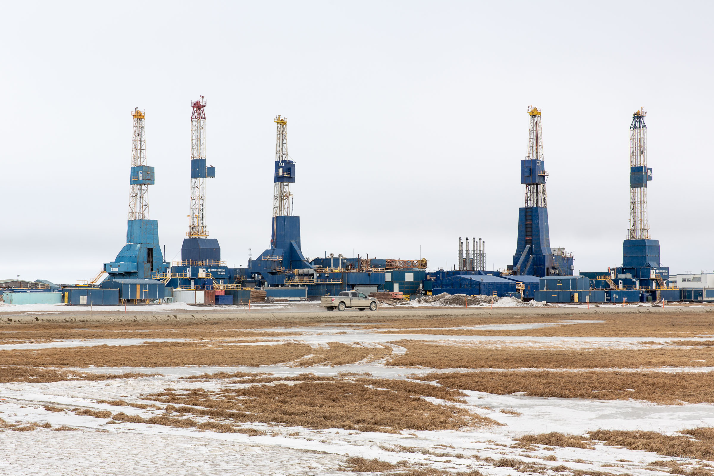
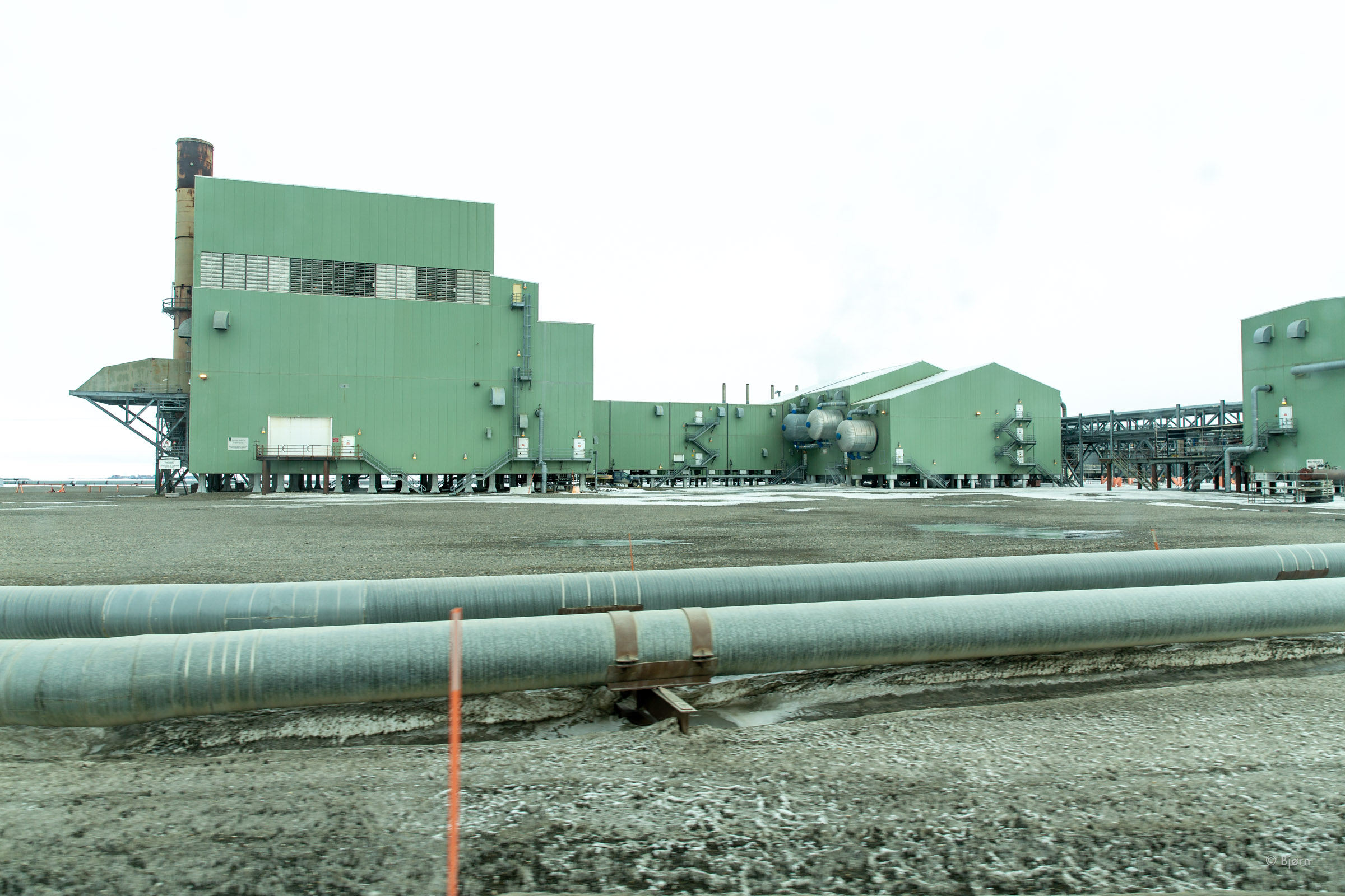
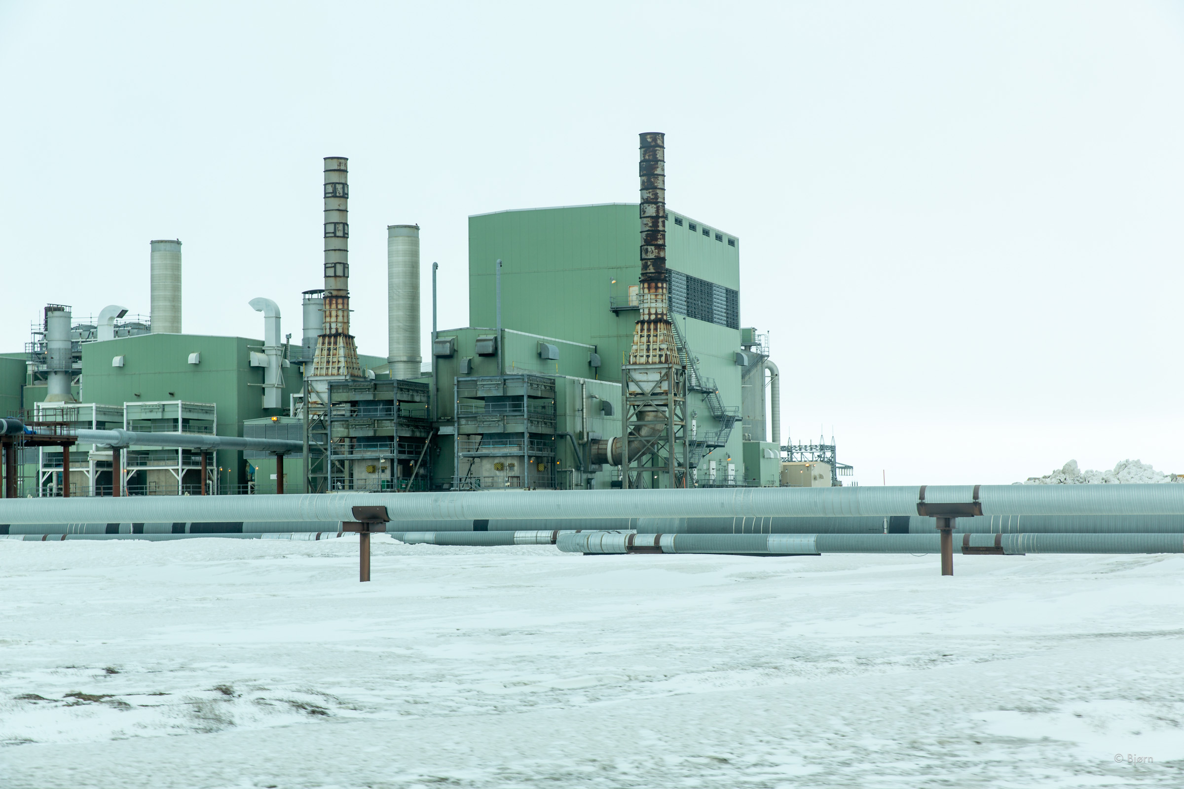
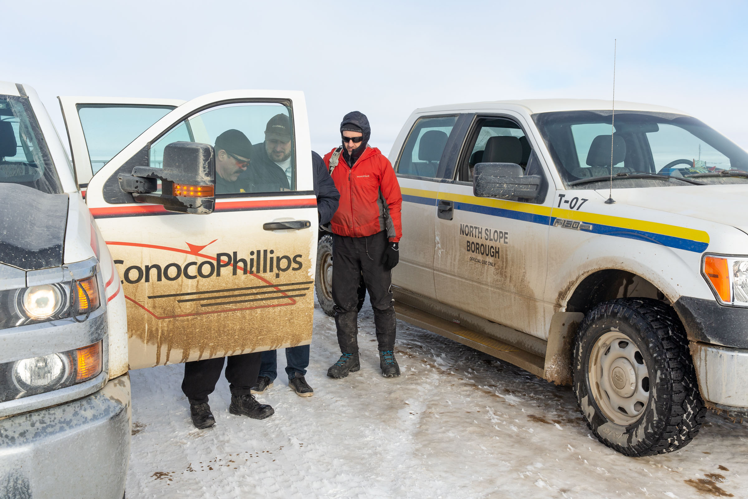
In Deadhorse—the industrial community on the North Slope of Alaska, full of man-camps and mostly out-of-region-oil-company-workers—Mark and I stood out like sore thumbs. Many people cycle up to Deadhorse along the Dalton Highway in the summer months but in the still-wintry month of May, our fat-bikes and Patagonia garb looked out of place amongst the Carhart-and-steel-toed-boot uniform of the oil-filed workers.
After putting our bikes together in a truck-warming bay at the airport, we rode across the street to the Prudhoe Bay Hotel. We had no idea how we were going to get past the secure oil fields and to the beginning of the trail we planned to follow. We hoped to get some information. On wilderness expeditions, I have come to depend upon local knowledge. In this instance, we were beginning our trip in a bustling community where no one is local and none had information. “CWAT Trail? Never heard of it.”
The hour was late; we’d both spent the previous evening frantically packing and had risen early to drive to Anchorage. We decided to get a meal and a room at the hotel and try to figure out this stubborn and atypical hurdle in the morning.
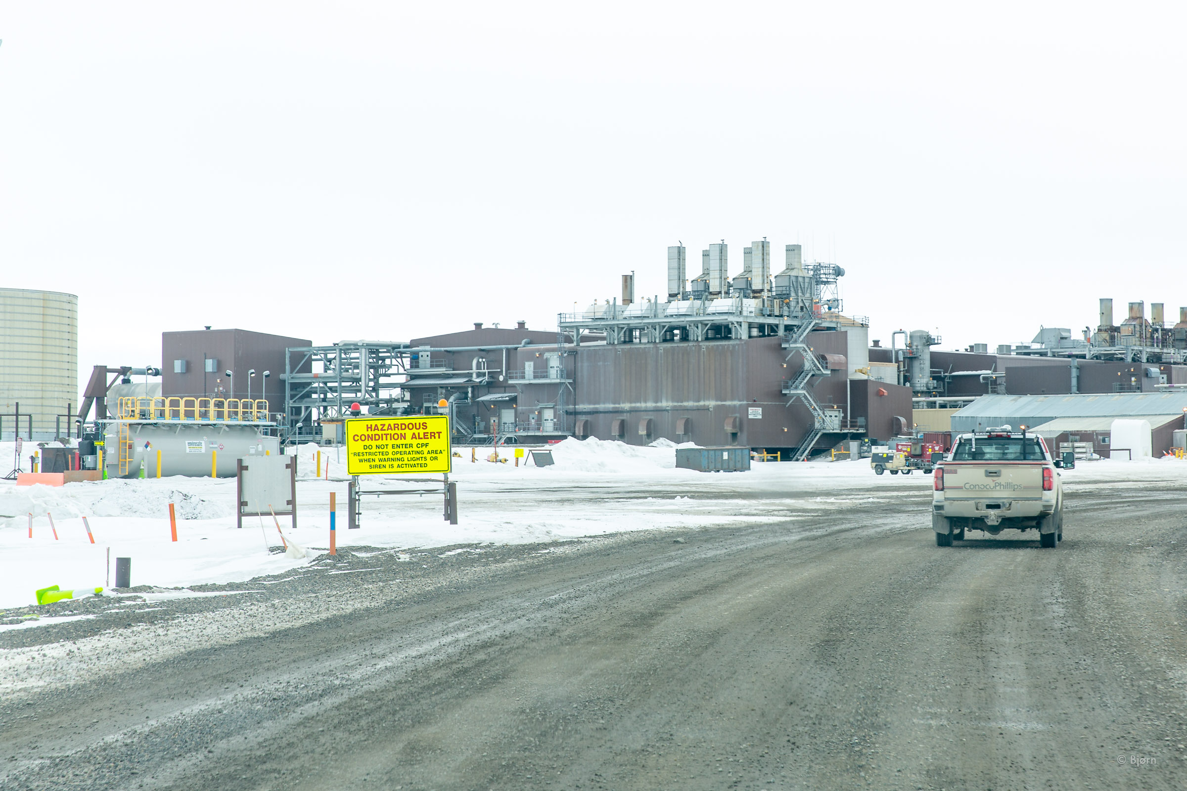
“Are you guys from Seward?” the security guard asked us as we walked into his office the following morning. “Yes,” we said. Although neither Mark nor I recognized him, we saw this as a sign that we had an above average chance of getting past the security impediment. Our hopes were quickly dashed. “Not a chance,” came Zack, the security guard’s, reply, after we explained what we were trying to do. “The only way to get through the oil field is if you have an identification badge for both BP and Conoco Philips, which you’d have to fly back to Anchorage to get.”
Zack was willing, however, to see what he could do but he gave little reason to hope. He called one superior after another to let us explain our situation and need over the speakerphone. From the higher-ups we received variations on the theme of “No,” and “Hell No.” Our prospects were looking grim until our helpful security guard told us of one option that remained: a transport from a North Slope Borough employee.
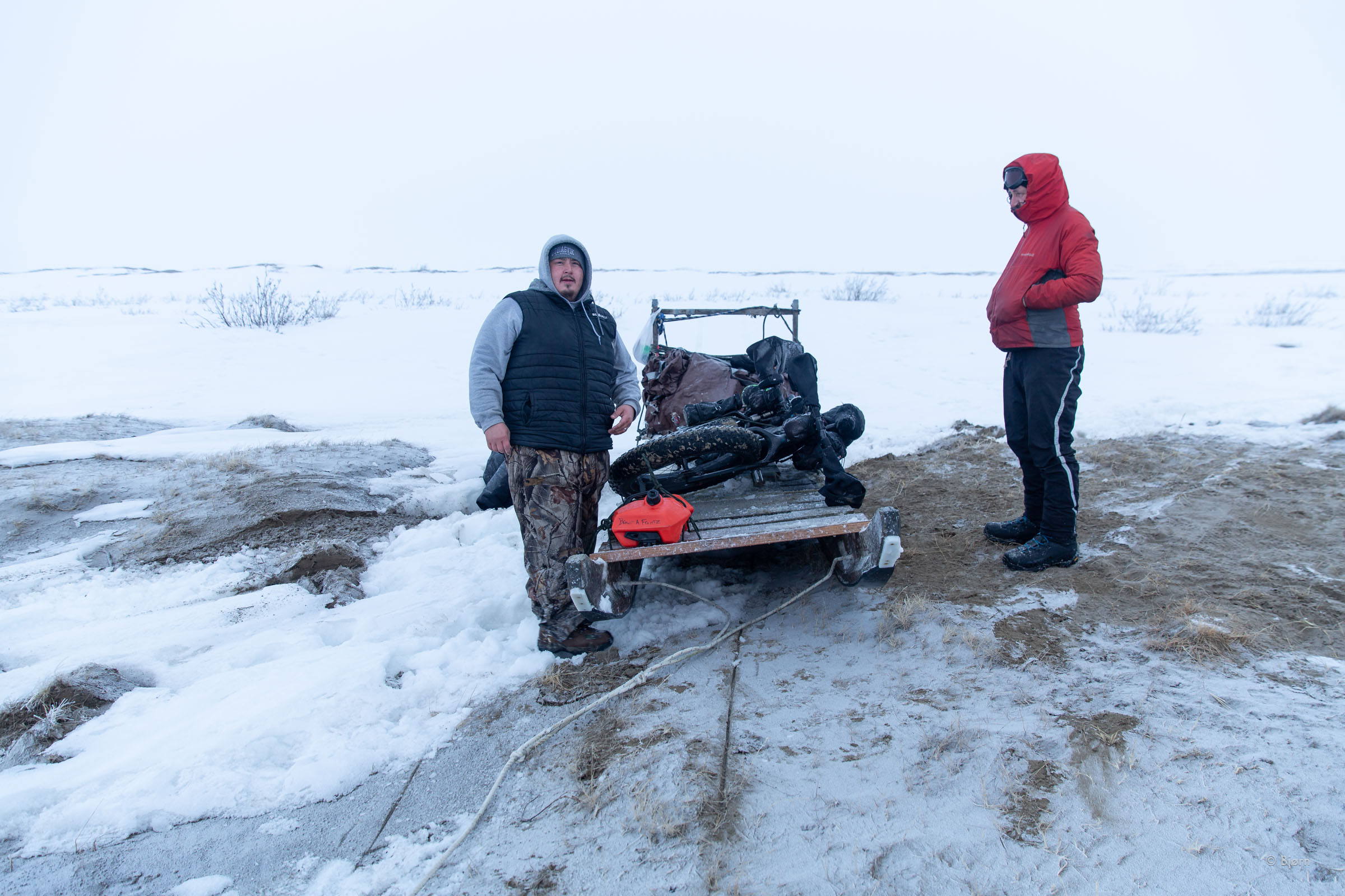
At the main borough office in Utqiagvik, Brower Frantz answered the phone. After explaining our situation and who we were, Brower told us that he might be able to help us reach the trailhead beyond the secure oilfield areas. A few hours later we were in a pickup truck, with our clearances and a security truck escort, in front, carrying our firearm, which we’d brought for bear protection. A more surreal beginning to an expedition I have never met.


Lost and Found and Lost and Found Again
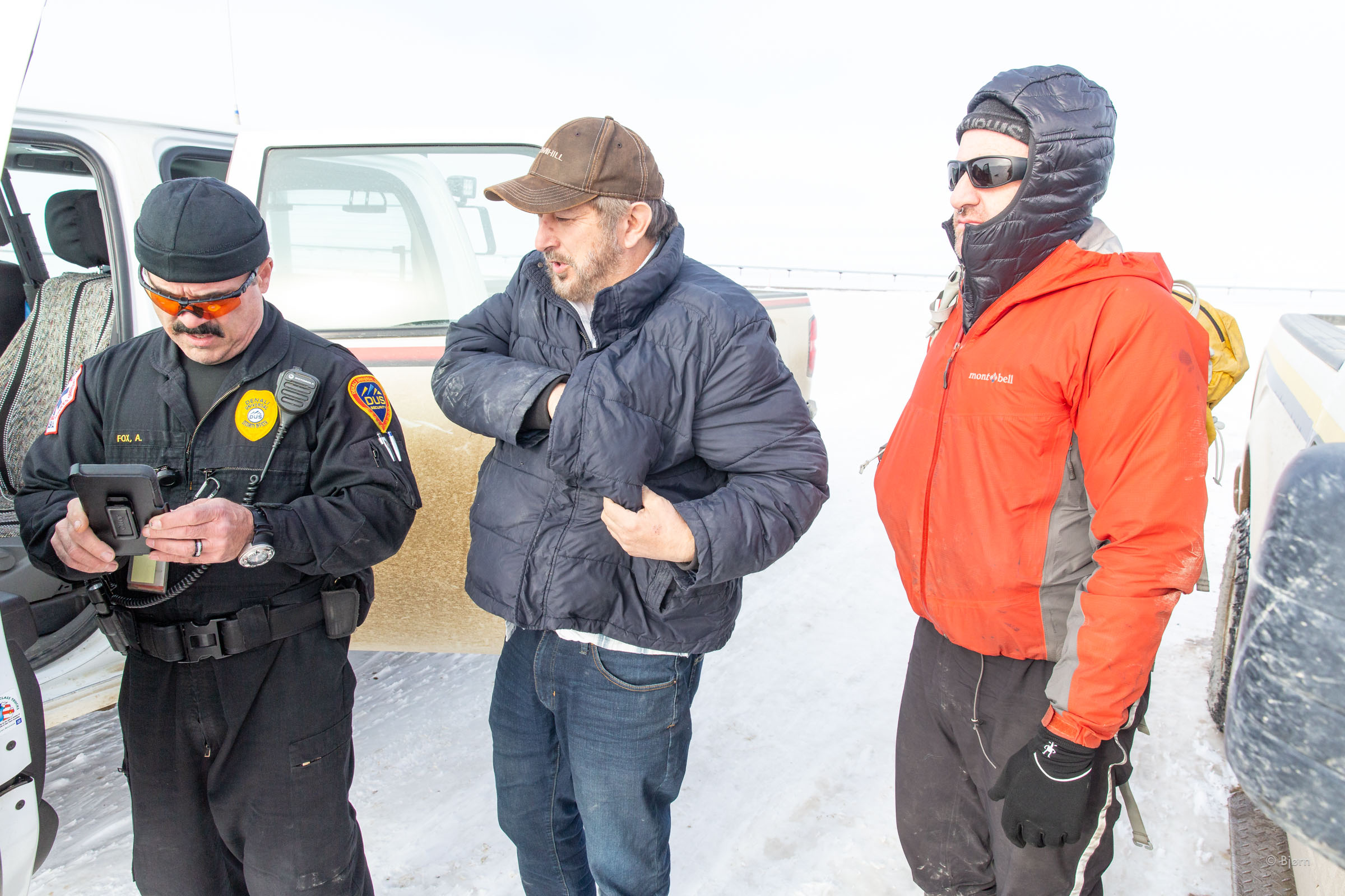
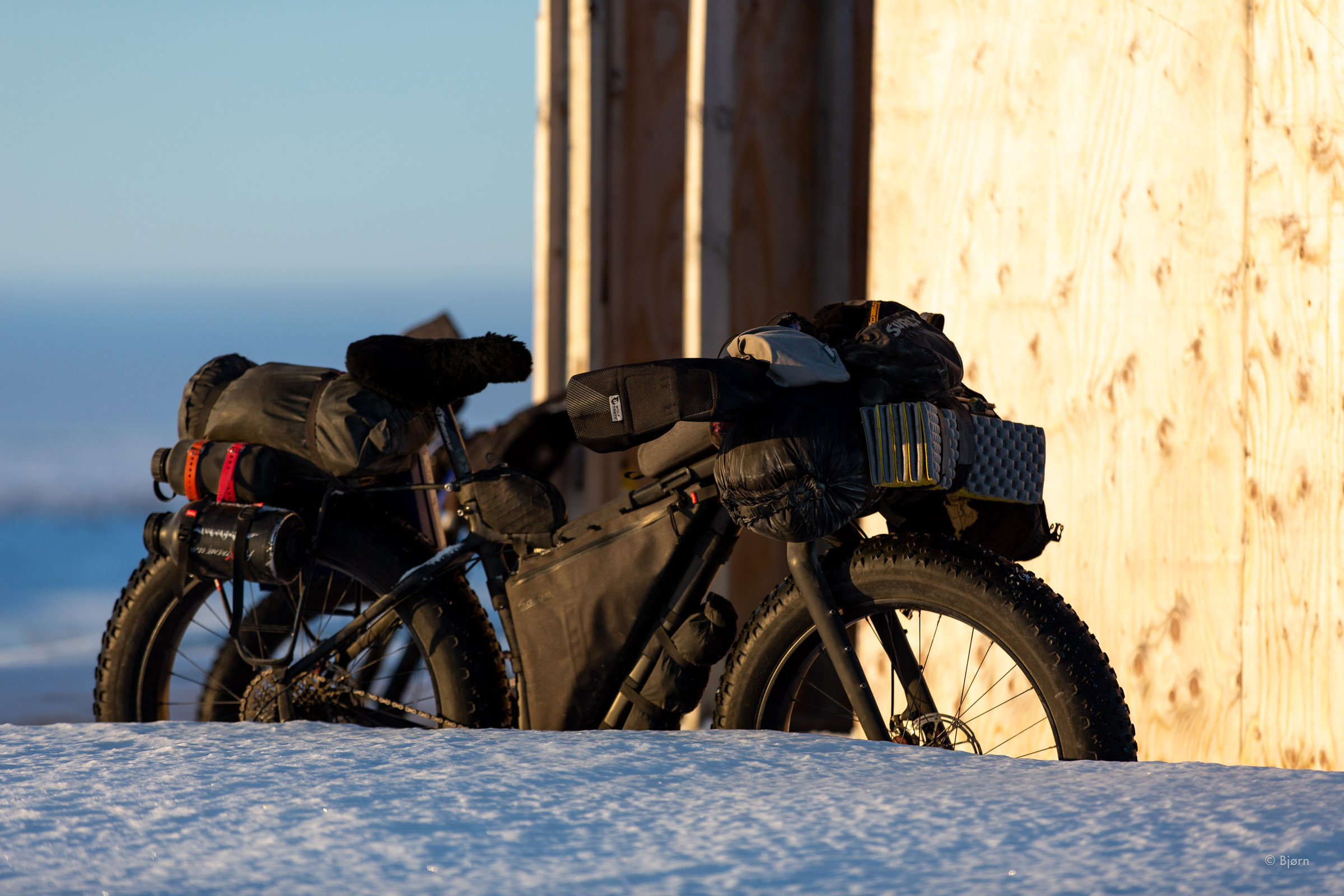
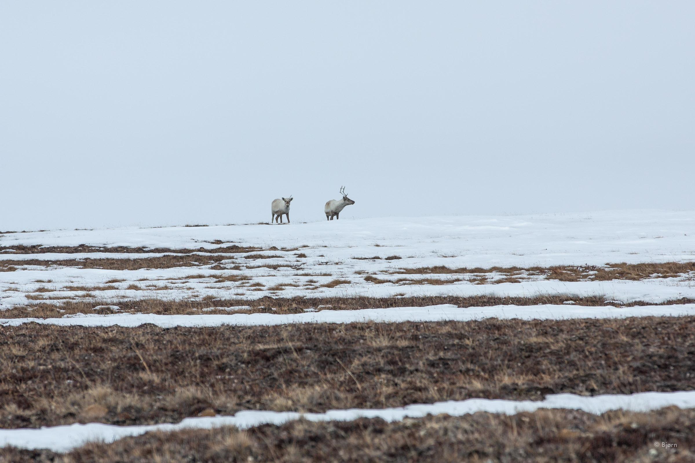
After passing through the BP oil filed lease area we met a Conoco Philips security driver and again gave him our gun to shuttle ahead of us. “They do this for the locals, too,” Tom Martell, our gracious borough driver told us. “Even bb guns are forbidden.” Typically, I prefer carrying bear spray over firearms for bear protection but the North Slope is a windy place. Brown bears were awake from their winter hibernation and although we’d be traveling on an inland trail, polar bears exist in this region. My friend Billy had lent me his 4” barrel 500 Smith and Wesson revolver – the largest handgun they make.
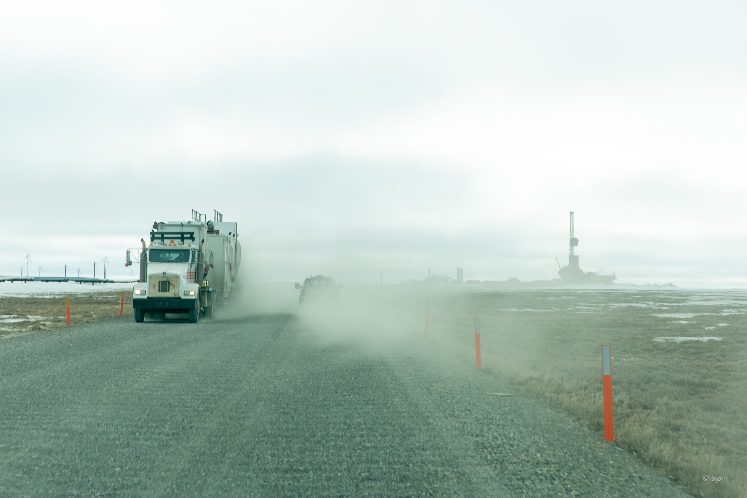
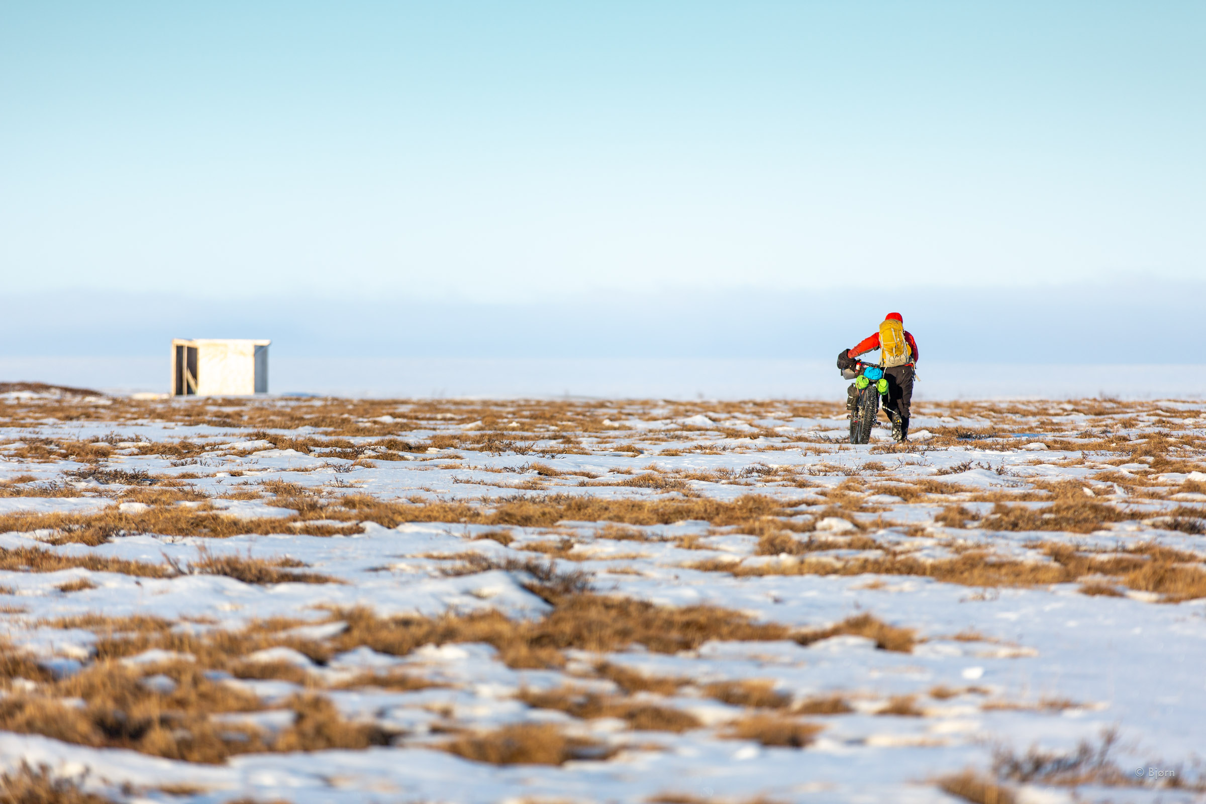
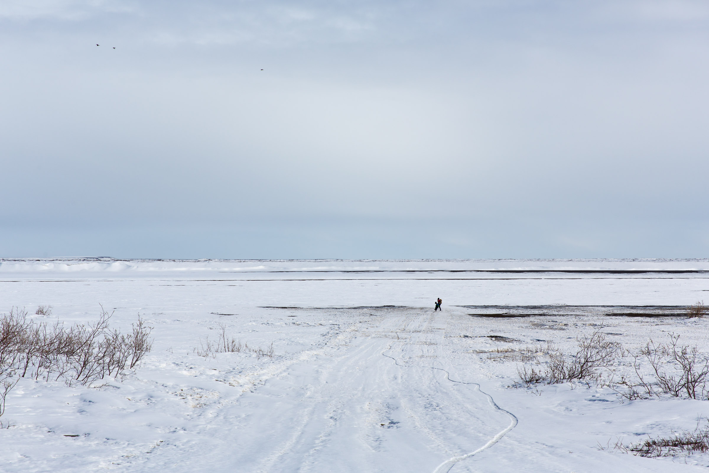
When we reached the end of our industrial road trip, the two trucks stopped and we got out. A post-apocalyptic Mad Max movie script swirled in my mind. We thanked Tom, unloaded our now dusty bikes from the bed of the truck and waved goodbye as they drove away.
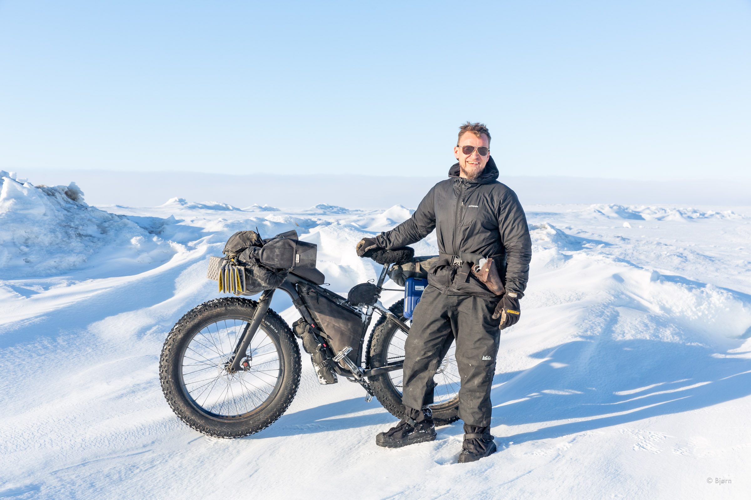
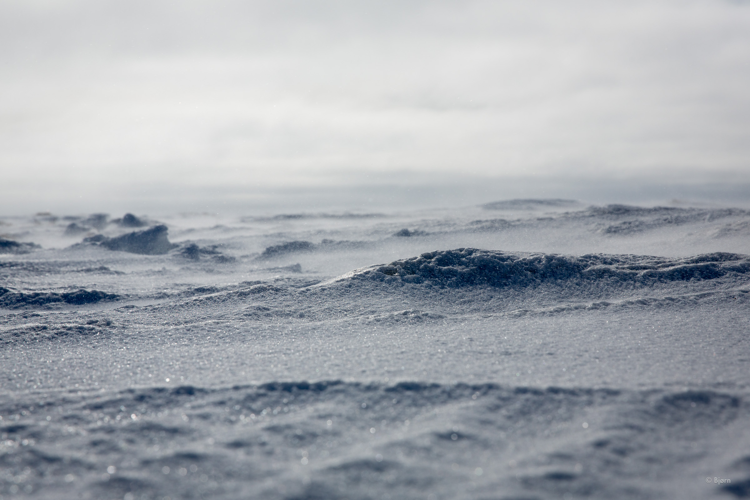
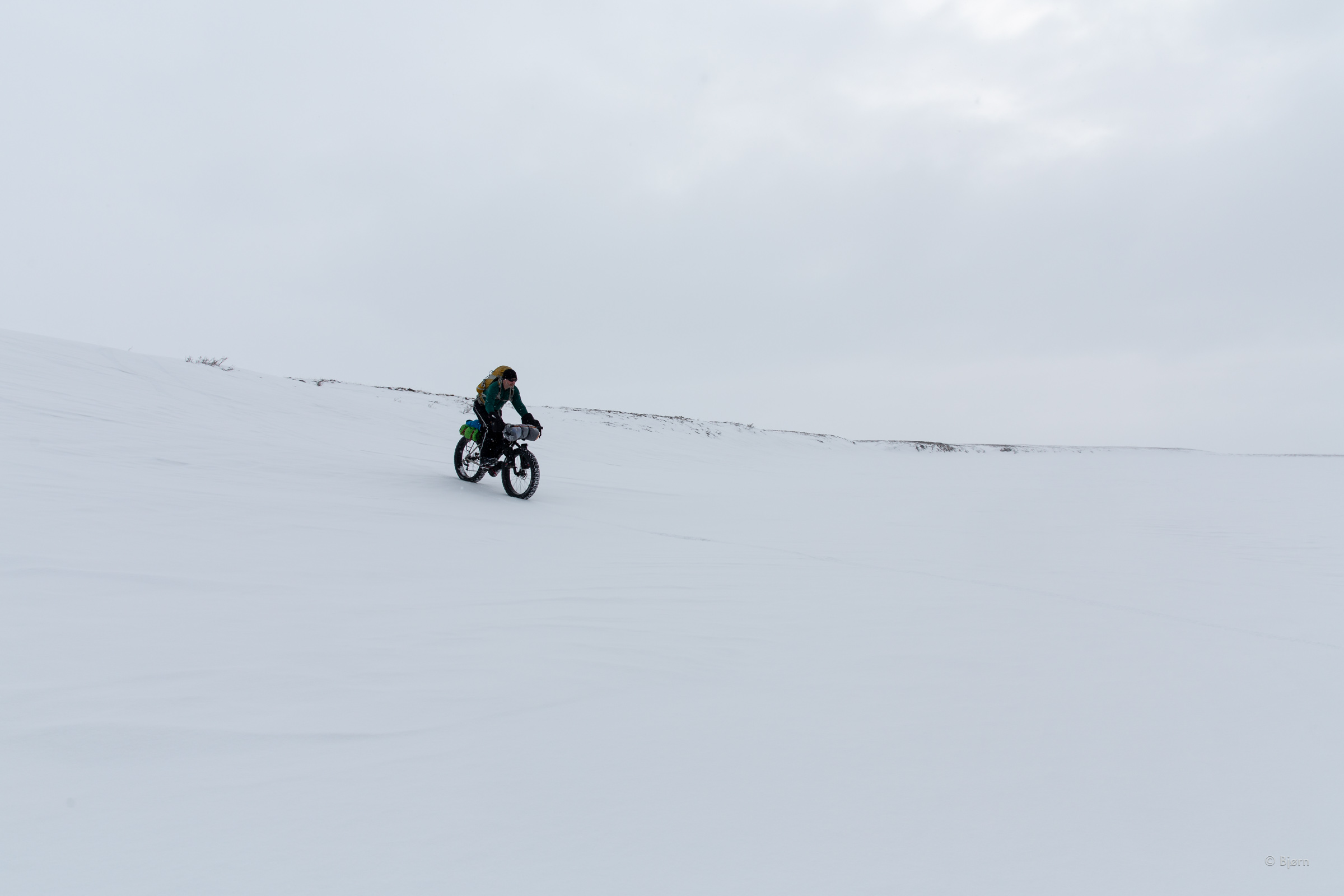
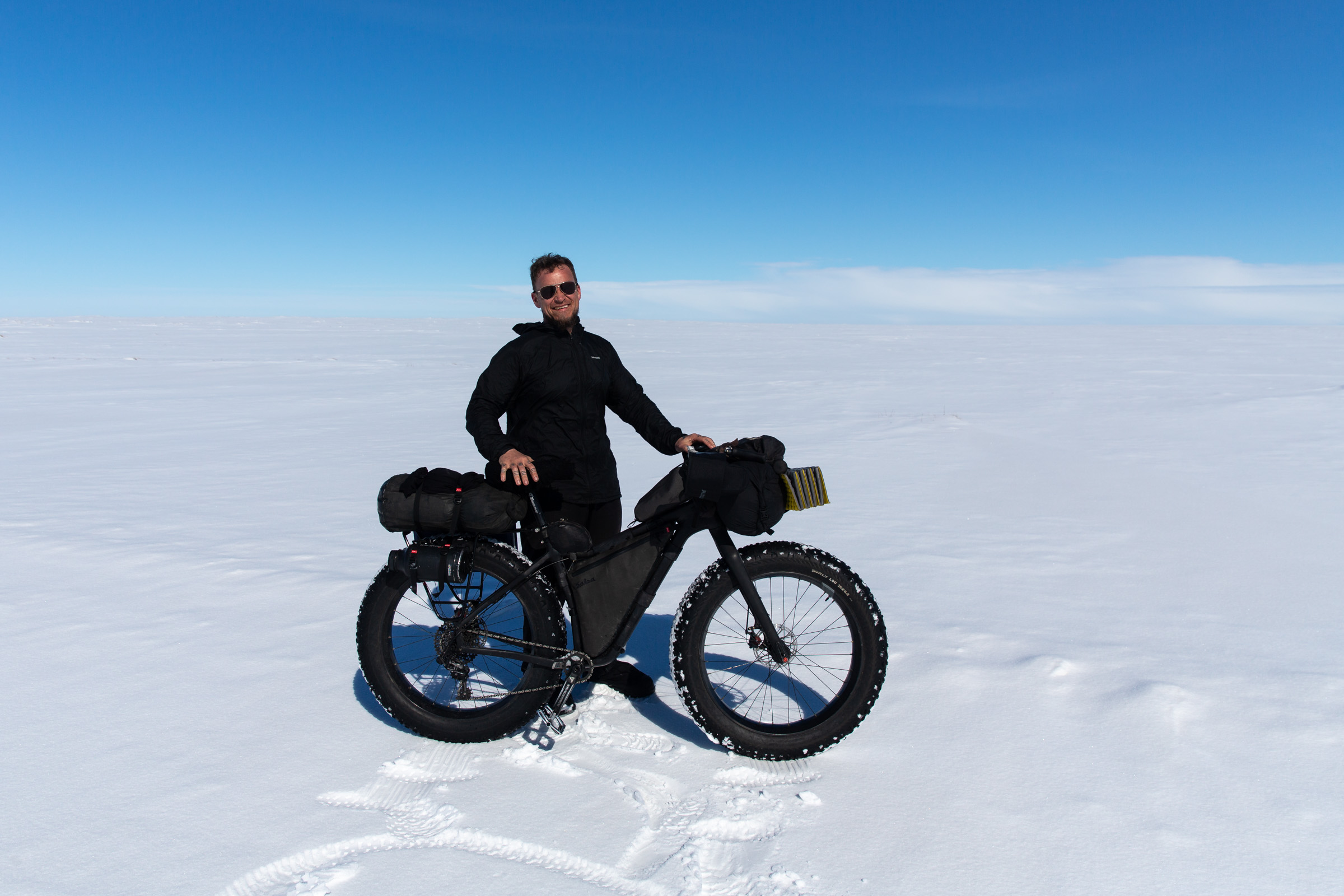
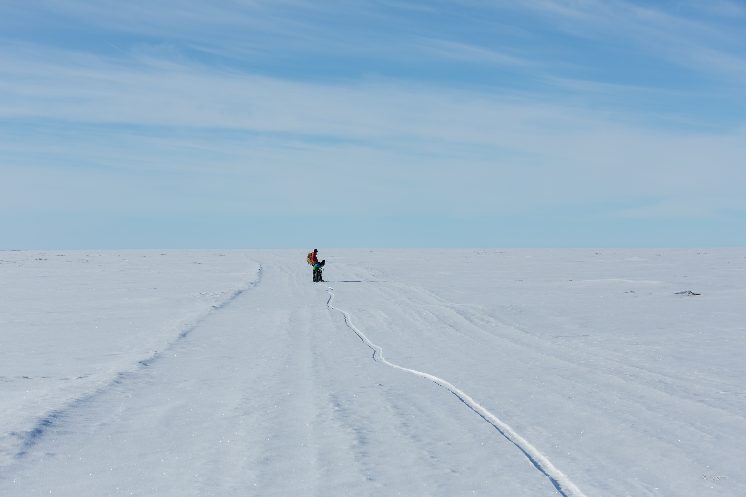
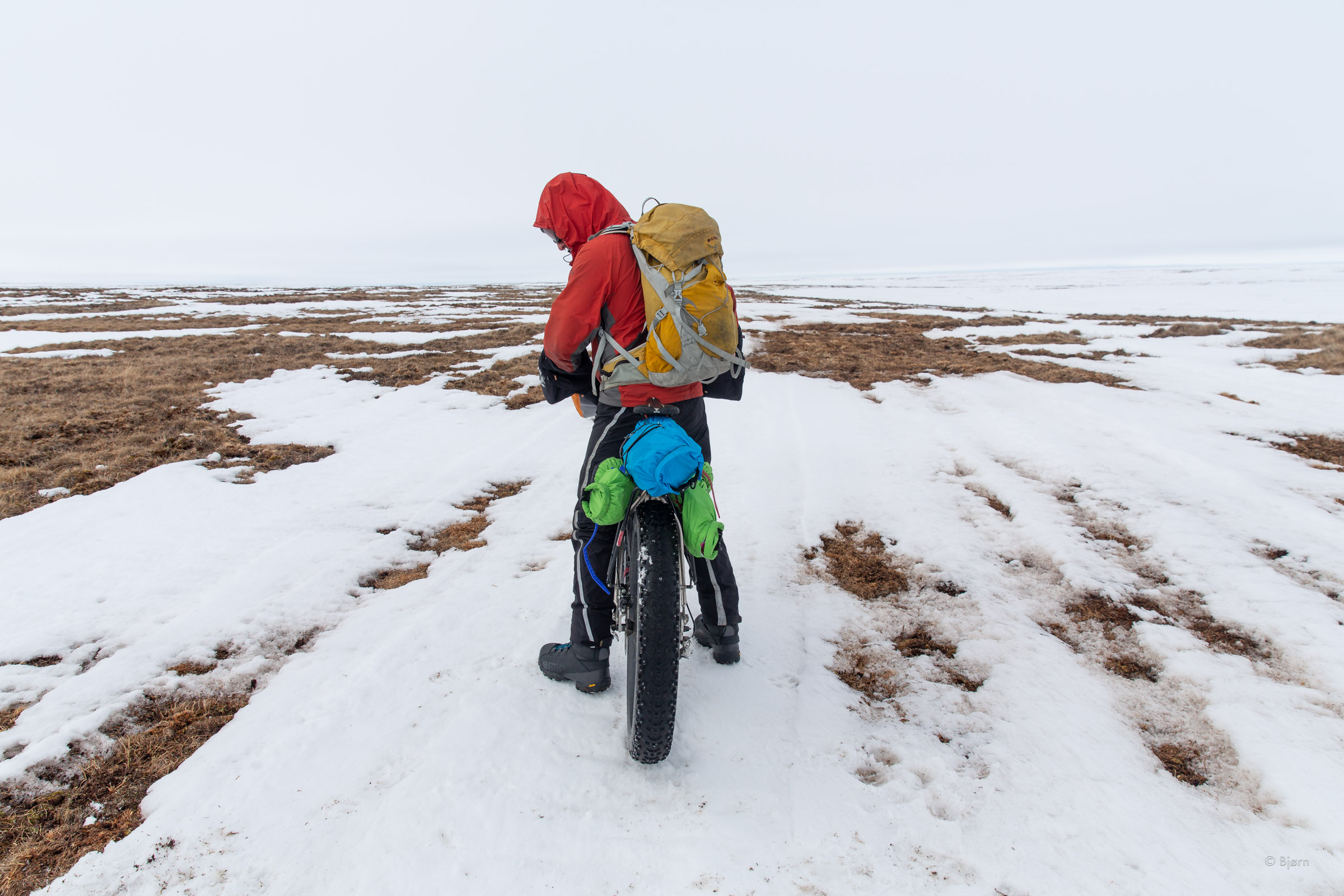
The profound and ominous sense of holy shit, we are fucking out here was quickly erased once we hit the trail. The conditions were exactly what we’d hoped they’d be – rock hard snow, verging on ice, with a strong easterly tail wind. The temperature was in the mid-20s; the afternoon sun was on our faces and my trepidations evaporated into bliss as we rode along at top speed.
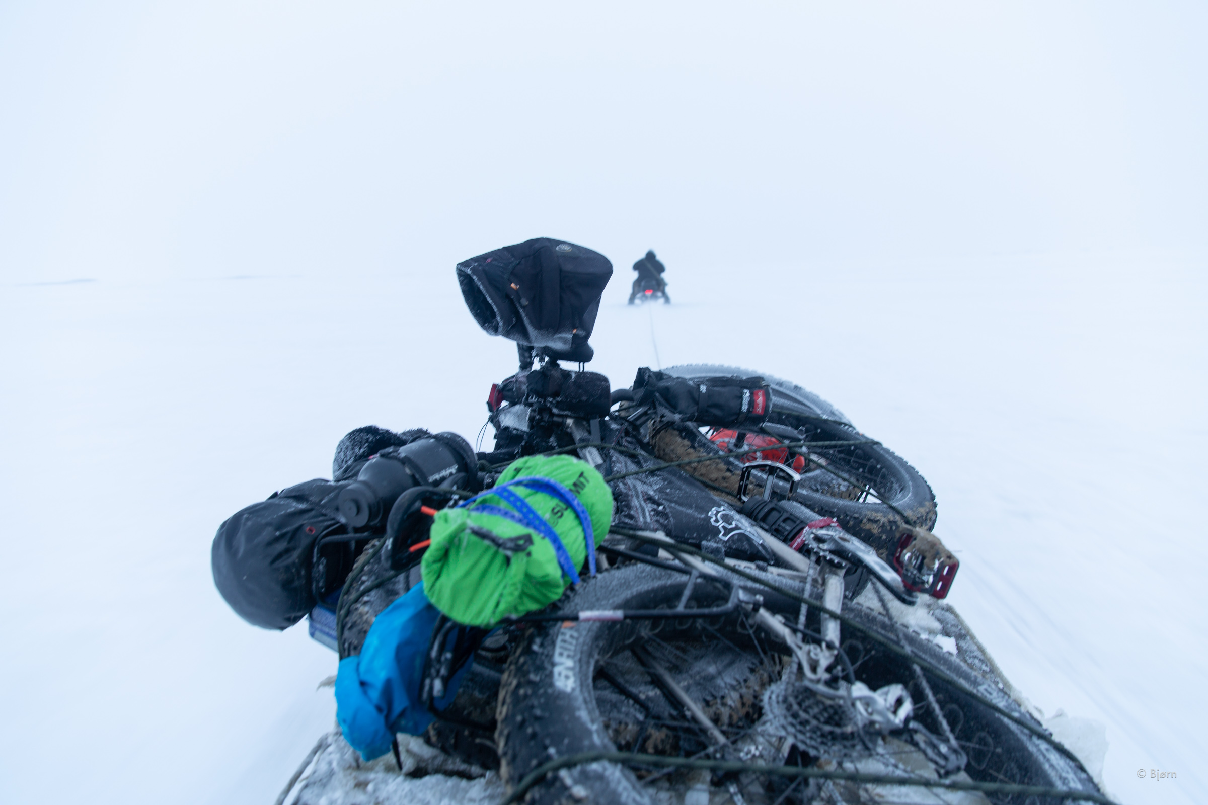
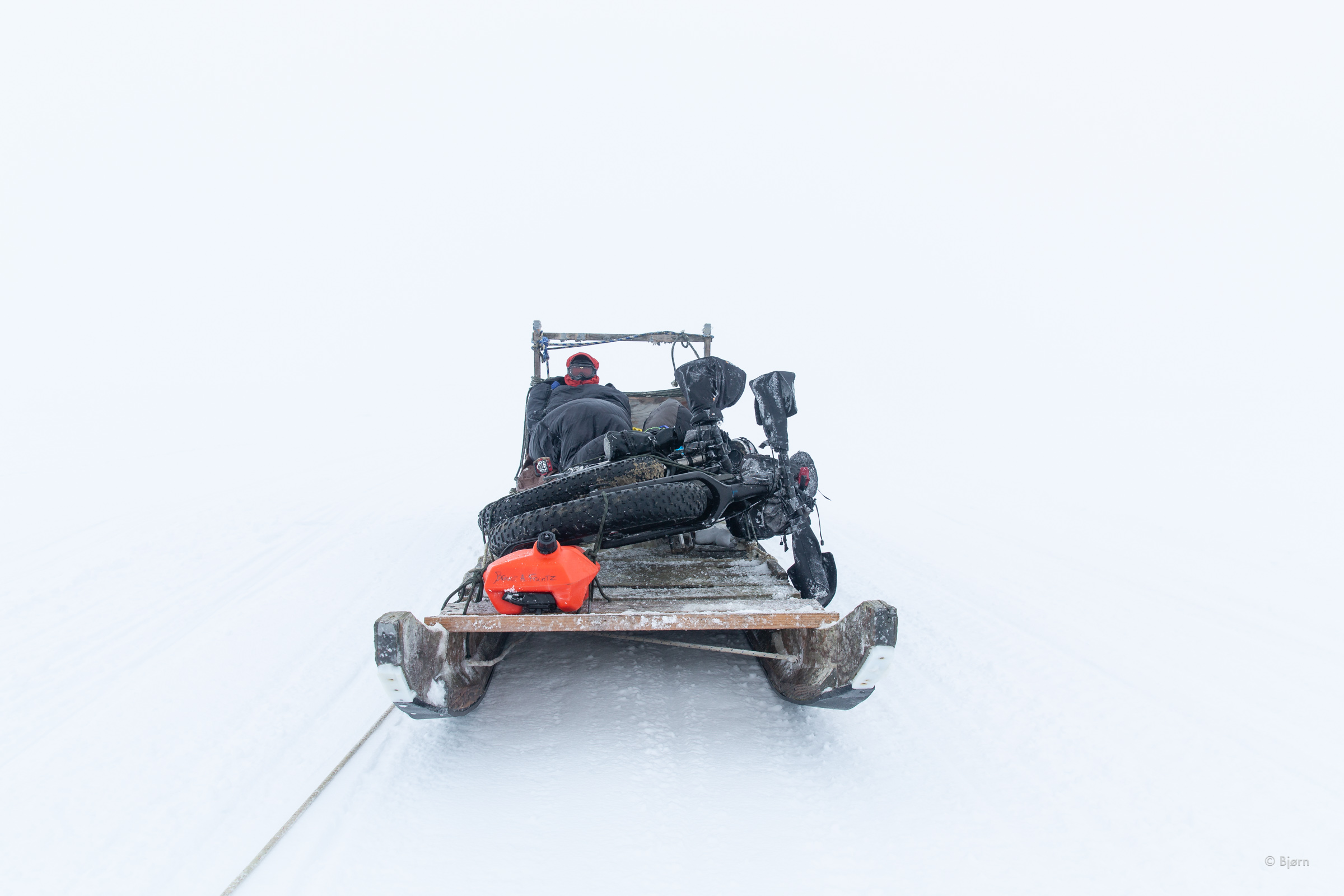
The CWAT Trail is a recent undertaking by the North Slope Borough. For the last two winters, the borough has groomed and maintained an overland route from Utqiagvik to Deadhorse to allow residents an alternative for bringing vehicles or supplies to the extremely remote and most northerly community in the United States. Beginning in February, the route is punched in with piston bullies. Groups of Utqiagvik residents drive trucks and cars up from Fairbanks or Anchorage to Deadhorse, and then over the tundra on this nearly-300-hundred-mile fleeting snow trail. By the time we began our trip all the caravans had wrapped up for the season and all the markers had been removed. The trail, however was obvious as day.
Before leaving home, I’d contacted the borough and told them of our plan. I talked first with search and rescue and then with someone from the land-use department. They graciously approved our non-commercial journey and had sent me a low-res satellite image with the route overlaid on it. The majority of the trail is straight west but then turns north for the last 70ish miles. In the corner of the image, text read, “Proposed 2019 route.” As Mark and I sped along, neither of us thought much of the fact that we were beginning to trend south. We’d seen no other trail and the one we were on was a veritable highway.
Although we’d not crawled into our sleeping bags until after midnight, I woke with a start at 6:15 and fired up the MSR stove to start melting snow. With so much ground to cover before the next thaw, which could come any time, we needed to make the most of each precious day.
Minutes into our early morning ride we encountered snowdrifts that entirely covered the trail. Riding over drift snow is energy intensive and slow going on a fat-bike. For five miles the drifts persisted, as did our confounding southbound compass heading. We were beginning to worry that we’d somehow gotten onto another trail but kept justifying our foreword push because neither of us had seen any sign of another trail. “Maybe there is open water on the Colville River and they re-routed to cross it further up?” I offered. Around 2:00 in the afternoon we began to worry in earnest.
“Yes, you’ve gone too far south,” our friend Hig confirmed over our InReach. He sent us coordinates, as did our friend Qaiyaan in Utqiagvik. We were on an oil company exploratory trail, headed for the Brooks Range. Somehow we had missed the trail. By the time we were certain that we needed to backtrack, a strong wind from the northeast had manifest. Knowing that the wind was supposed to blow itself out by morning, we set up shelter and sat it out.
Once we made it back over the snowdrift section of trail, the following morning, and back to our first camp, we saw a split in the trail that we’d missed the first time. We knew it wasn’t the trail we ultimately wanted but it headed northwest rather than northeast, as the trail we’d followed in did. Taking this trail, we reasoned, would be better than the original one. As long as we continued north we were bound to encounter the east-west CWAT trail we wanted, and this trail would veer us more to the west. Within an hour we’d found what we were looking for – the westbound CWAT. Once we were lost but now we were found. Our confidence had taken a blow and we’d used up precious fuel but we felt our spirits lift as we began to zip along again, in the right direction.
My mind had just begun to relax a little when another text came through Mark’s InReach. We’d been on the westbound trail for six miles when our friend from Utqiagvik sent a message saying we were, yet again, on the wrong trail. I punched in a short and succinct reply - “Fuck!” Sure enough, the GPS waypoints showed that we were south of the trail by about 5-miles. “There should be a Y,” he said, “where they merge.” He sounded uncertain; we were crushed.
We continued west for another mile until we saw a wide-open patch of terrain. Tentatively, I veered my bike off the trail to the north. The open snowfield barely supported my weight atop my bike so we let out tire pressure to what I consider stupid-low and we began hunting through the open tundra for the CWAT chimera.
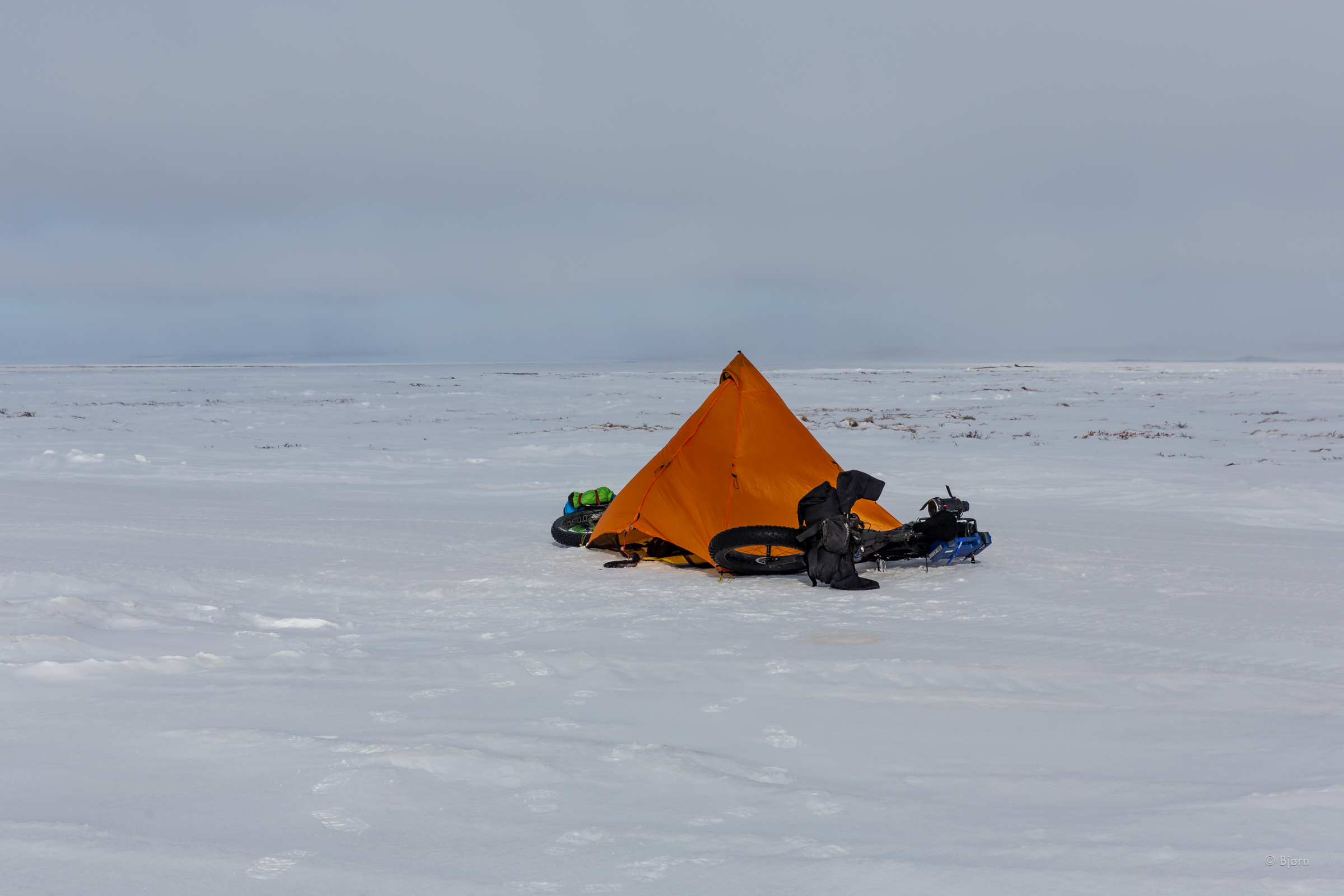
Hours later, exhausted and demoralized, we gave up. We’d stumble-fucked through bare tundra, slushy bogs, and open snowfields and were further north than all the waypoints. We were in terrible terrain for a trail to be. To the west, as far as we could see, was a pasture of willows poking through the snow - horrible ground even without a bike to travel through. We pitched our shelter and drank Mark’s celebratory airplane whiskey. All seemed lost.
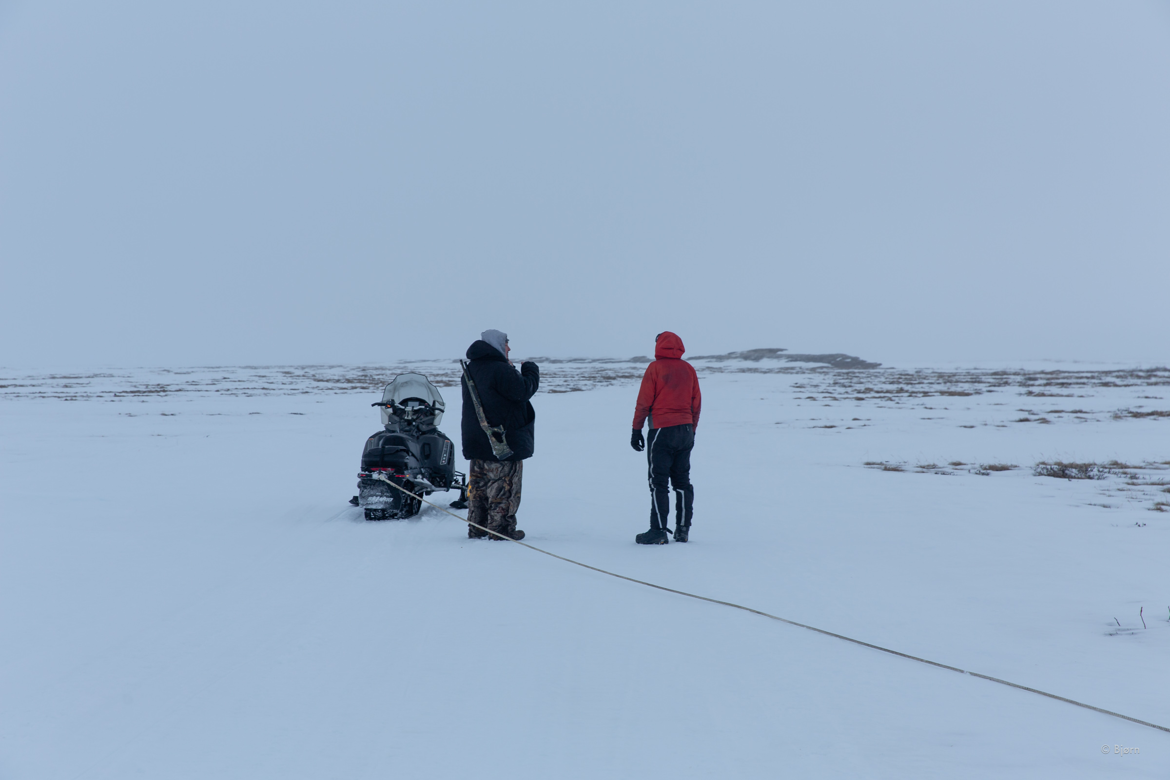
“We looked and looked but can’t find it. Pretty sure we were on CWAT but now r worried about not having enough fuel,” I texted to my friend Qaiyaan in the morning. “I’ll see if my buddy from Nuiqsut can run you out some gas. You got some money to pay him?” From where we were, the village of Nuiqsut was about 10 miles away in a straight line. Before replying to Qaiyaan, Mark and I had a discussion. Although it seemed like our trip was off to a shaky start, I lobbied that we take the opportunity to re-fuel and carry on. He agreed.
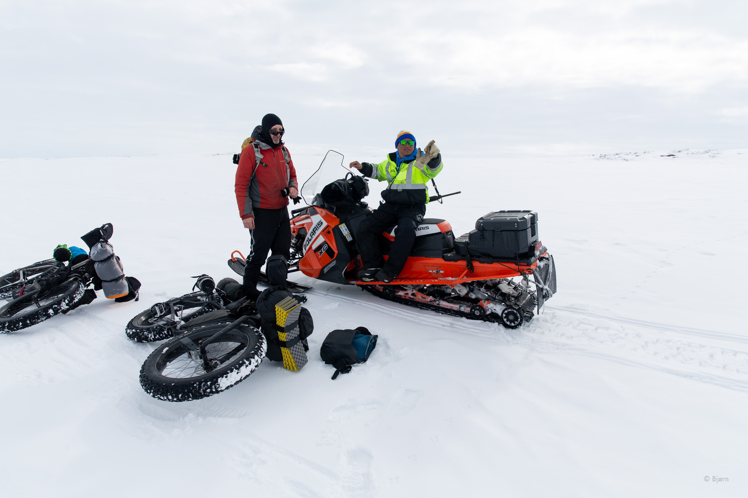
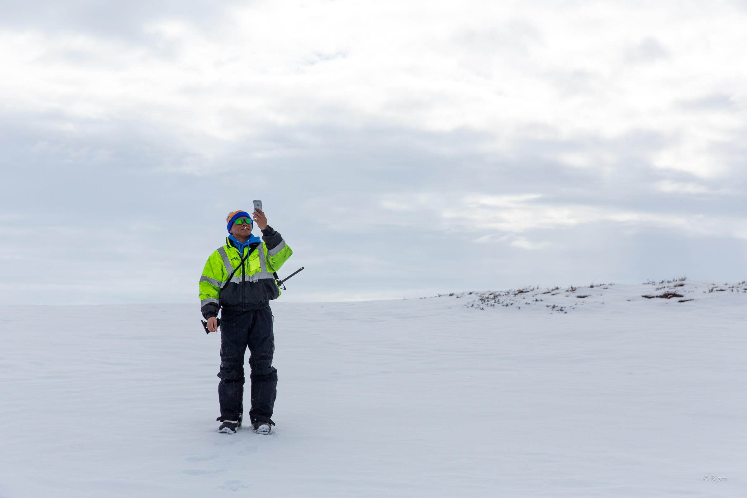
“My buddy Thomas Napageak is a hella AF hunter,” Qaiyaan said in his last text. Good, I thought. Hunters know their way around the country and we needed some fucking answers. An hour later Mark and I were slowly making our way back south when we saw Thomas’ snowmachine approaching. As he drew near he ascended a bluff and it looked as though he may miss us. “Plug your ears,” I told Mark. I took the 500 out, pointed it into the air, as far away from my ears as possible and fired a shot. My right ear rang and I went half deaf for several minutes but the cannon blast had worked.
“Yea, you were on CWAT,” Thomas said. As Mark filled our fuel bottles with the white gas, Thomas snapped a photo with his smartphone and walked above his snowmachine holding it above his head to find a signal. “You posting that?” I asked. “Yea. I wrote white gas for white guys,” he said, and we all busted up laughing. After being lost and found and lost and found again, we had fuel. Furthermore, our expedition had been given a name – White Gas For White Guys.


Two Days of Near-Bliss
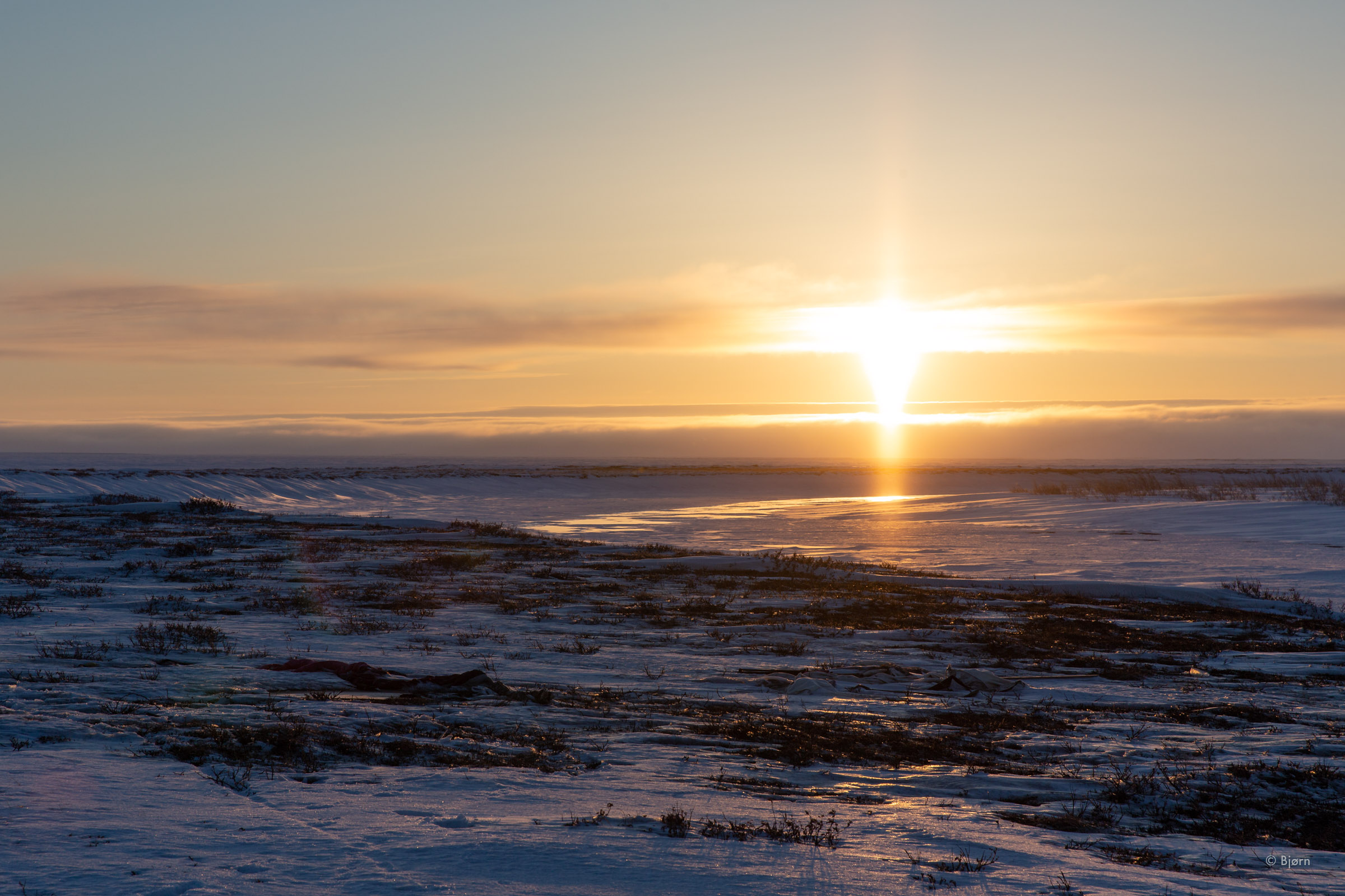
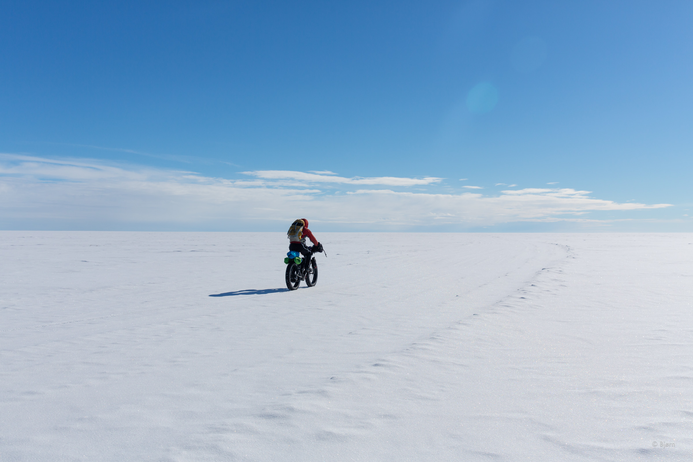
“We are exactly atop Hig’s waypoint,” Mark said as we stopped on the west side of the Colville River to drink from our thermoses and eat a bite. Over the night it had snowed and for the first time on our trip there had been no wind – rare phenomena in the Arctic. The inch of light snow atop the hard trail slowed our speed some but the conditions were still way above average for efficient snow travel by bike.
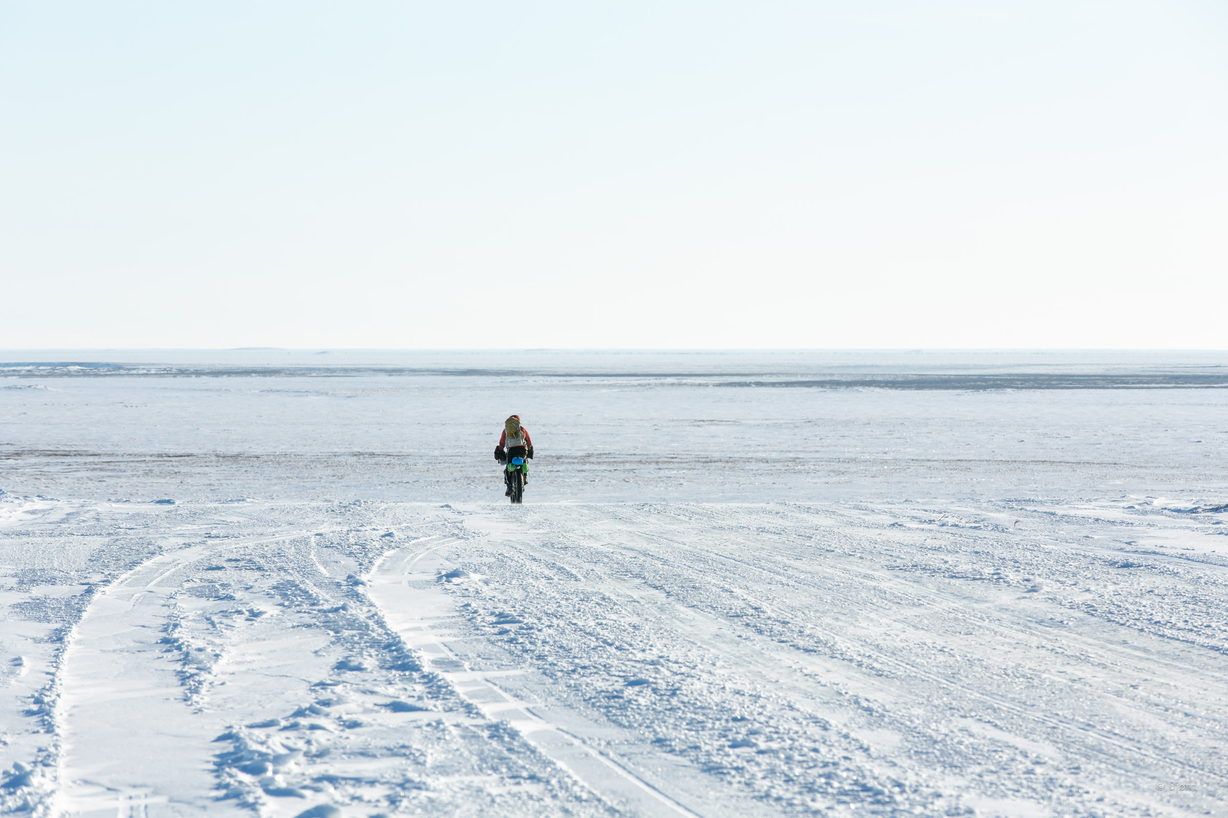
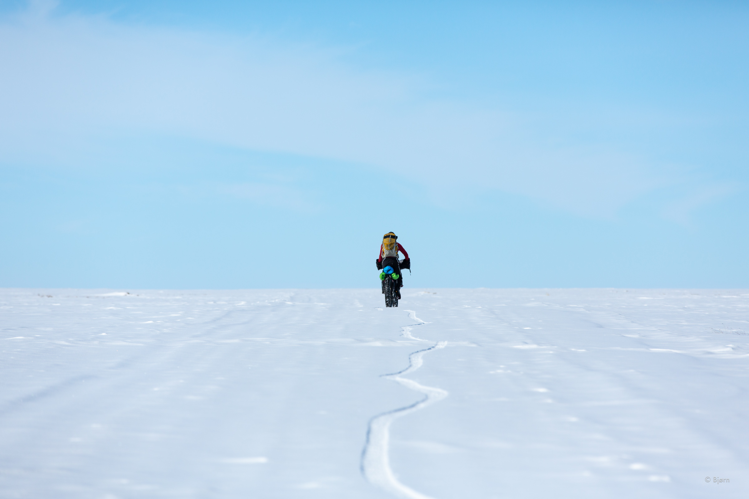
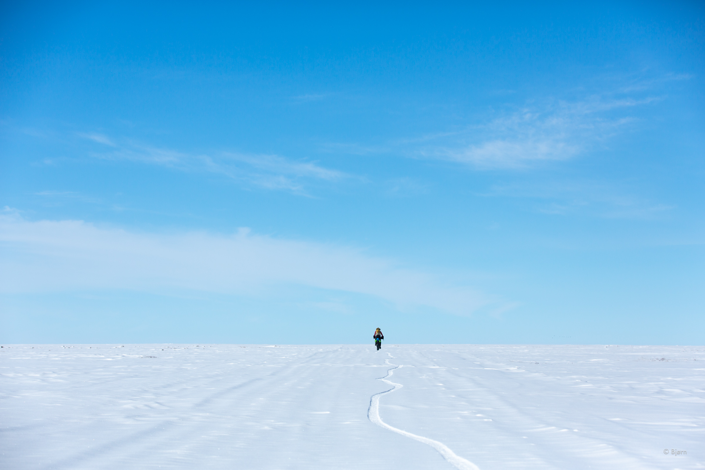
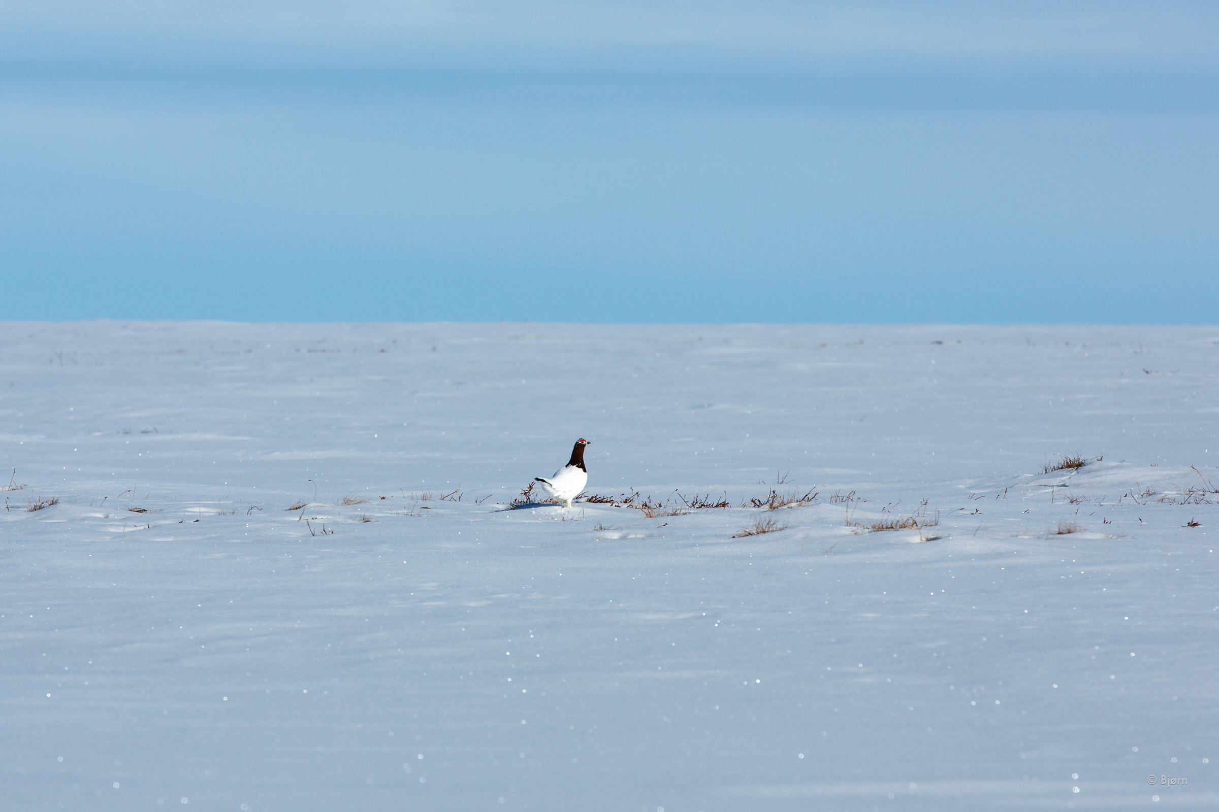
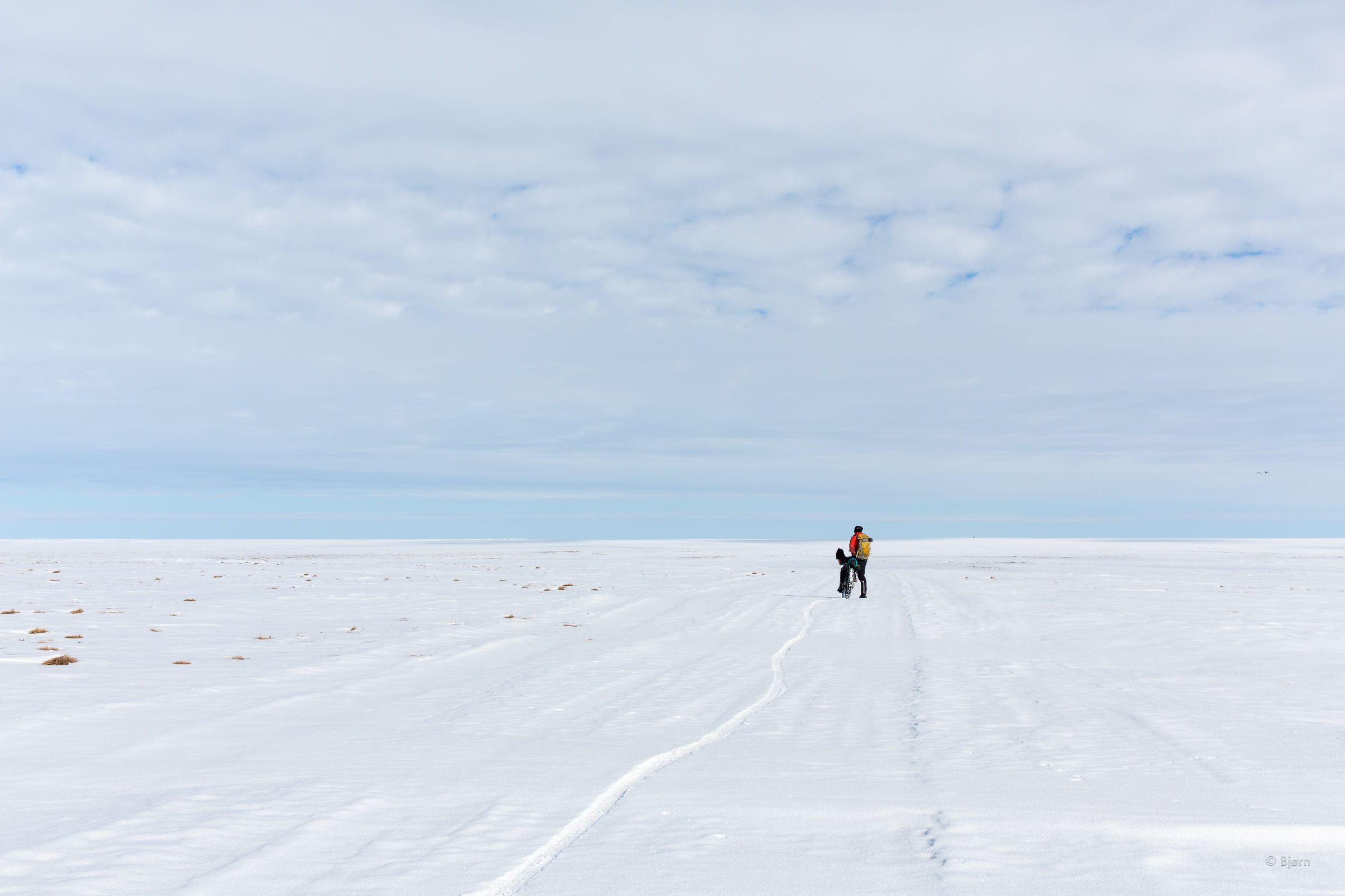
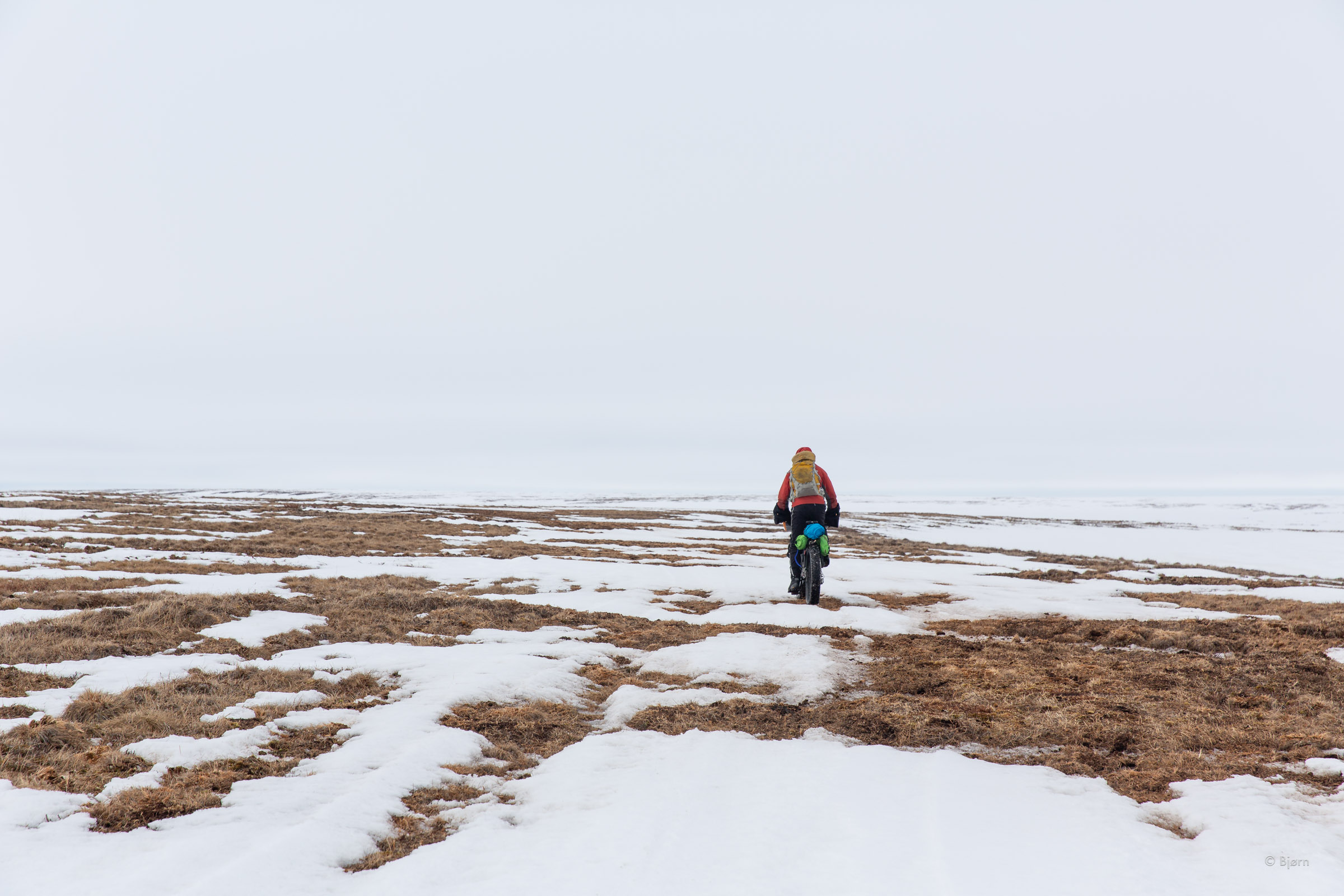
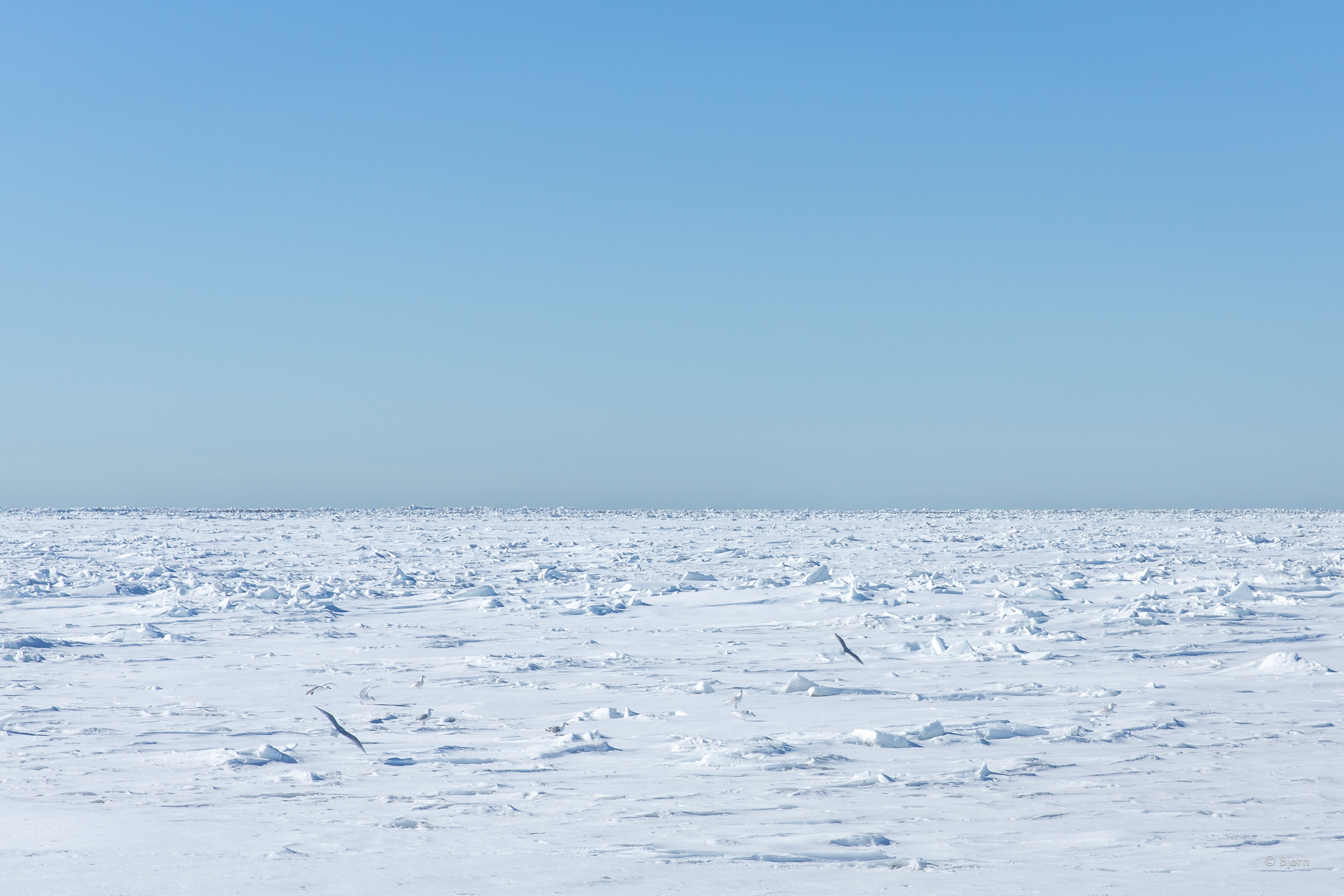
West of the Colville, we entered terrain unlike any I have ever experienced – absolutely flat, white with snow, and yet beautiful beyond description. Ptarmigans cackled and the sun shone strong as we rode on mile after mile. “This may be the closest we’ll ever get to experiencing what it’s like to be on the moon, eh?”
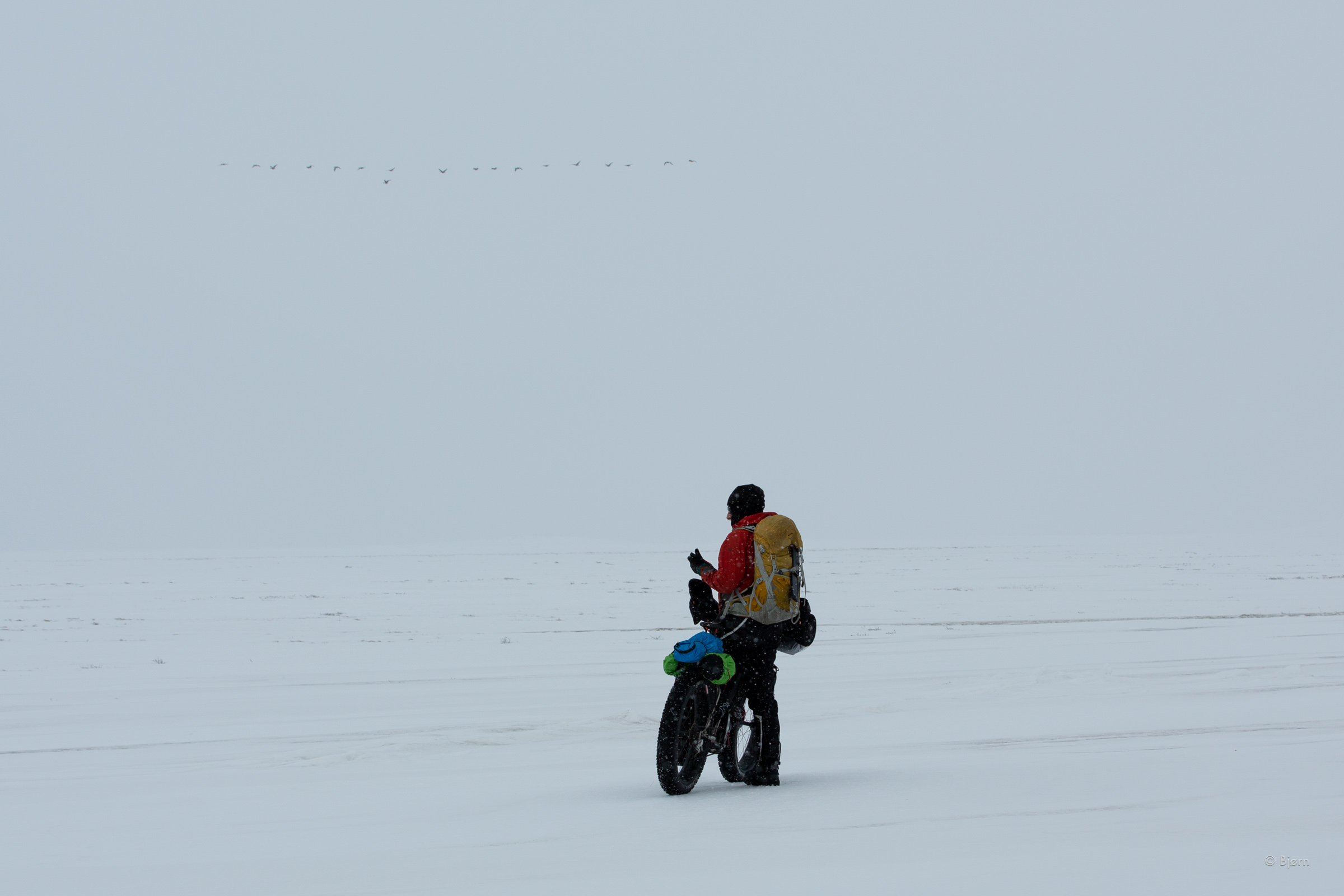
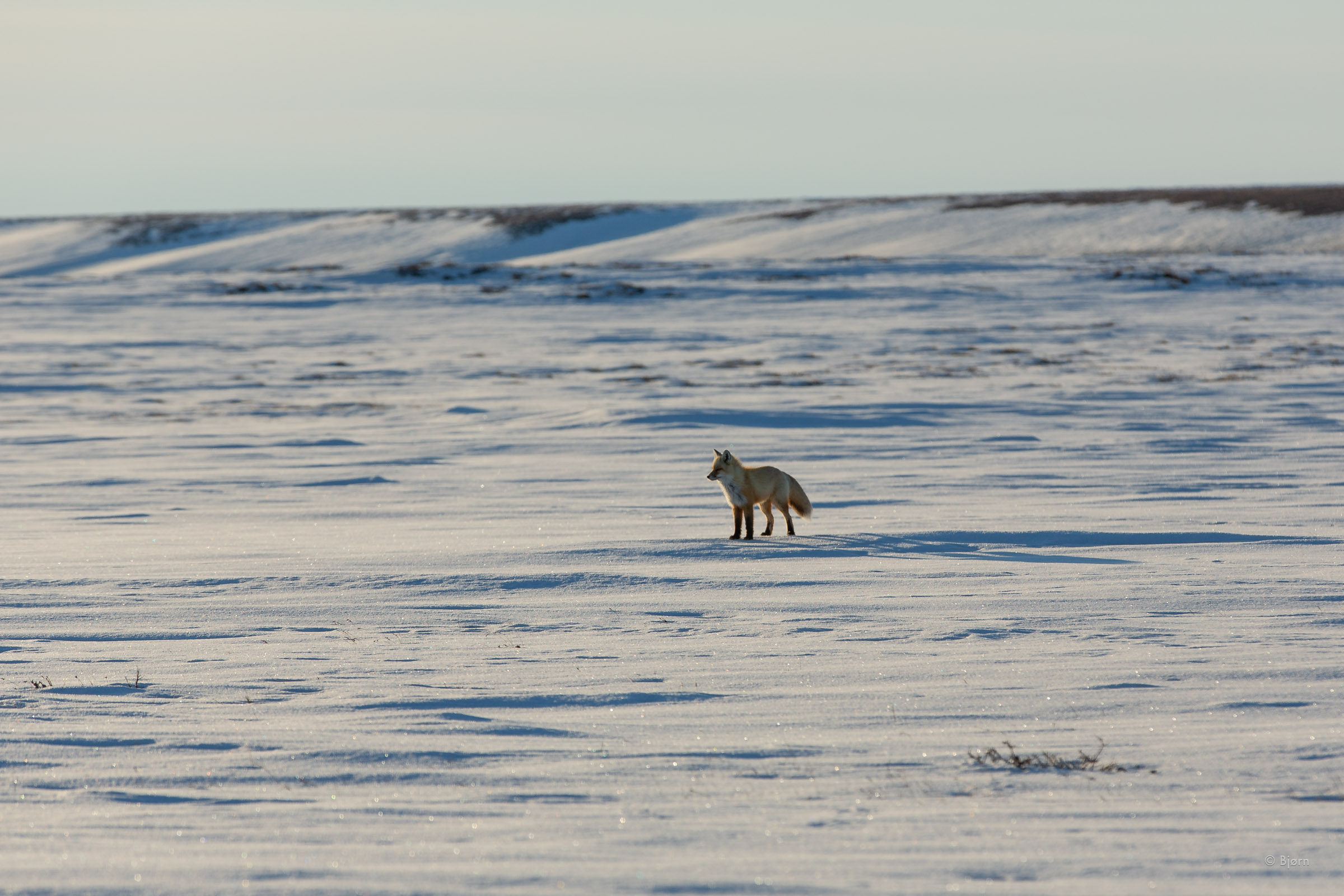
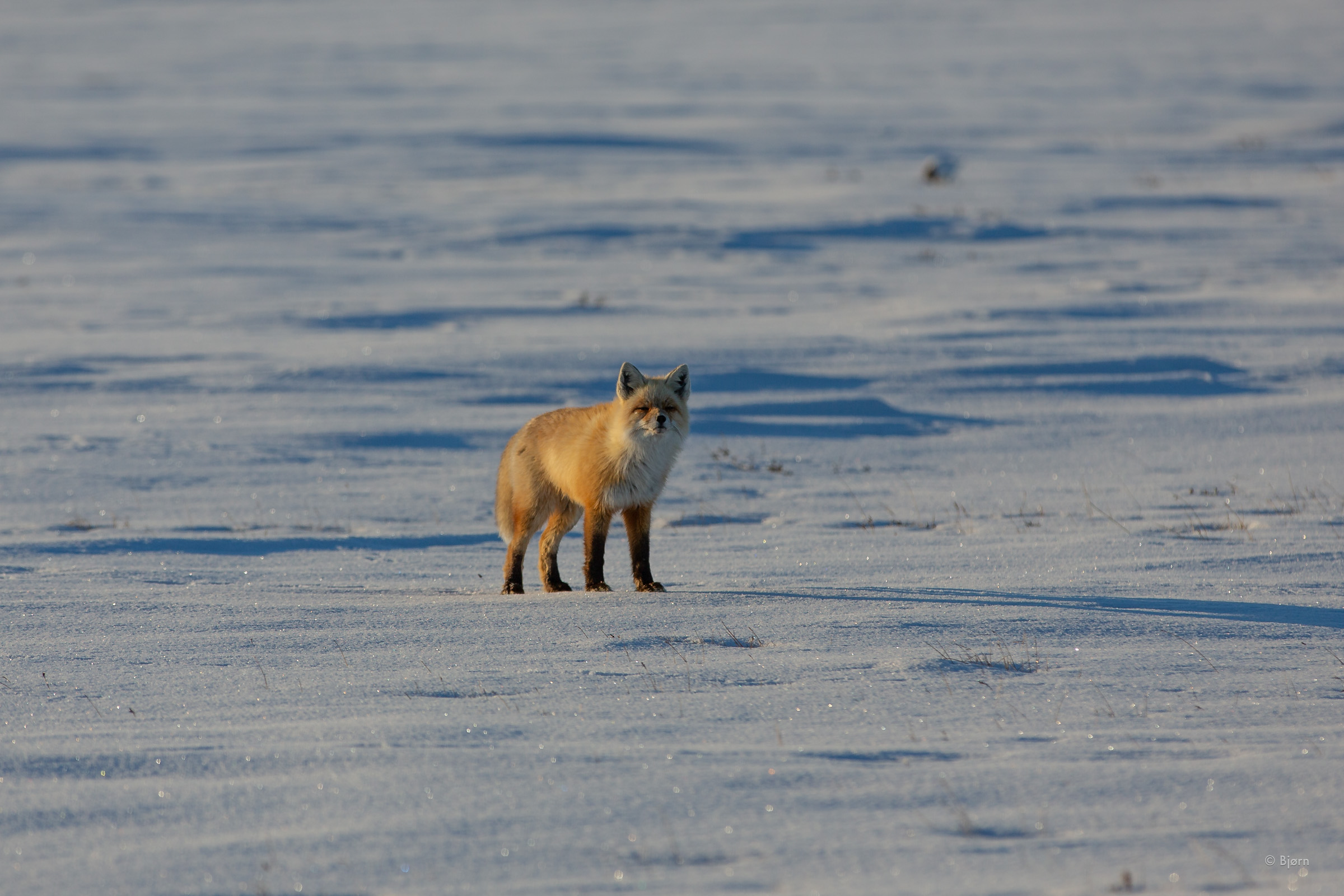
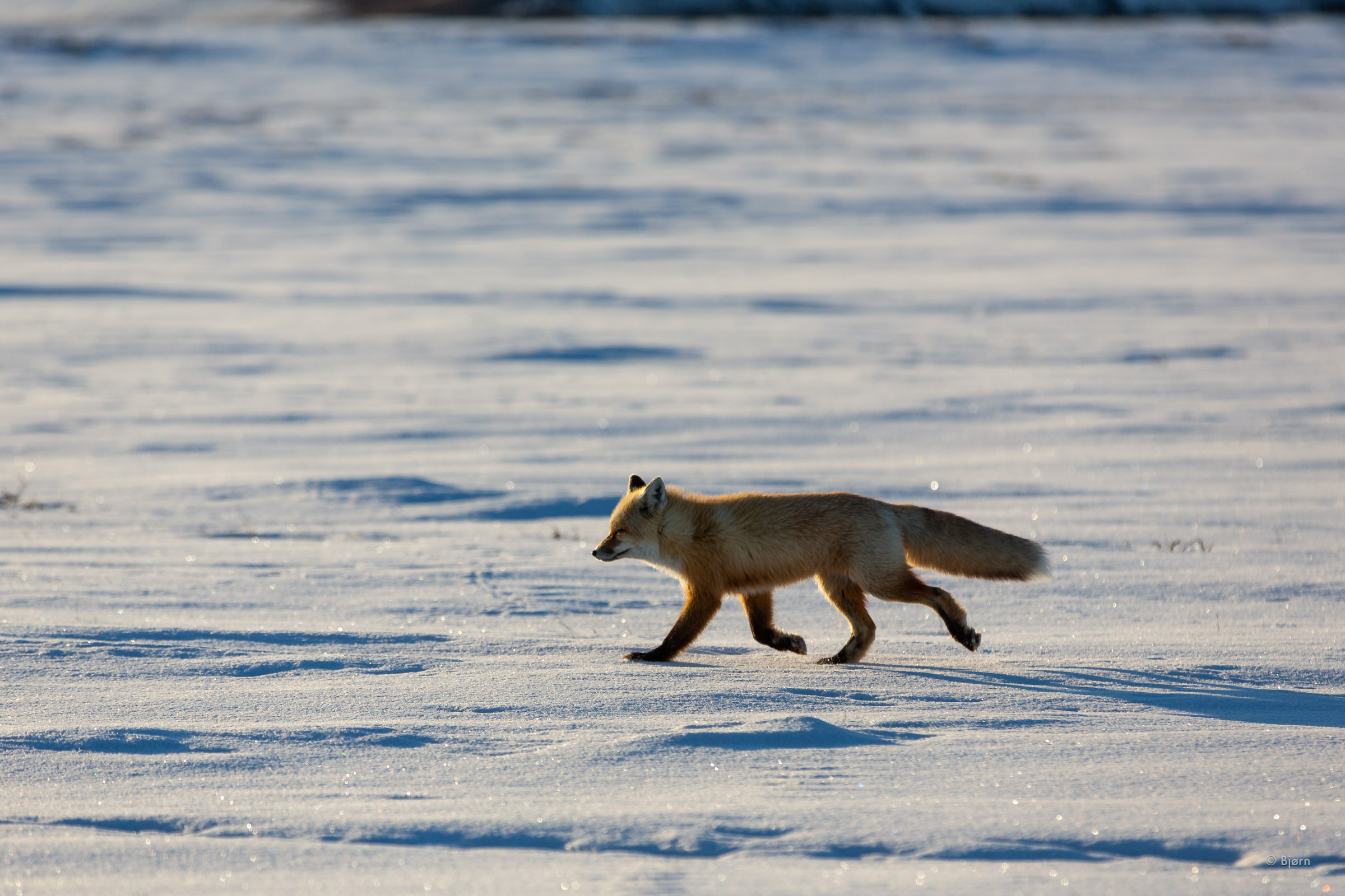
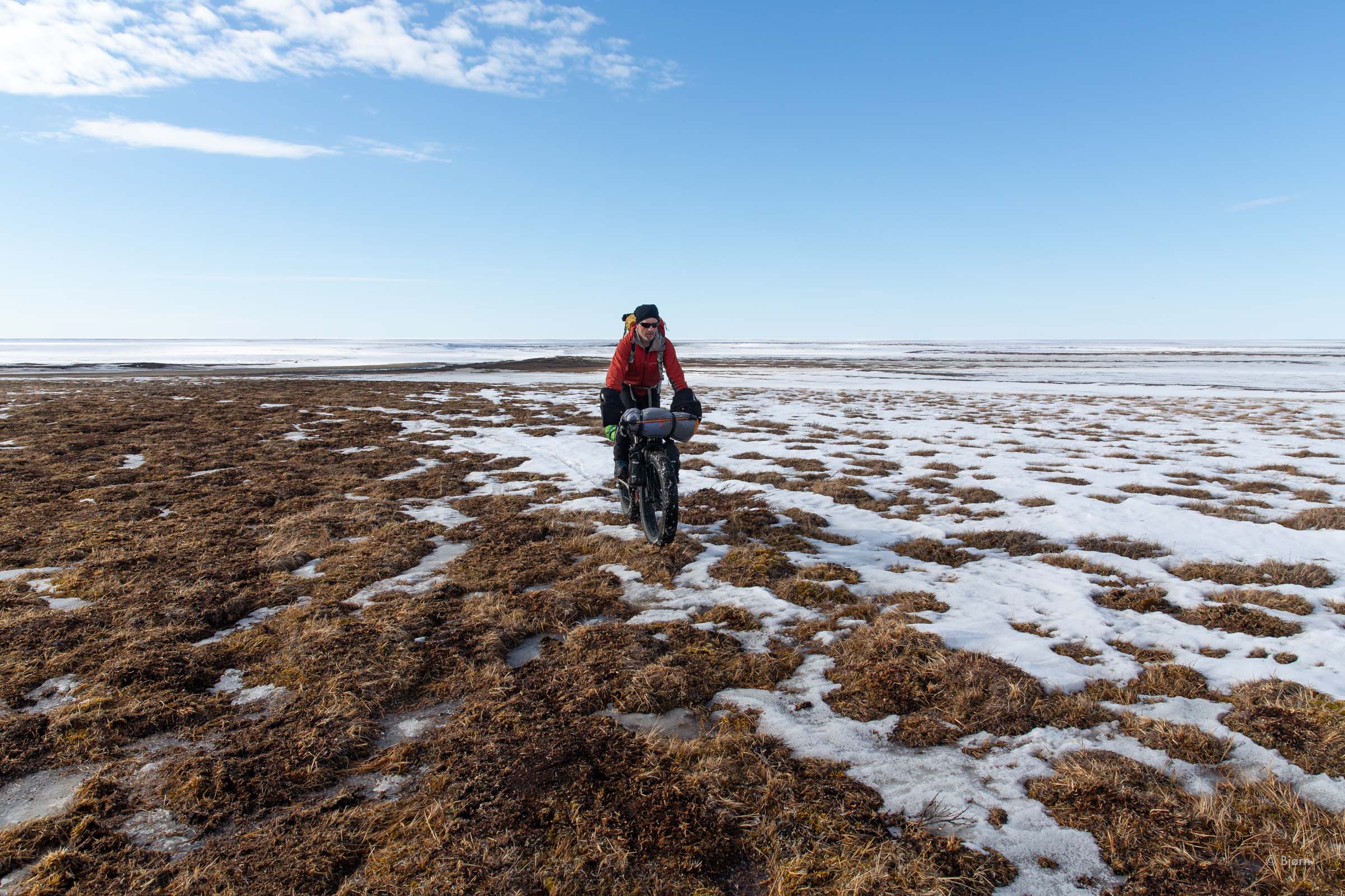
For two long days we traveled toward our destination, uninterrupted by route-finding or serious decision-making. Signs of the impending spring breakup were everywhere though. Each day we saw more and more migratory geese, swans and cranes making their way to their spring nesting grounds and each day more of the bare tundra exposed itself.
We were west of Arctic Alaska’s greatest lake, Lake Teshekpuk, when it began to warm up above freezing and the trail started to become sloppy. The new snow that had fallen when we were still east of the Colville was now, also, becoming a pain. During the heat of the afternoon, the skiff of snow melted but not entirely. As the snow re-froze, the surface morphed into a crispy verglas that insulated the softer snow beneath. We took out more tire pressure and nosily crunched onward.
Although it was only 5:00 PM, we decided to camp early on our third afternoon since leaving the Colville. “Let’s set the alarm for 2:00 AM and cross our fingers that it freezes tonight.” As we made coffee, the inside of our shelter, at 3:30, was still wet with condensation and outside we could make slushy snowballs. It hadn’t frozen. A damp and chilly fog settled in as we rode away at 5.
“How are you guys doing?” Came a message from Brower Frantz in Utqiagvik. We didn’t know what to say.
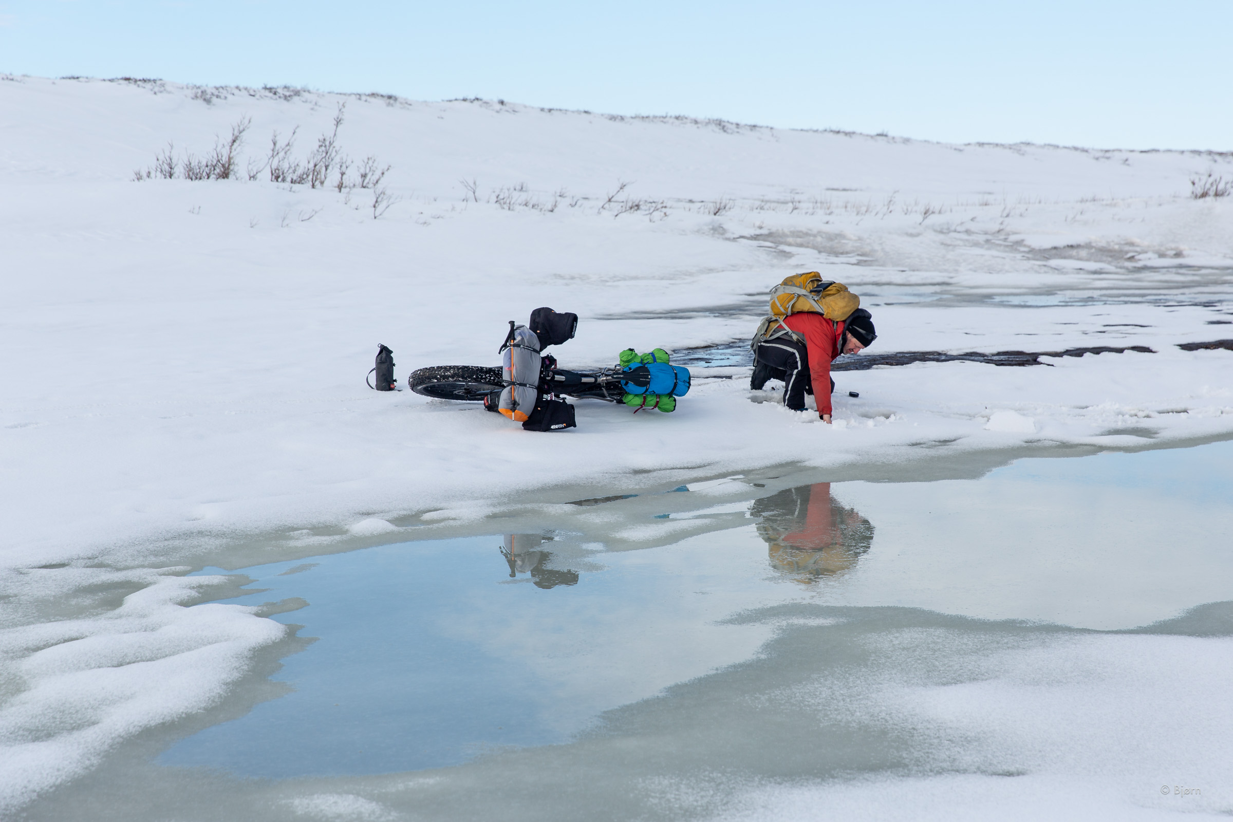
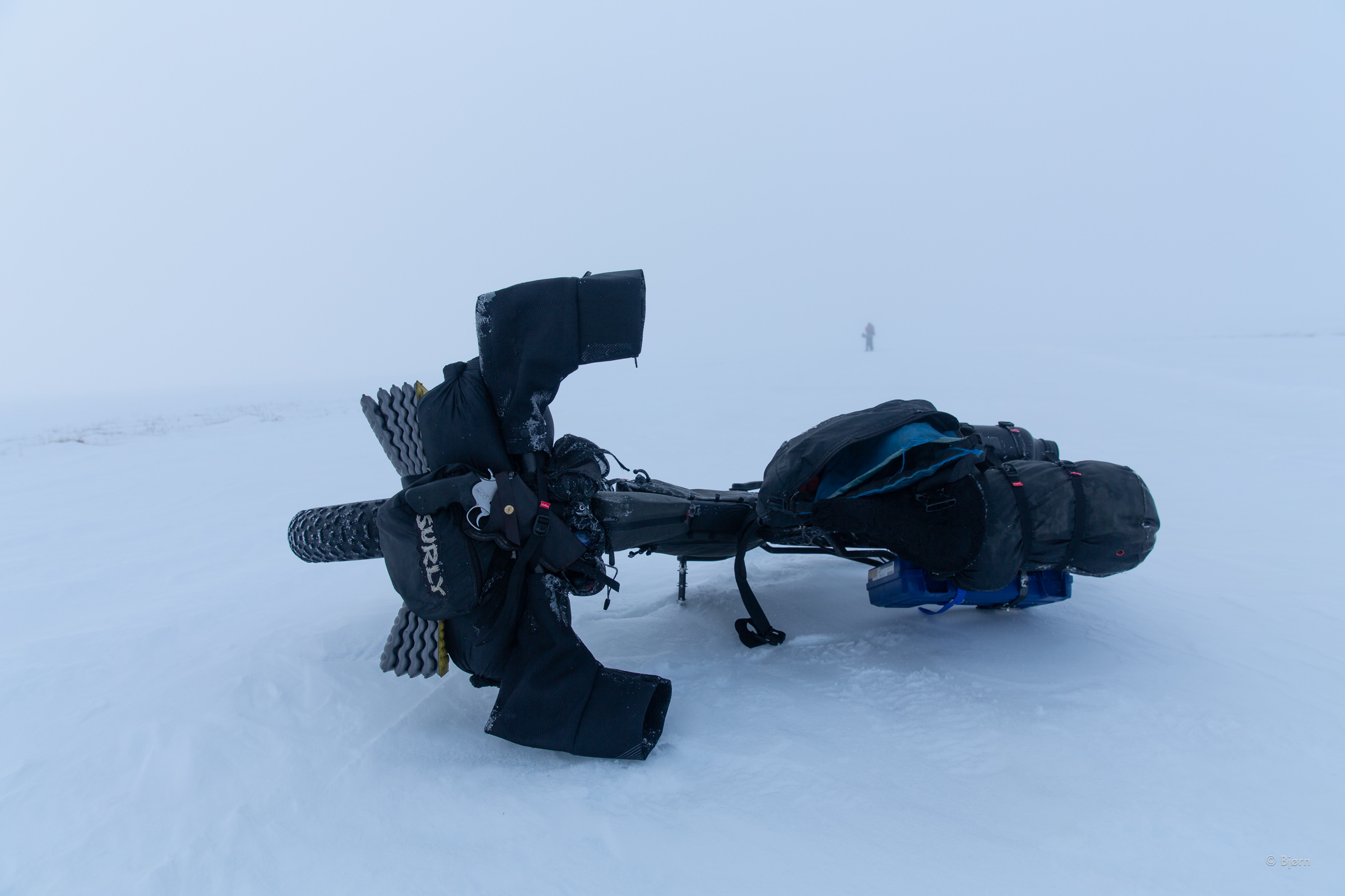
As we took more and more tire pressure out, we slowed to nearly walking speed and often had to dismount to push beyond the worst of the rotten patches. By 11 they were all rotten patches. Crossing a channel of the Ikpikpuk River, I stomped on and compressed the slush to keep my calf-high over-boots from being overtaken with the flowing open water. West of the river we found a dry patch of ground and sat down to discuss our options.
“You are super close to my cabin,” Qaiyaan’s InReach message said. He sent us coordinates and told us to head there. “It’s only a couple miles from where you are. There’s food and beds. I’ll come get you tomorrow evening.”


Saved
We were enveloped in thick pea soup fog as we sat on our little dry clump oasis on the shore of the Ikpikpuk. “We should reply to Brower, eh?” Mark punched in a response to his question, how you doing. A few minutes later, Brower replied and said he’d come retrieve us. This guy, whom we’d never met in person, was willing to finish his work day and head out into the fog and rotten snow for a 3 to 4 hour snowmachine trip to our location and give us a ride into Utqiagvik. “Quyanaq*. Thank you, Brower.”
For the first time on our trip we had access to dead willow branches and bits of driftwood. We built a fire to help ward off the damp and chilly air as we waited. Late in the evening, Brower sent another message, “Still getting everything together. Will leave town around 11.” Mark and I had started our day at 2:30 so we decided to set up the shelter and get a few hours of shut-eye.
We sprung awake as the sound of Brower’s machine drew near. We greeted him with groggy enthusiasm but needed a few minutes to pack everything away for what was bound to be a bumpy sled ride. He’d brought several 30-gallon containers of fuel for his cabin, which was less than three miles from our location. “I’ll go drop this off and come back in a minute,” he said. By the time he returned we were packed and bundled up, wearing every item of clothing we’d brought.
At our first pit stop, Mark and I pulled out our sleeping bags. When we resumed the trail we both crawled inside them, boots and all. Our goggles quickly misted over from the fog but we hunkered down and took in the experience.

Utqiagvik
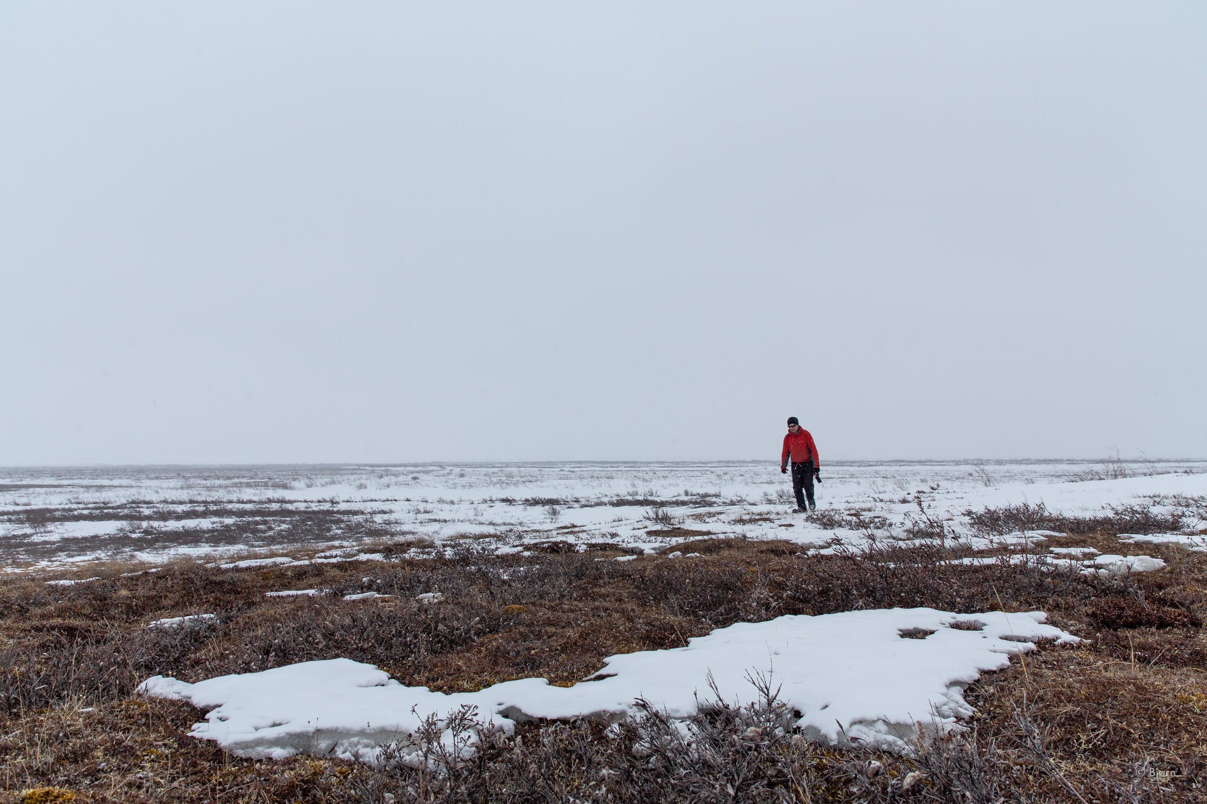
The new day was in full swing when Brower pulled his snowmachine into Utqiagvik. The day before the entire community had melted out and the streets were bare gravel and mud, and slicks of water pooled in every depression. City workers were busy throughout the community pumping water away from homes and streets.
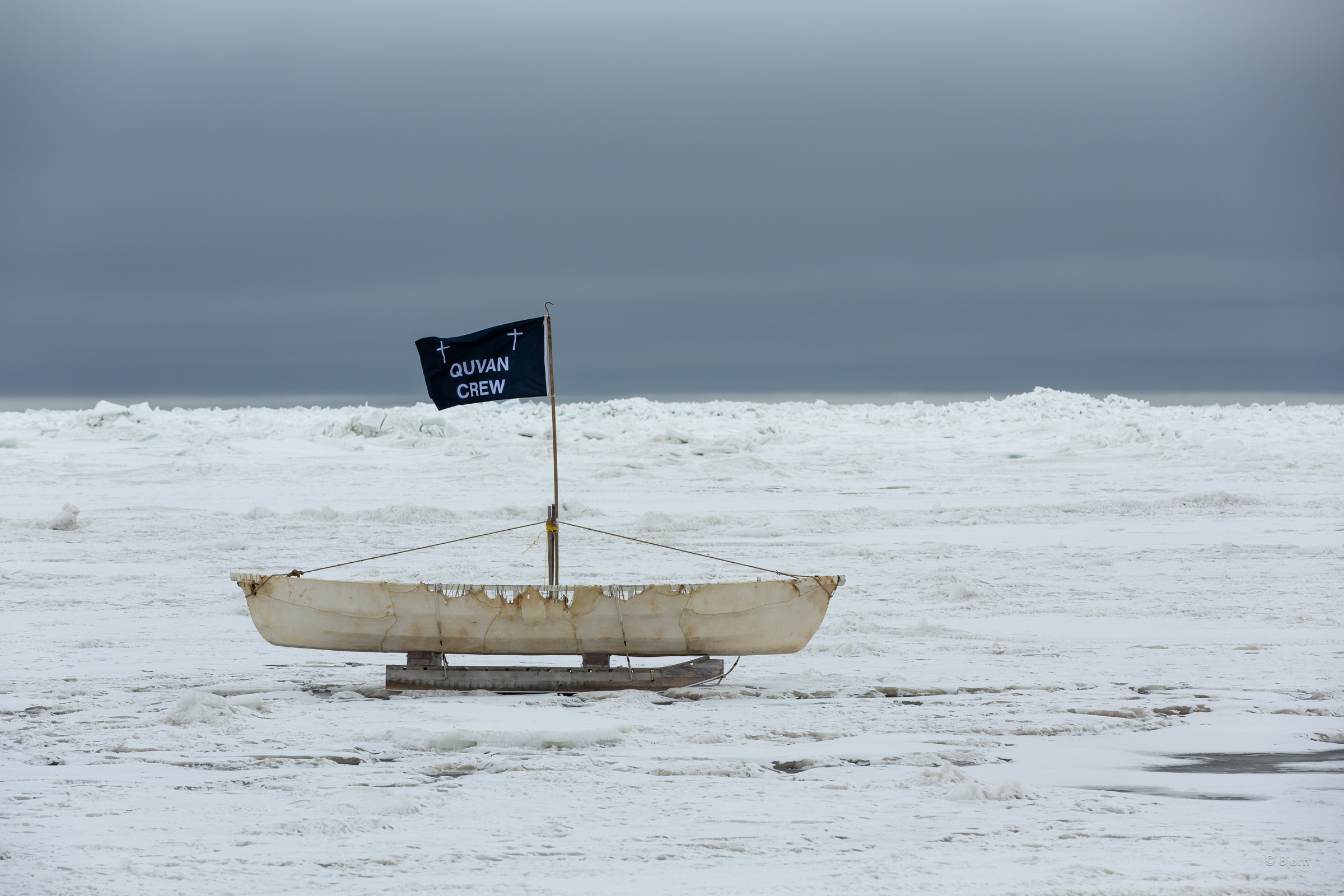
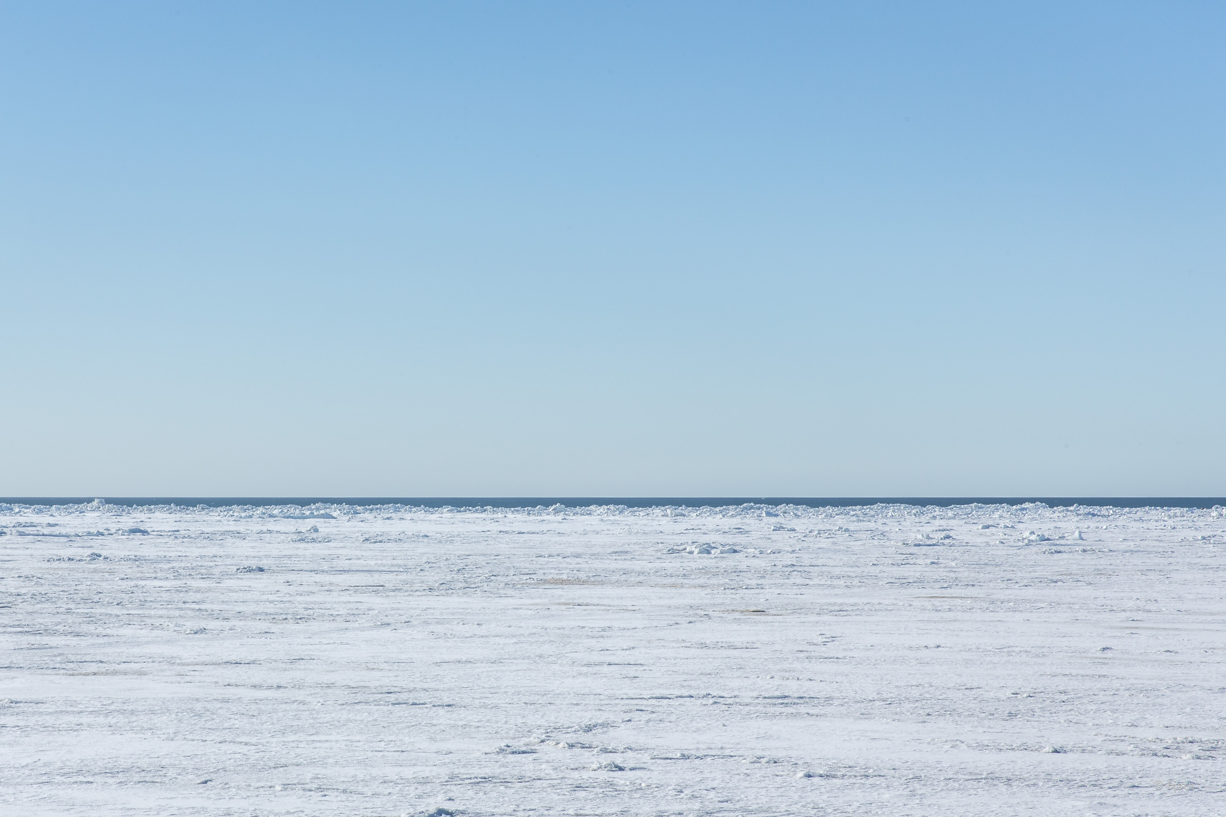
As Mark and I unpacked ourselves and bikes from the sled, Brower went inside his house to change. When he came out he had news: “They just caught a whale right in town.” The open sea was less than a couple hundred yards offshore – an eerie, unnatural and obvious indication of our global climate crisis. Until very recently, the sea ice extended 20 or more miles out and whalers had to make trails through and over the hummock ice to set whale camp. “We’ll meet you at the Top of the World Hotel for breakfast,” we told Brower and gave him money for gas and our best guess at the value of his time.
All three of us looked haggard as we stumbled into a booth at the restaurant. Our poofy eyes and incoherent conversations helped inform our waiter that we wanted coffee and to keep it coming.

Reflection
Many obvious reflections can be made about our trip to the North Slope but none of them interest me too much. The main take-away for me is that I was able to experience an environment that I have been intrigued by for longer than I can remember, and it was more incredible than I could have imagined. This trip and experience gave me a small taste of the region’s moods, its wildlife, and, most importantly, its amazing people.
There are so many things that go into trying a new route with atypical equipment like a fat-bike but nothing teaches me more than giving it a shot. What we know now verses before we began is immeasurable. I plan to use this newfound wisdom to the best of my ability for next time.
*Quyanaq = Inupiat word for thank you