• Home
  • Photography
  • Videos
  • Journal
  • In The Media
Menu

Mjolnir of Bjørn

bjorn@groundtruthtrekking.org
Alaska
(907)-756-1920
Chop wood, haul water - good internet connection when you can find it.

Your Custom Text Here

Mjolnir of Bjørn

  • Home
  • Photography
  • Videos
  • Journal
  • In The Media

Icy Bay Mega-Tsunami

August 28, 2018 Bjørn Olson
A National Park Service Zodiac passes under the massive landslide that caused the 'mega-tsunami.'

A National Park Service Zodiac passes under the massive landslide that caused the 'mega-tsunami.'

This article originally ran in Alaska Magazine. 

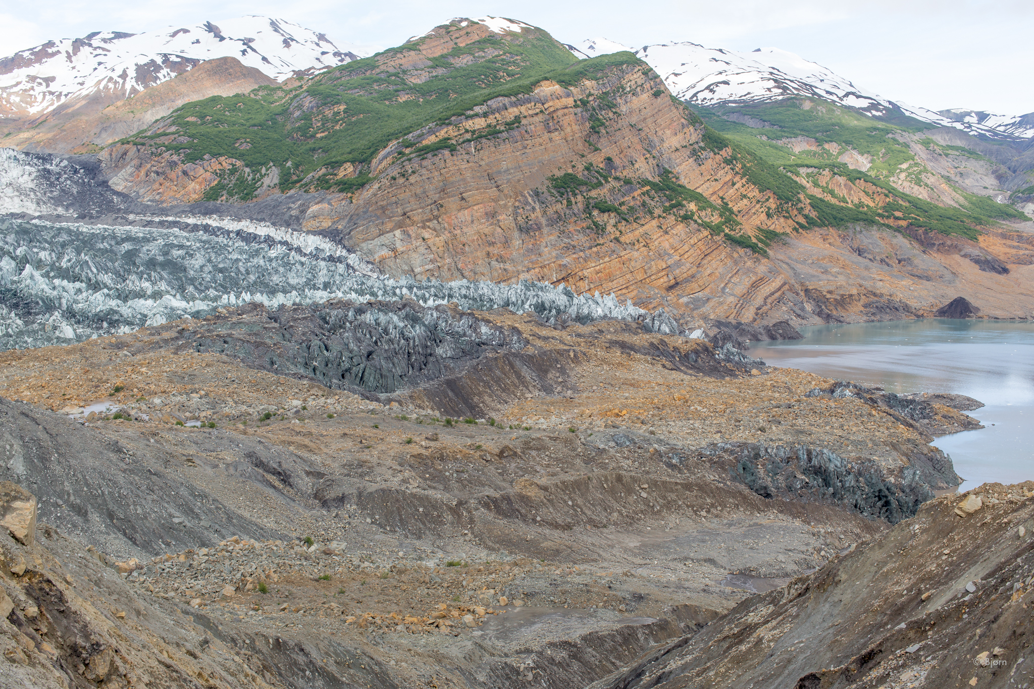
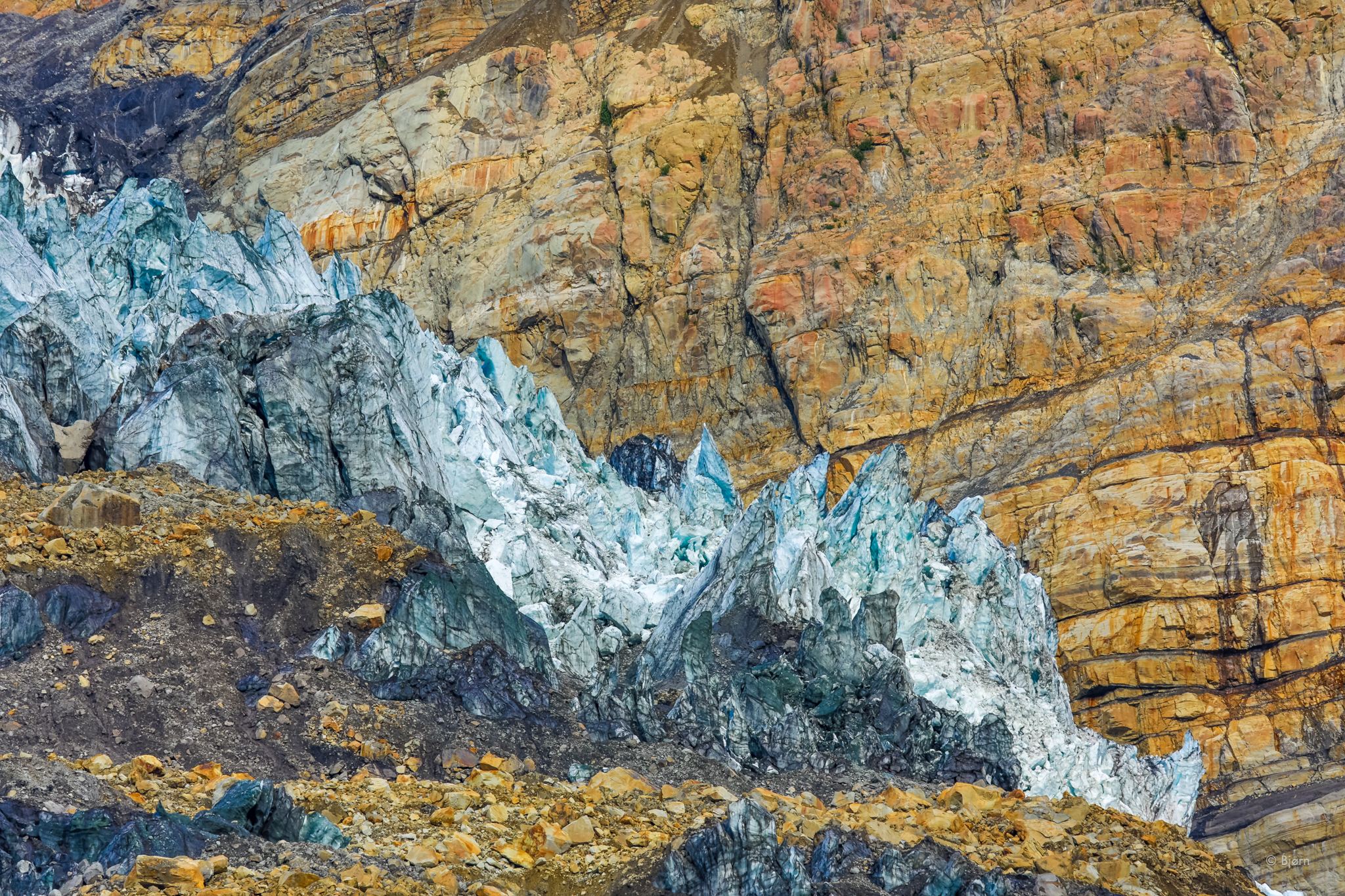
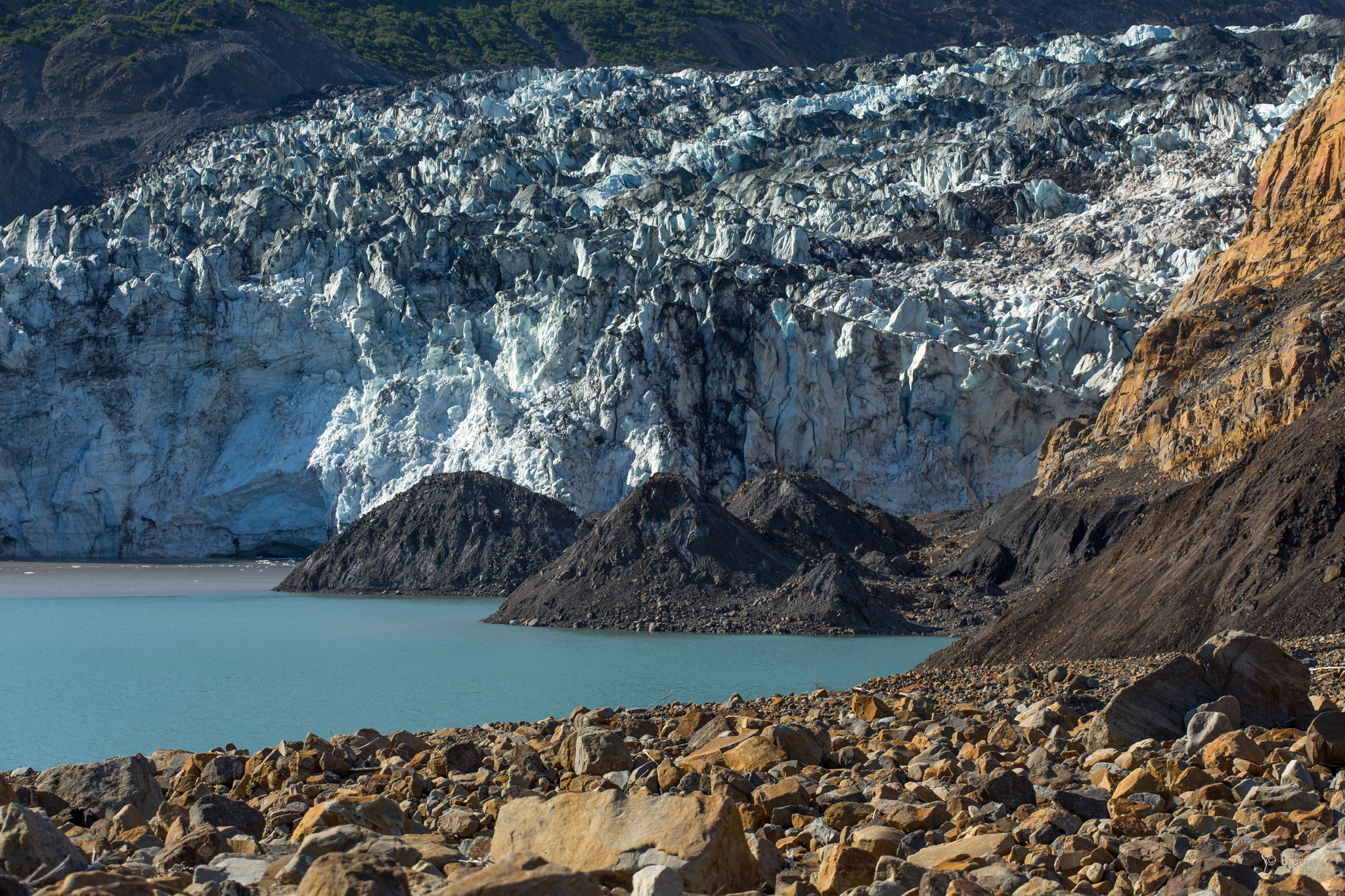
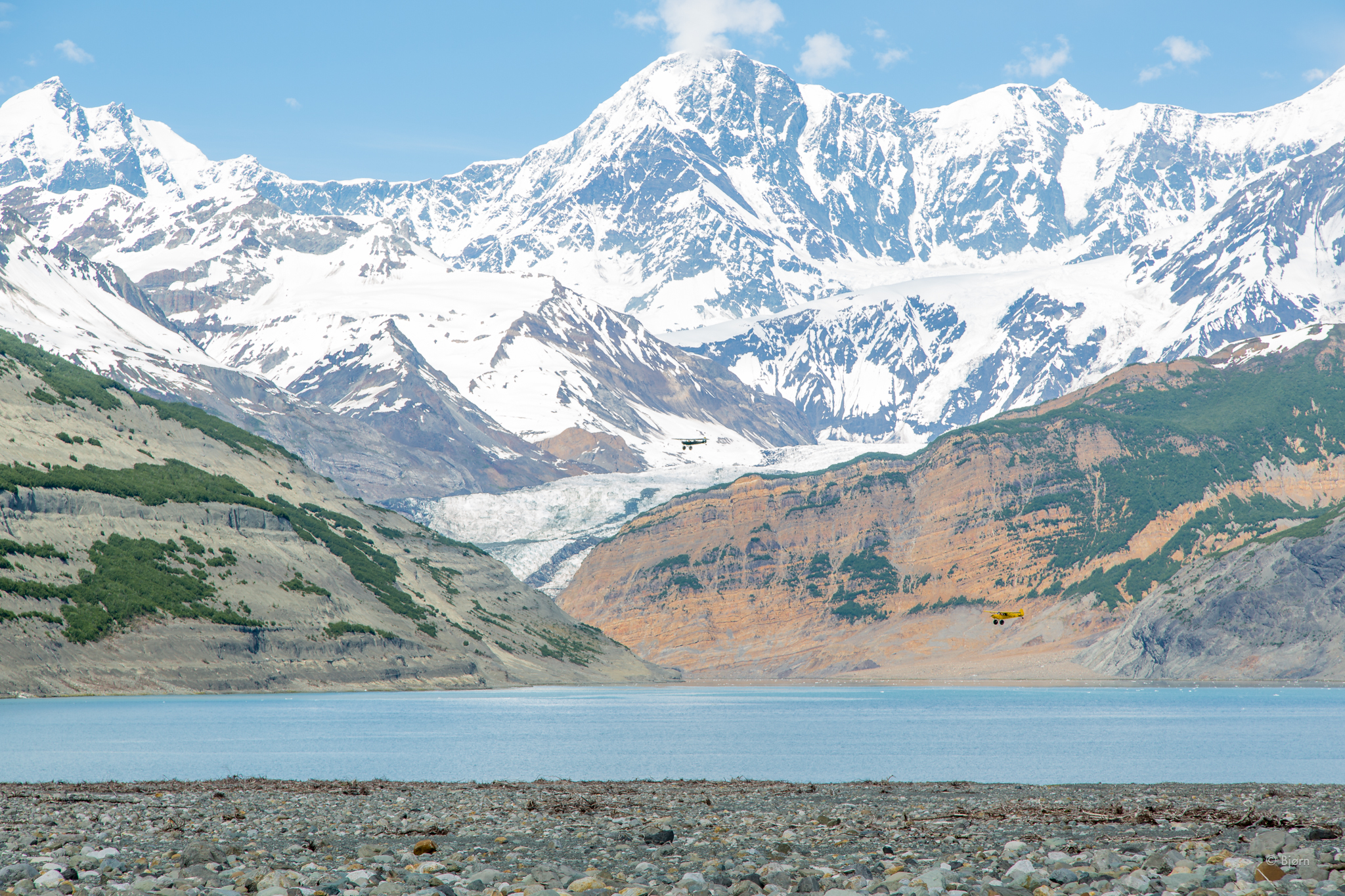
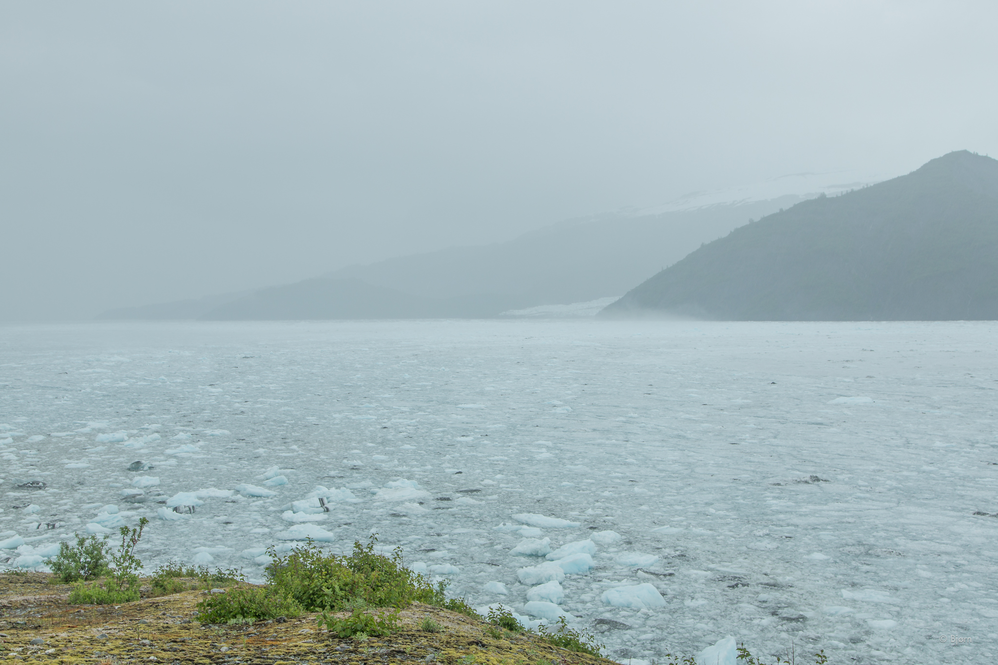
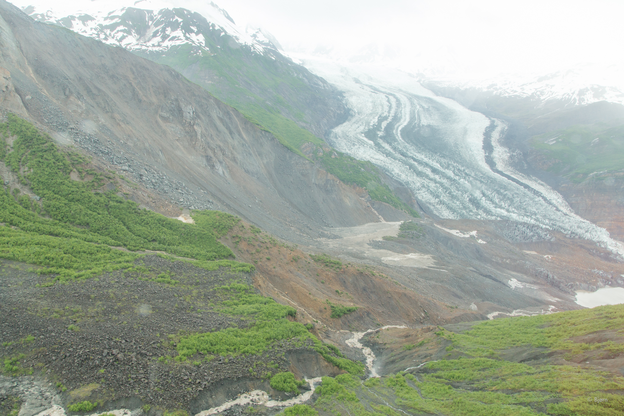
On October 17, 2015 a mountain at the head of Taan Fjord, an arm of Icy Bay, Alaska broke in half and crumpled under its own weight. Some 200 million metric tons of material came crashing down in what must have been a deafening roar. Some of the rock slid onto the snout of a tidewater glacier but most slid into the head of Taan Fjord – displacing a massive volume of water. This landslide-generated tsunami had a maximum height of over 600 feet. The wave traveled down the fjord, dislocating sediment and scouring forest for over ten miles.

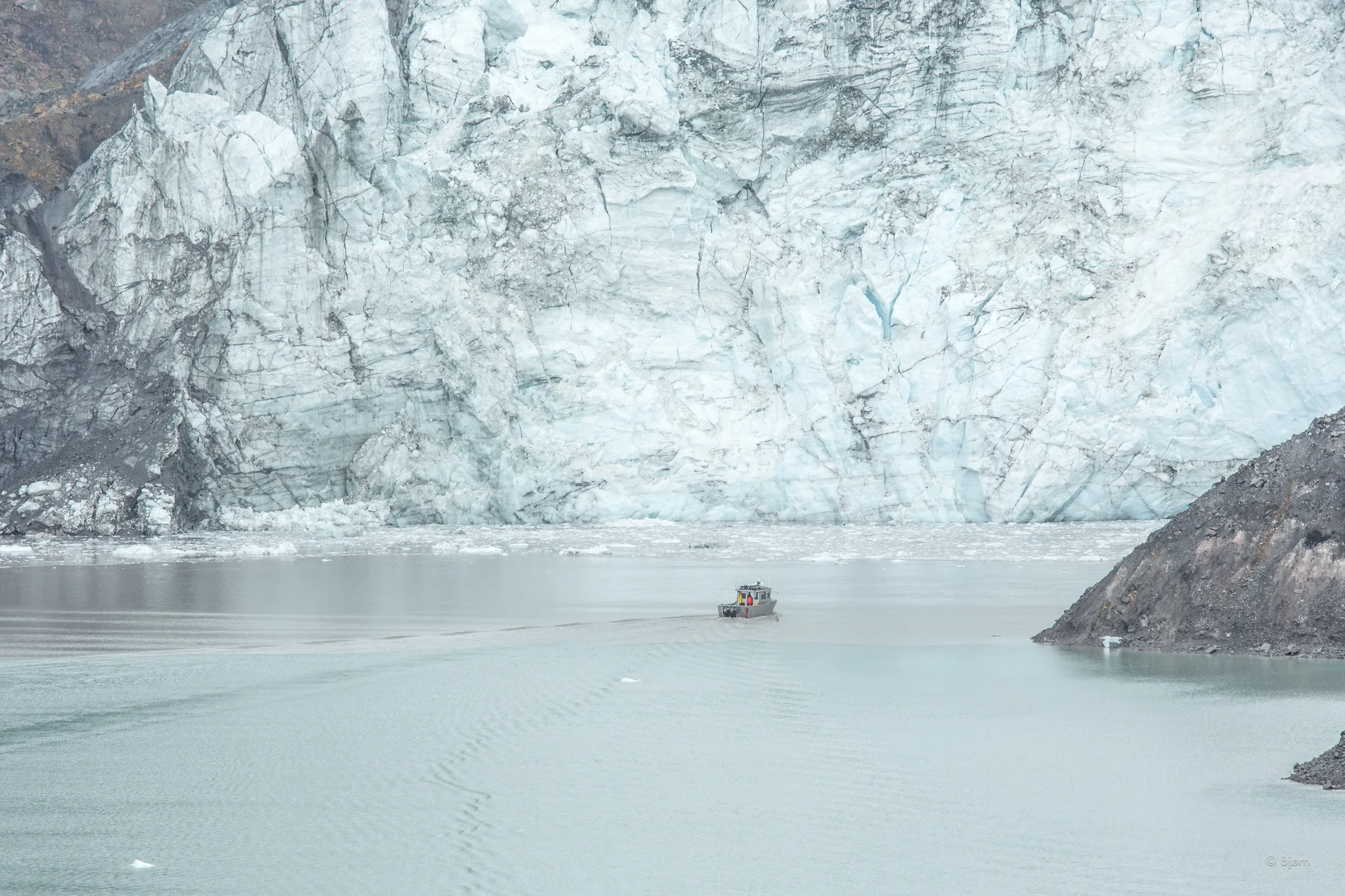
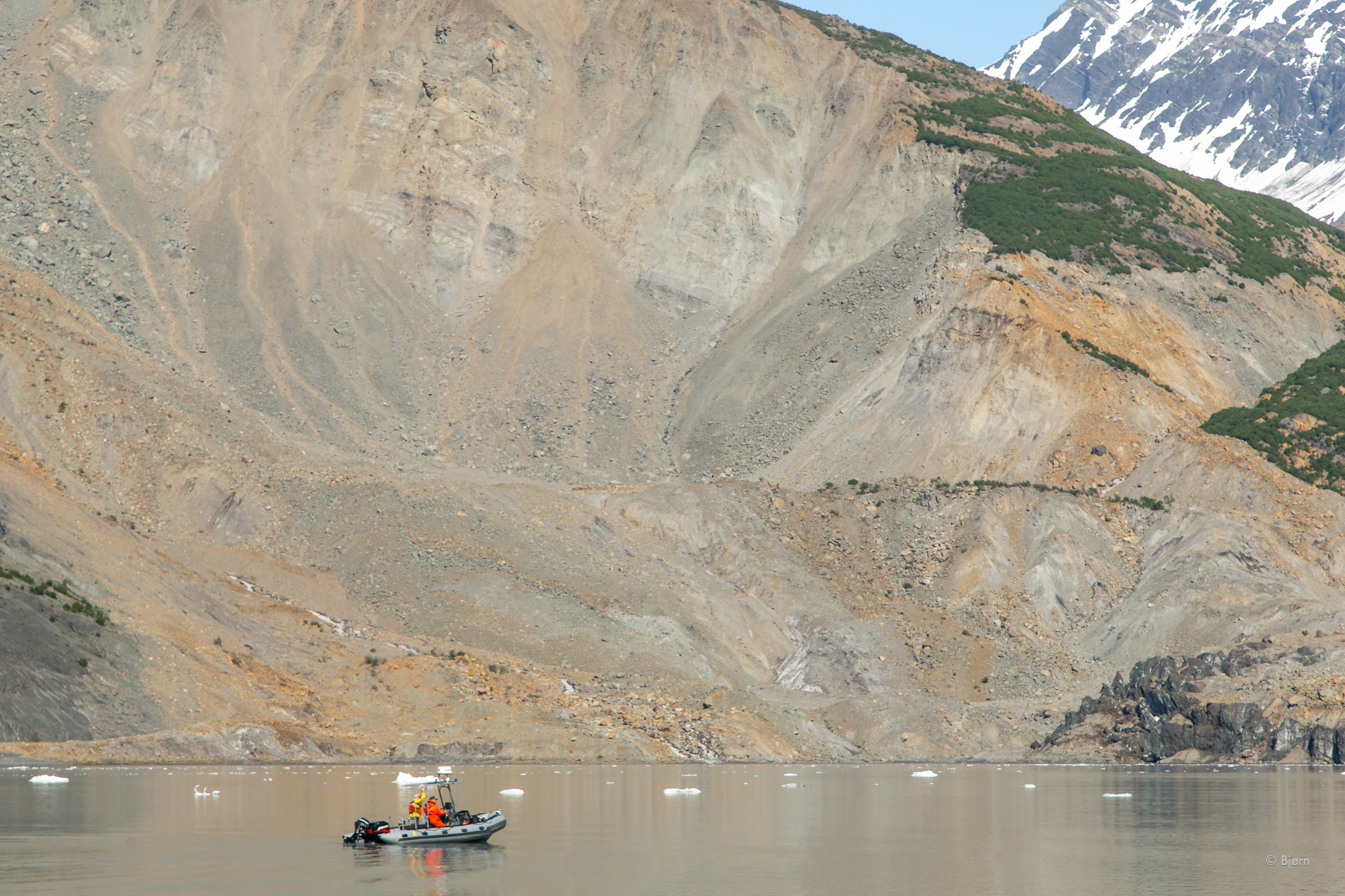
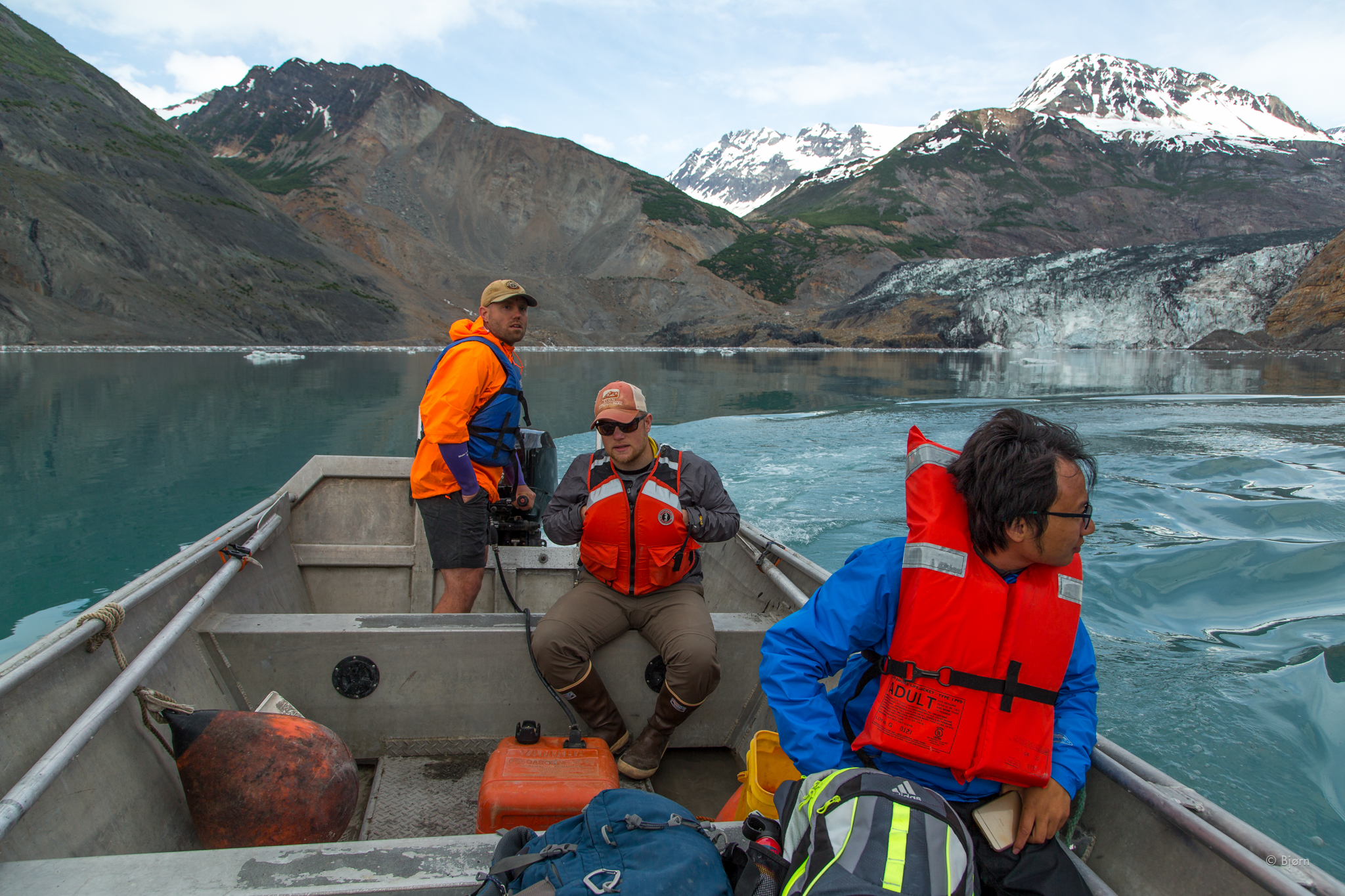
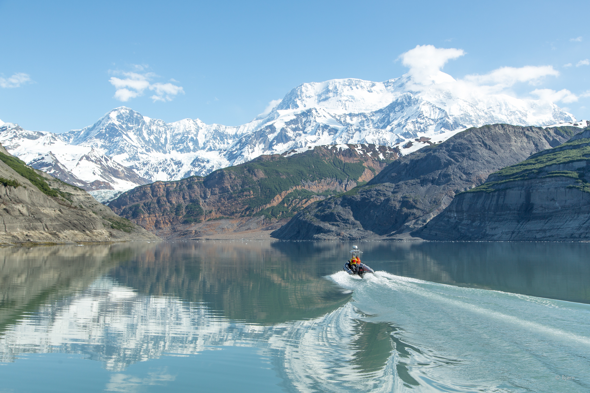
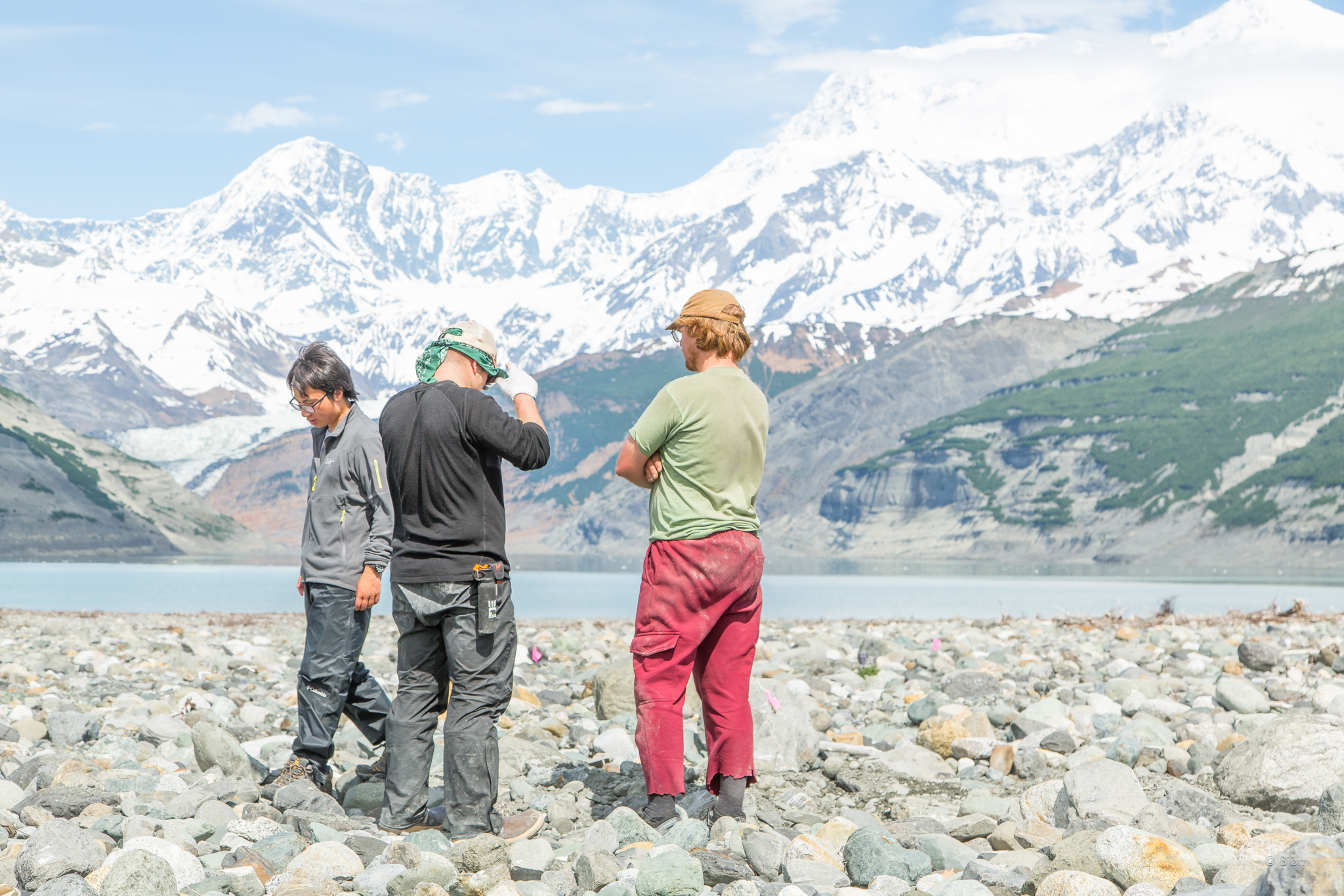
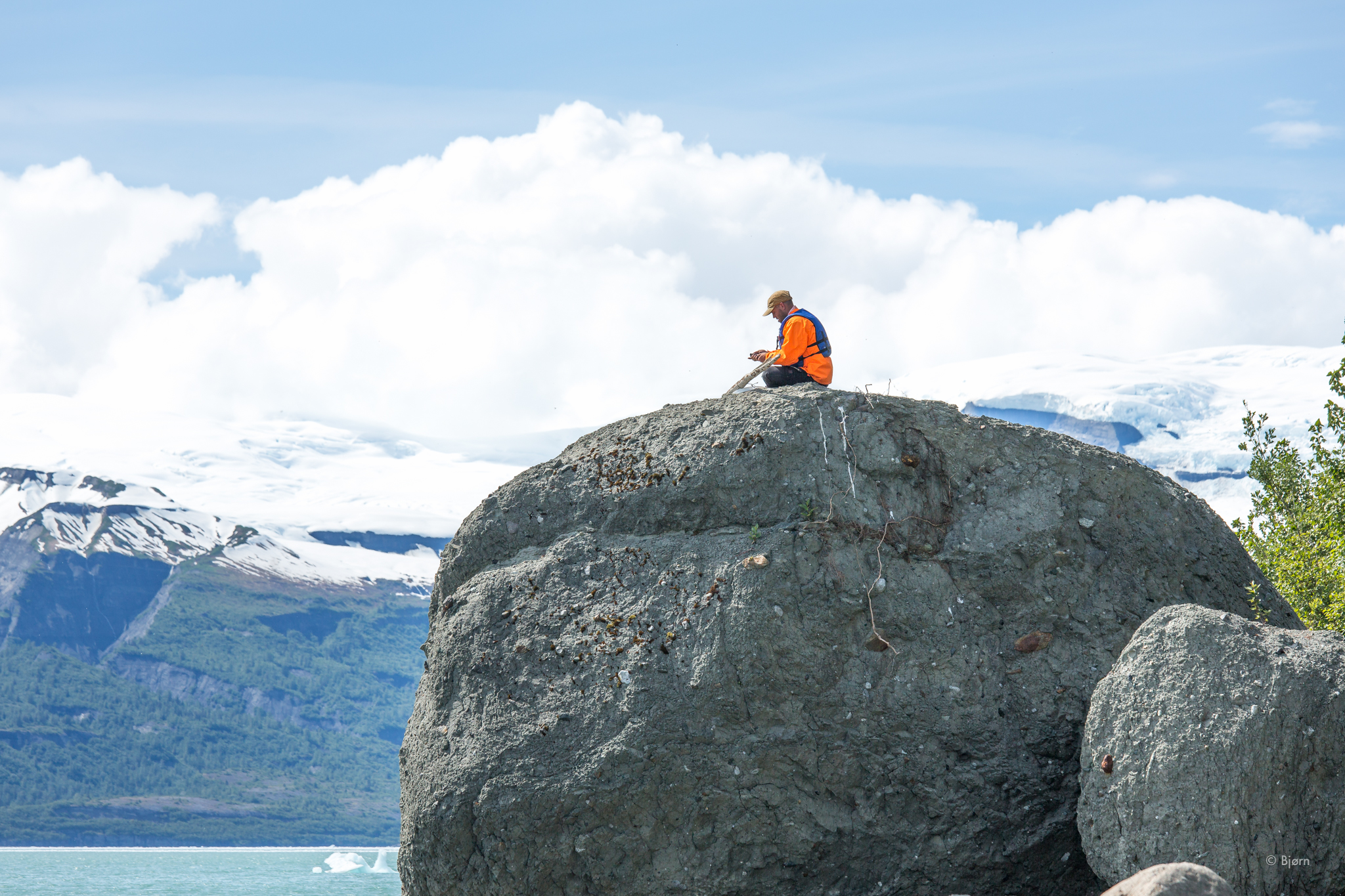
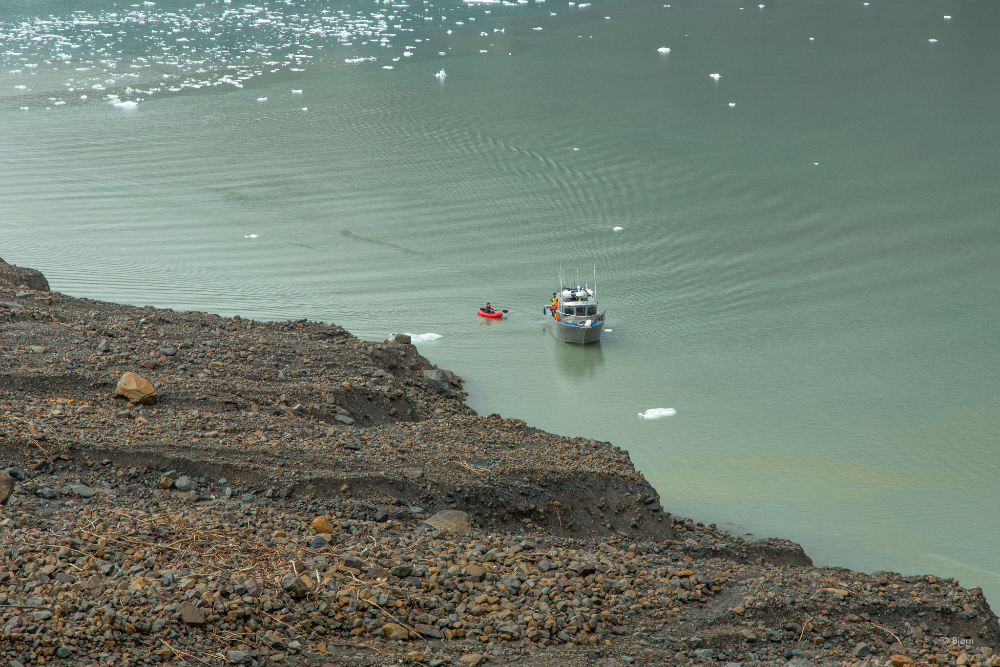
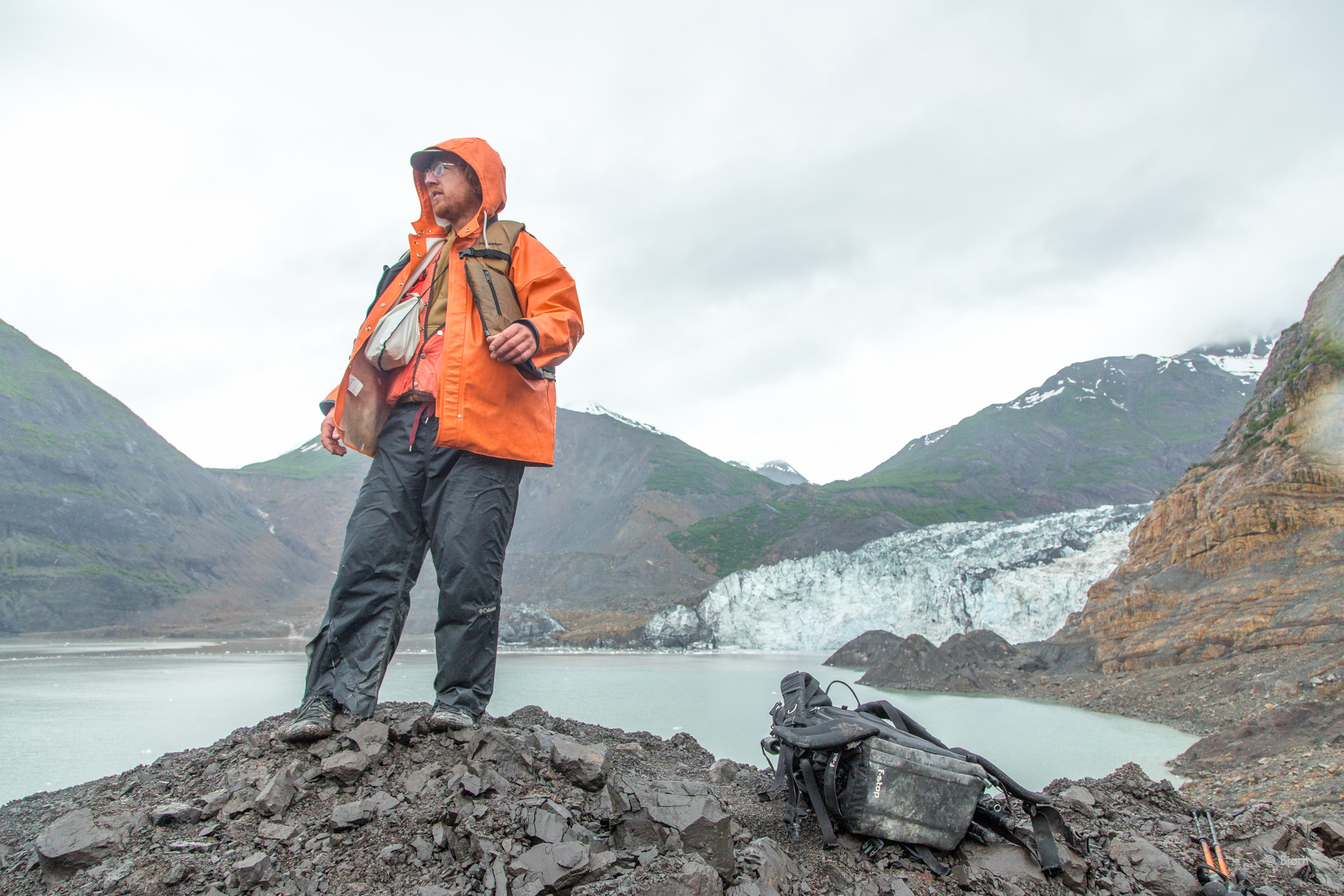
JUNE 2016: From the foredeck of the MV Seawolf, an aluminum six-pack charter boat, I turn to see Scott Chadwick, the burly Yakutat boat captain, look nervously from his depth sounder to the slowly approaching shore. Chocolate syrup water in the silty glacial fjord obscures hidden rocks. My eyes are peeled; ready to yell stop at the first sign. The bow grinds against the shoreline and gently makes contact. Perfect. The look of apprehension on the captain’s face is gone and I, along with four earth-scientists, disembark. 

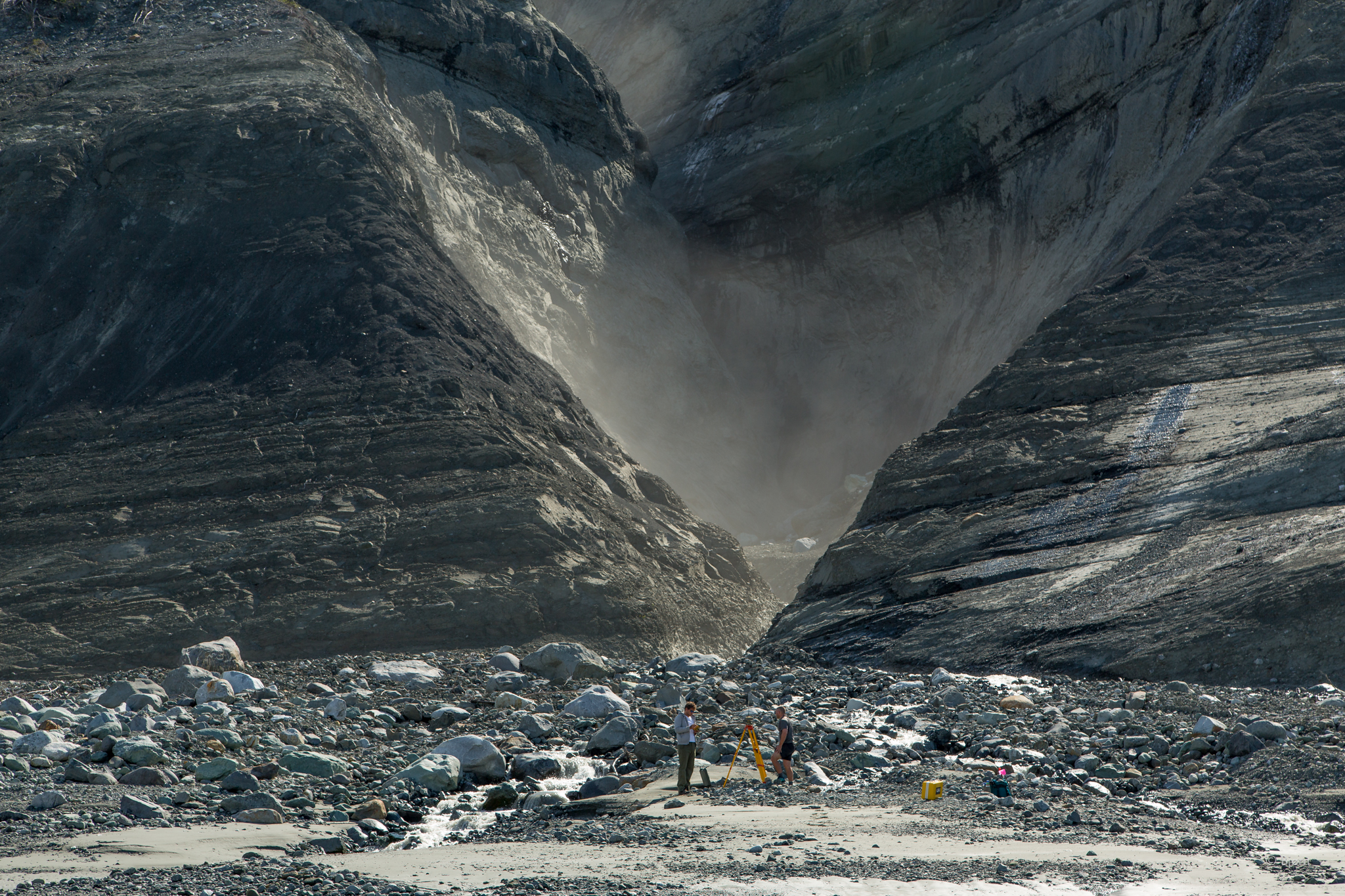
On land, the five of us create a gear-chain and hand scientific equipment and my camera gear up the steep and unstable edge of the shore. Directly across the bay is the massive, cleaved-in-half mountain. The boulders and gravel under my feet had traveled over a kilometer from somewhere within that mountain and were deposited here in a feat of unimaginable violence. “Sometimes geology isn’t slow,” Bretwood Higman, one of the scientists observes.

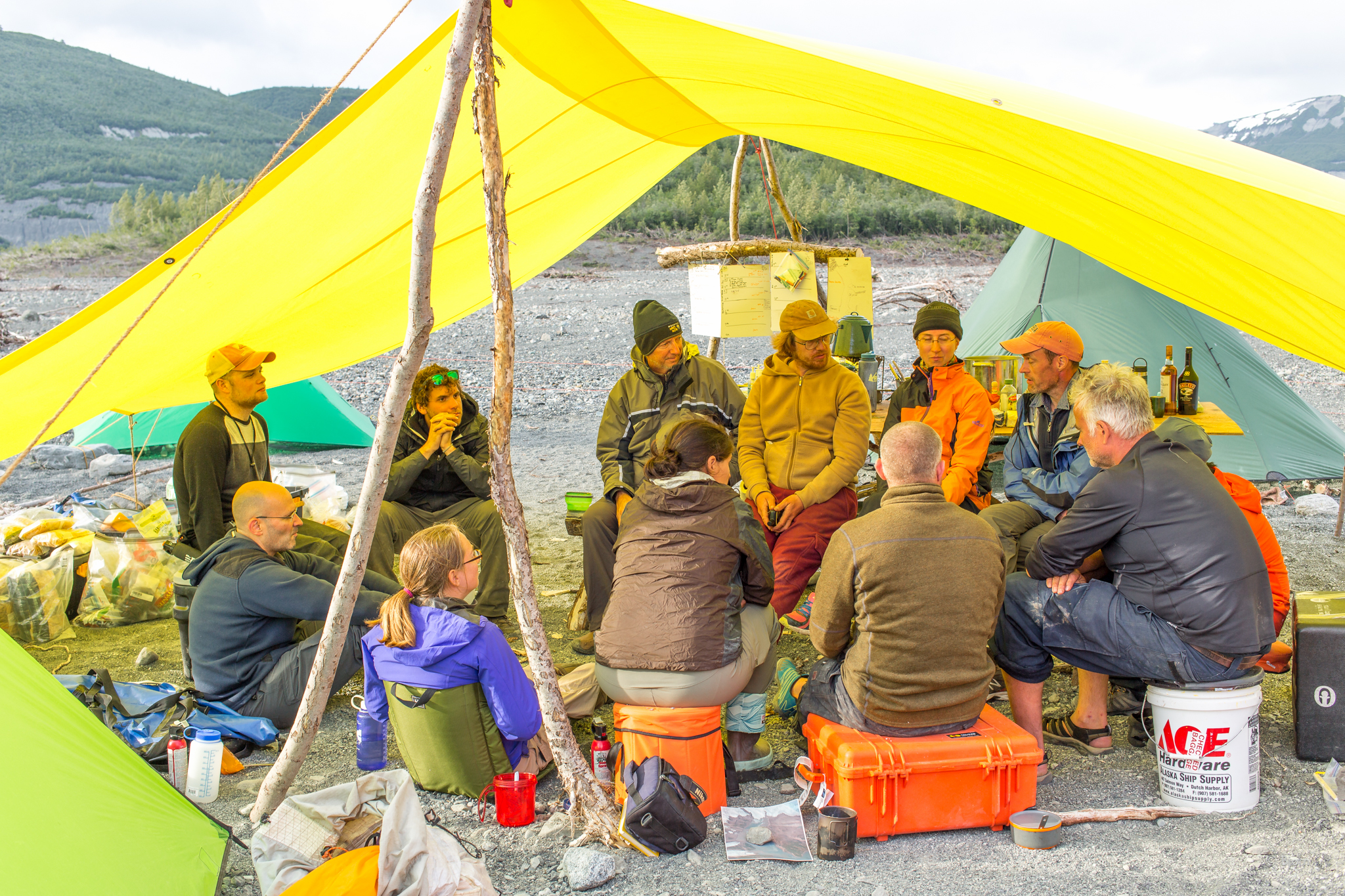
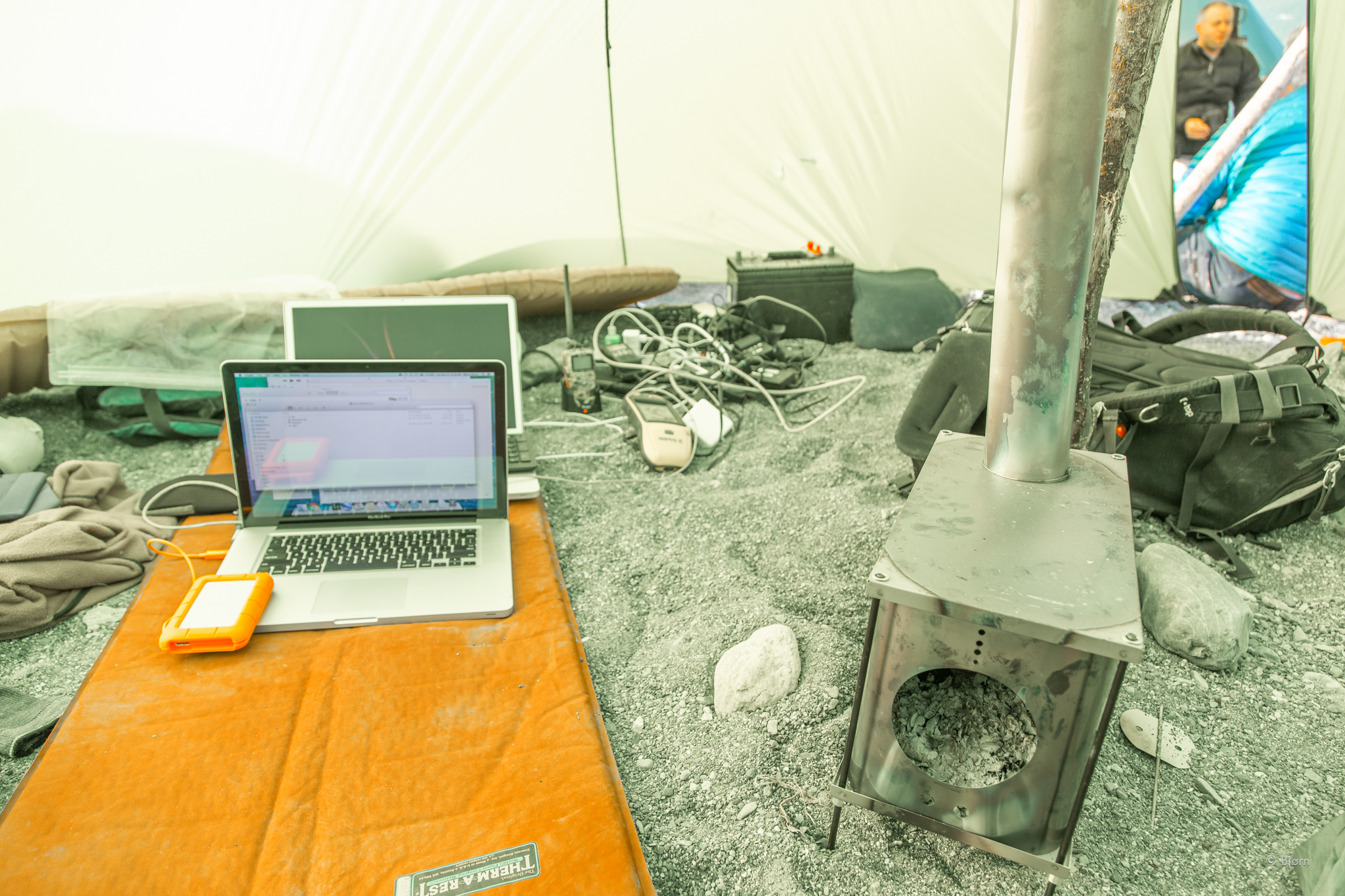
My task is to document what the “crime investigators” learn about the Icy Bay landslide-generated mega-tsunami - to tell their story of geologic and hydrologic discovery.

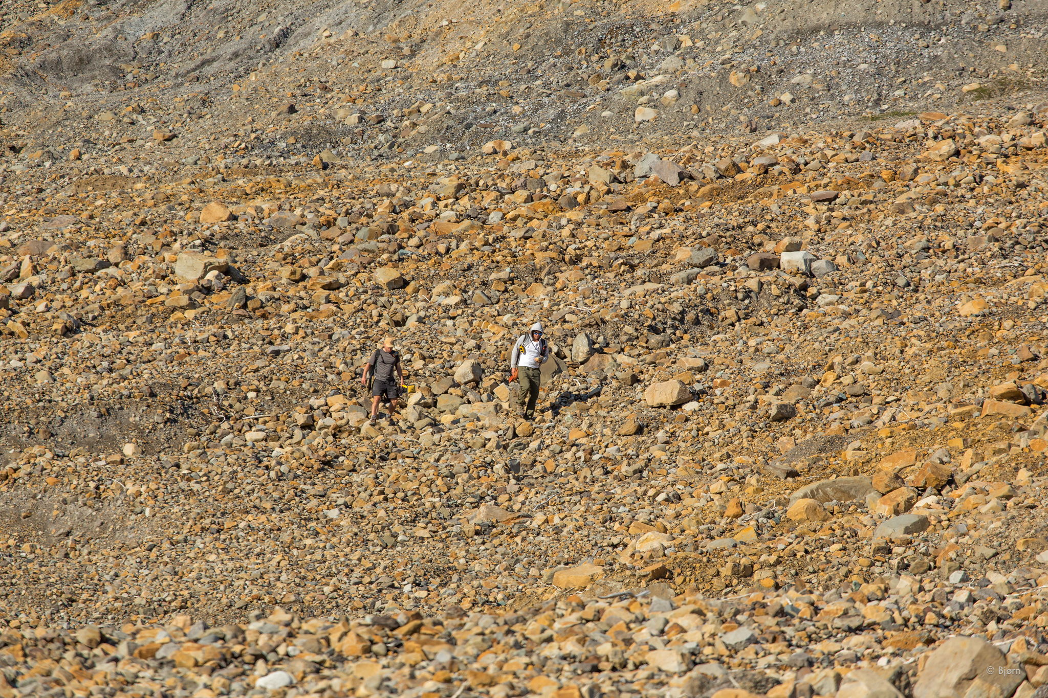
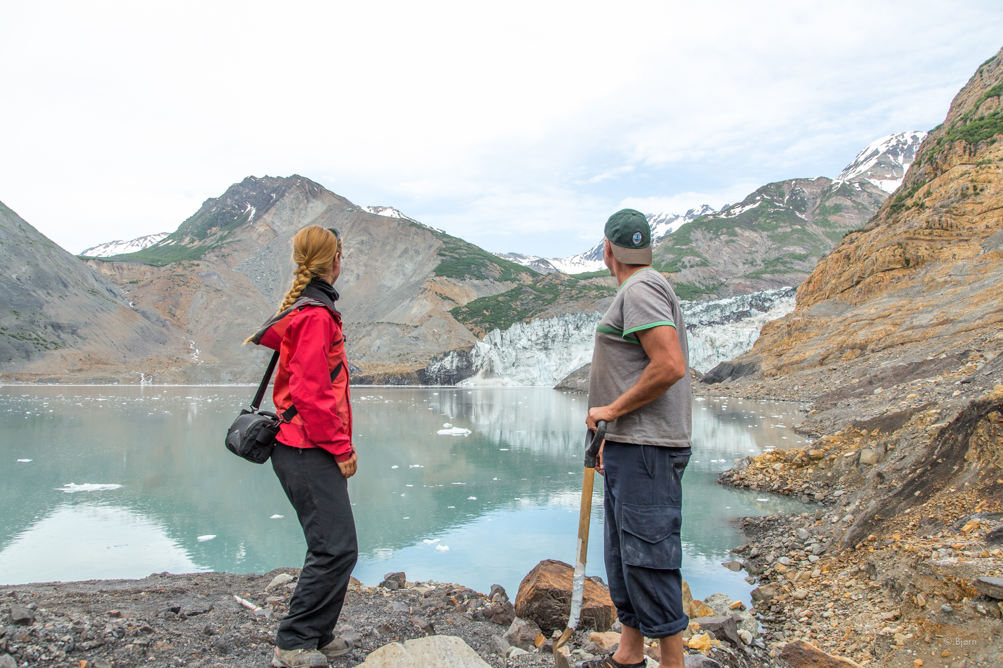
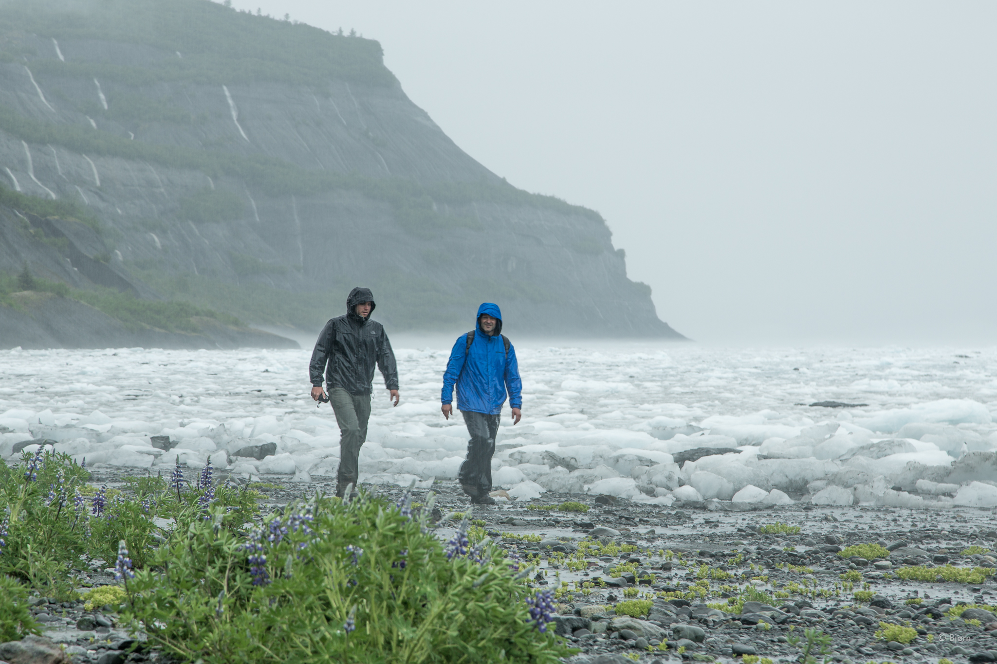
After shooting video from the shore we wave goodbye to Scott, who will spend the day fishing, while we walk up the valley to find the high watermark of the tsunami.

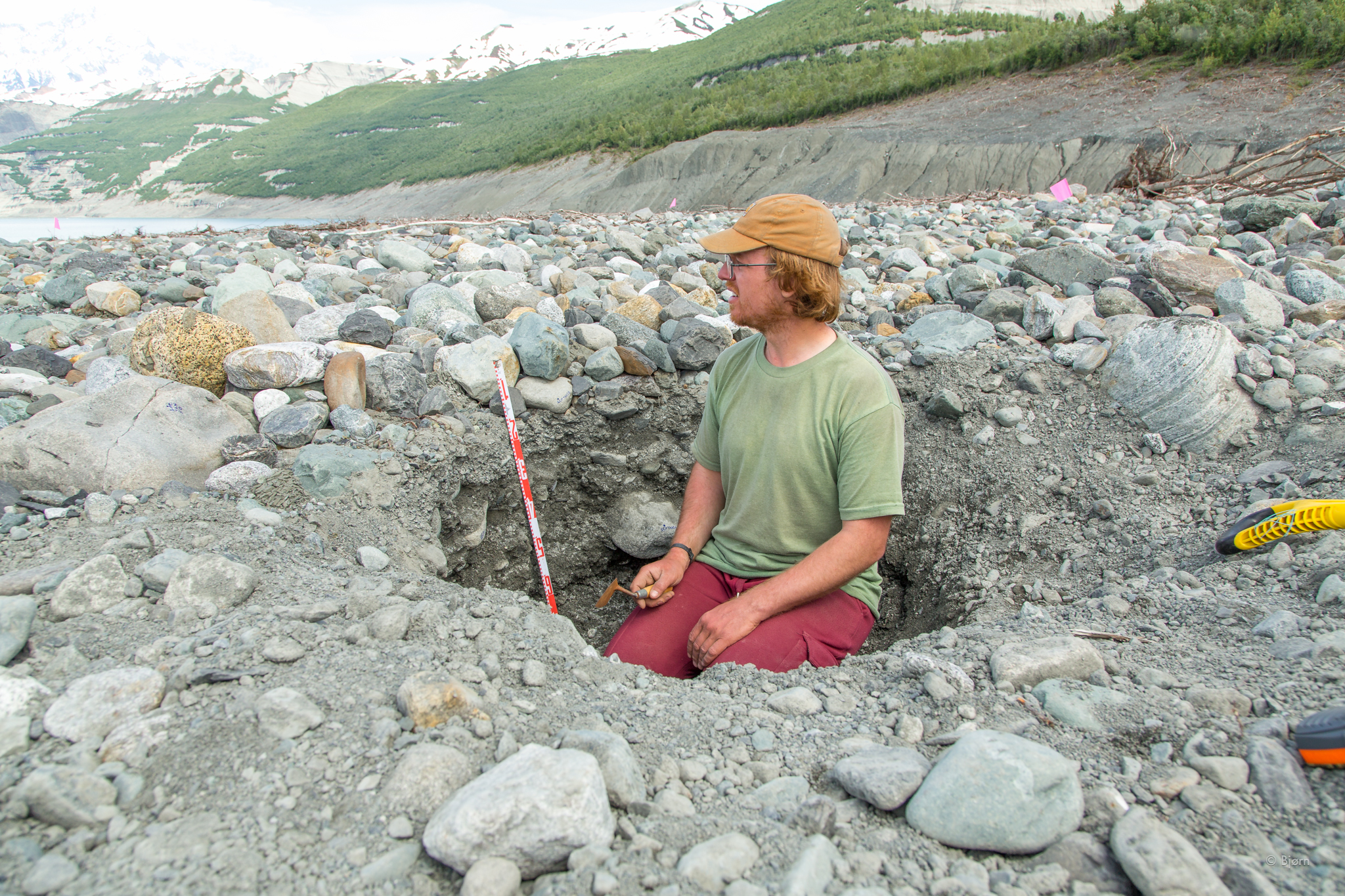
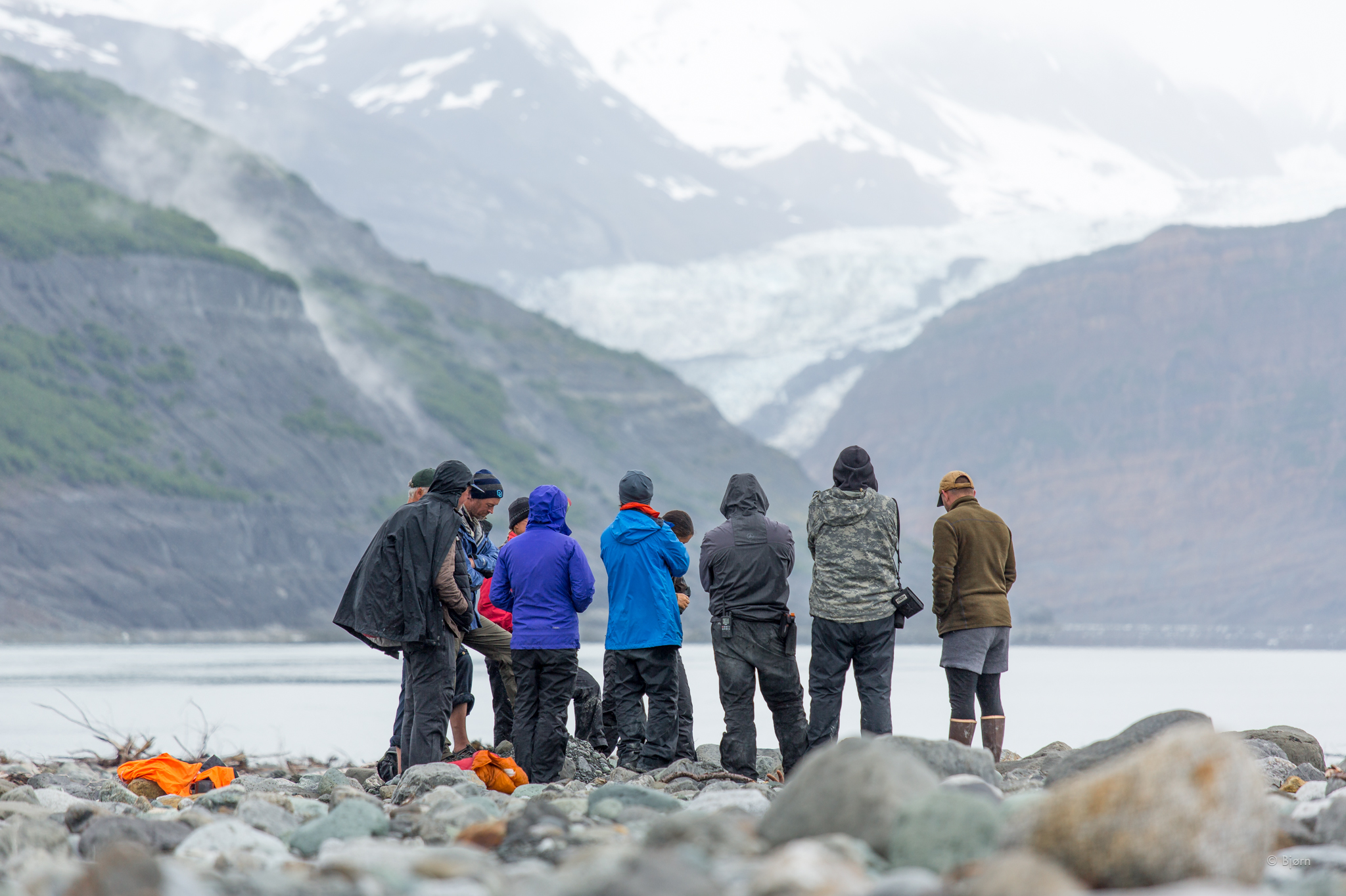
The National Science Foundation has funded this series of investigative expeditions. Scientific inquiry is why we are here. “It’s like a perfect experiment,” Colin Stark, one of the geologists says. “Find the remotest place in north America where a massive landslide and tsunami occurred, without loss of life or destruction to infrastructure. Run a host of experiments and make observations. Learn from that, and apply it to building some sense of what will happen when a similar event occurs, which will inevitably happen in a much more populated area.”

6O2C01321Bjørn Olson,_.jpg
6O2C03363Bjørn Olson,_.jpg
6O2C03484Bjørn Olson,_.jpg
6O2C04511Bjørn Olson,_.jpg
6O2C05062Bjørn Olson,_.jpg
6O2C07113Bjørn Olson,_.jpg
6O2C09741Bjørn Olson,_.jpg
6O2C10001Bjørn Olson,_.jpg
6O2C10912Bjørn Olson,_.jpg
6O2C11313Bjørn Olson,_.jpg
6O2C11354Bjørn Olson,_.jpg
6O2C11735Bjørn Olson,_.jpg
6O2C12301Bjørn Olson,_.jpg
6O2C13242Bjørn Olson,_.jpg
6O2C15241Bjørn Olson,_.jpg
6O2C15612Bjørn Olson,_.jpg
6O2C20211Bjørn Olson,_.jpg
6O2C20772Bjørn Olson,_.jpg
6O2C21443Bjørn Olson,_.jpg
6O2C21704Bjørn Olson,_.jpg
6O2C22435Bjørn Olson,_.jpg
6O2C22836Bjørn Olson,_.jpg
6O2C23157Bjørn Olson,_.jpg
6O2C23328Bjørn Olson,_.jpg
6O2C23679Bjørn Olson,_.jpg
6O2C25051Bjørn Olson,_.jpg
6O2C25282Bjørn Olson,_.jpg
6O2C01321Bjørn Olson,_.jpg 6O2C03363Bjørn Olson,_.jpg 6O2C03484Bjørn Olson,_.jpg 6O2C04511Bjørn Olson,_.jpg 6O2C05062Bjørn Olson,_.jpg 6O2C07113Bjørn Olson,_.jpg 6O2C09741Bjørn Olson,_.jpg 6O2C10001Bjørn Olson,_.jpg 6O2C10912Bjørn Olson,_.jpg 6O2C11313Bjørn Olson,_.jpg 6O2C11354Bjørn Olson,_.jpg 6O2C11735Bjørn Olson,_.jpg 6O2C12301Bjørn Olson,_.jpg 6O2C13242Bjørn Olson,_.jpg 6O2C15241Bjørn Olson,_.jpg 6O2C15612Bjørn Olson,_.jpg 6O2C20211Bjørn Olson,_.jpg 6O2C20772Bjørn Olson,_.jpg 6O2C21443Bjørn Olson,_.jpg 6O2C21704Bjørn Olson,_.jpg 6O2C22435Bjørn Olson,_.jpg 6O2C22836Bjørn Olson,_.jpg 6O2C23157Bjørn Olson,_.jpg 6O2C23328Bjørn Olson,_.jpg 6O2C23679Bjørn Olson,_.jpg 6O2C25051Bjørn Olson,_.jpg 6O2C25282Bjørn Olson,_.jpg

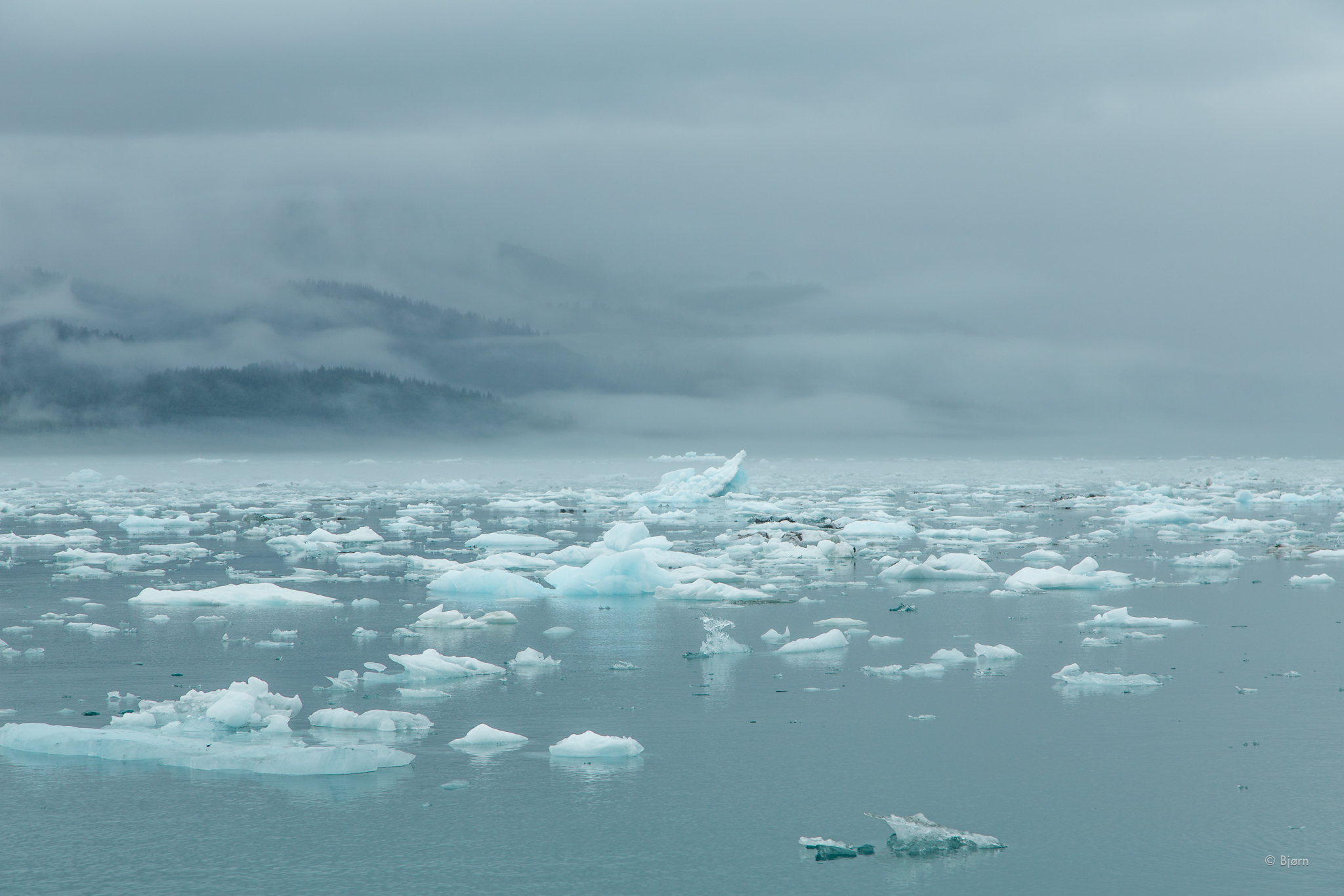
Landslide tsunamis have happened in Alaska before. Most notably was the 1958 Lituya Bay landslide and tsunami, which created a wave 1720 feet high – the highest wave ever recorded. What is unique about the Icy Bay landslide and tsunami is that scientists are able to study it so soon and with a suite of state of the art equipment.

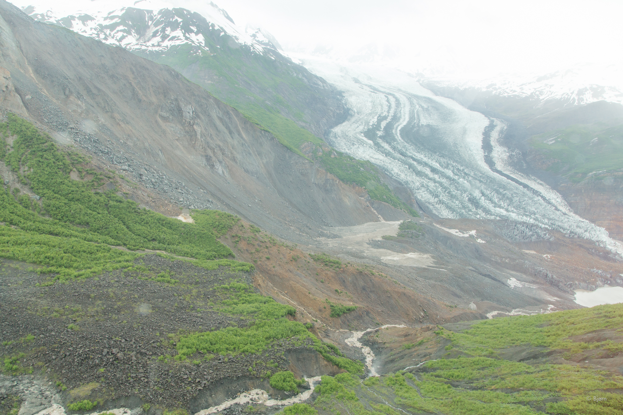
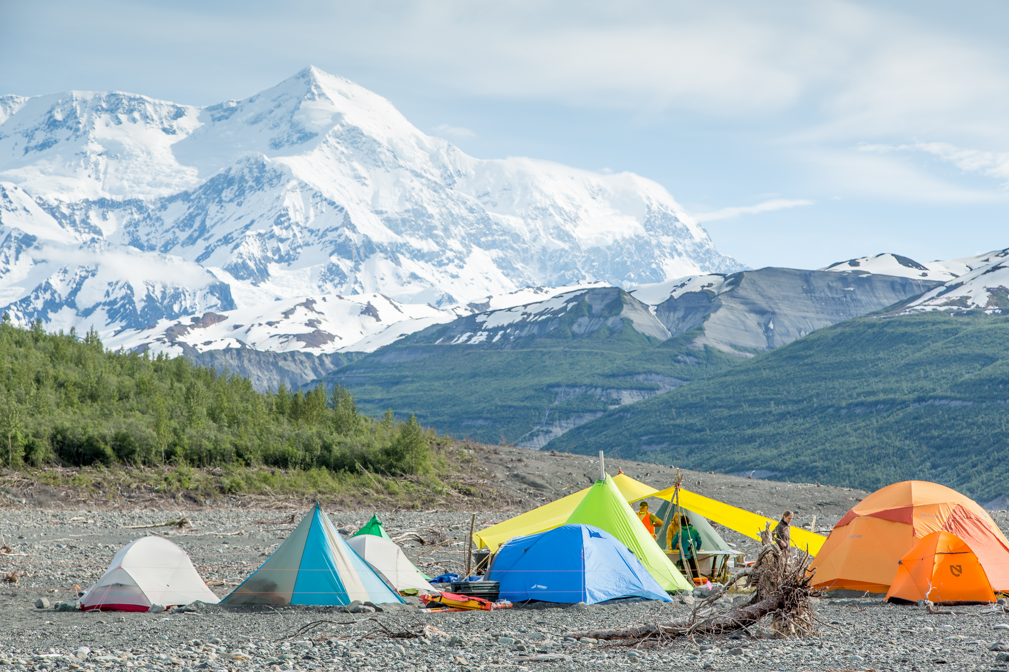
Alaska’s rapidly warming climate – twice that of the global average - is related to this catastrophe. Icy Bay was as recently as the early 1960s filled with glaciers to the mouth of the bay with ice as thick as 1000 feet. This rapid de-glaciation and de-buttressing of the hill slopes is at least part of the reason for the instability, which led to the landslide. Other areas of Alaska and Norway are experiencing similar phenomena much nearer to tourist destinations and communities.

“This is happening in environments that the Park Service manages,” Eric Bilderback, a National Park Service geologist says. “We should take this opportunity to learn where nobody was hurt so we can maybe be proactive about the things where people could be hurt.”

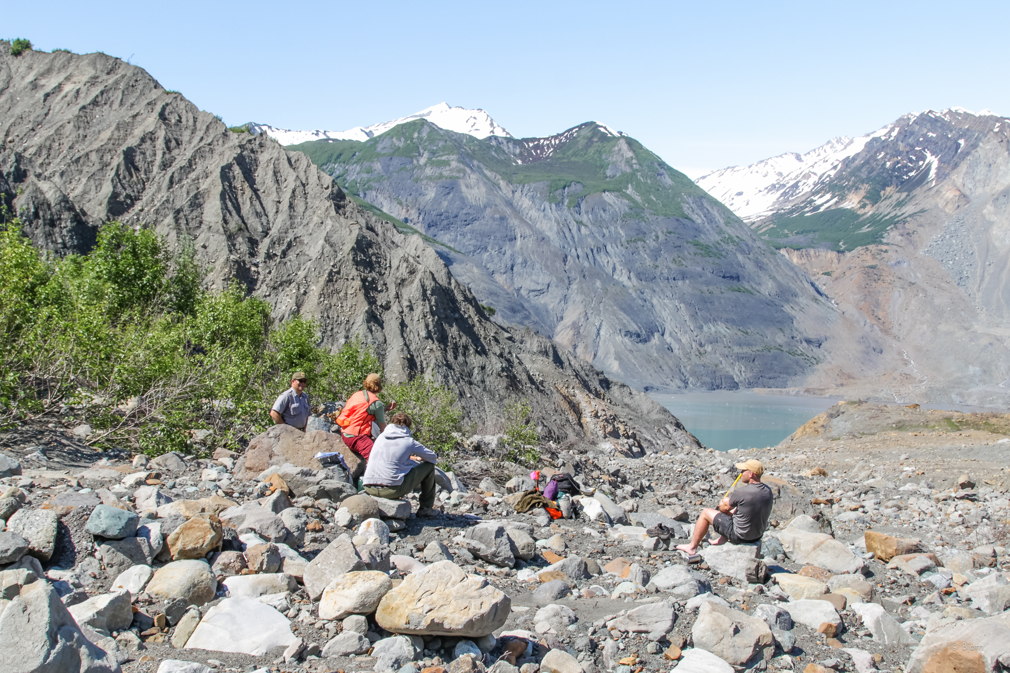
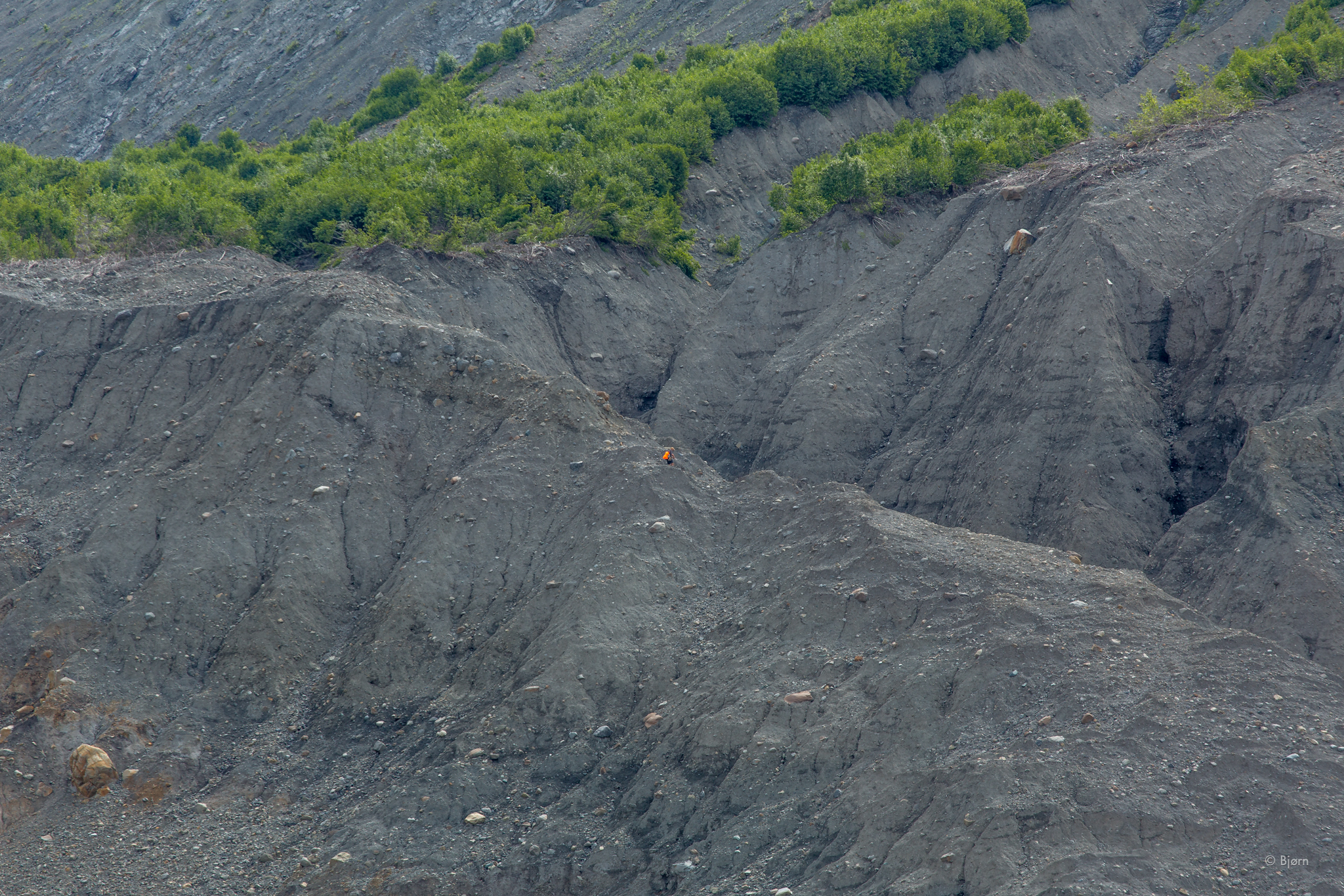
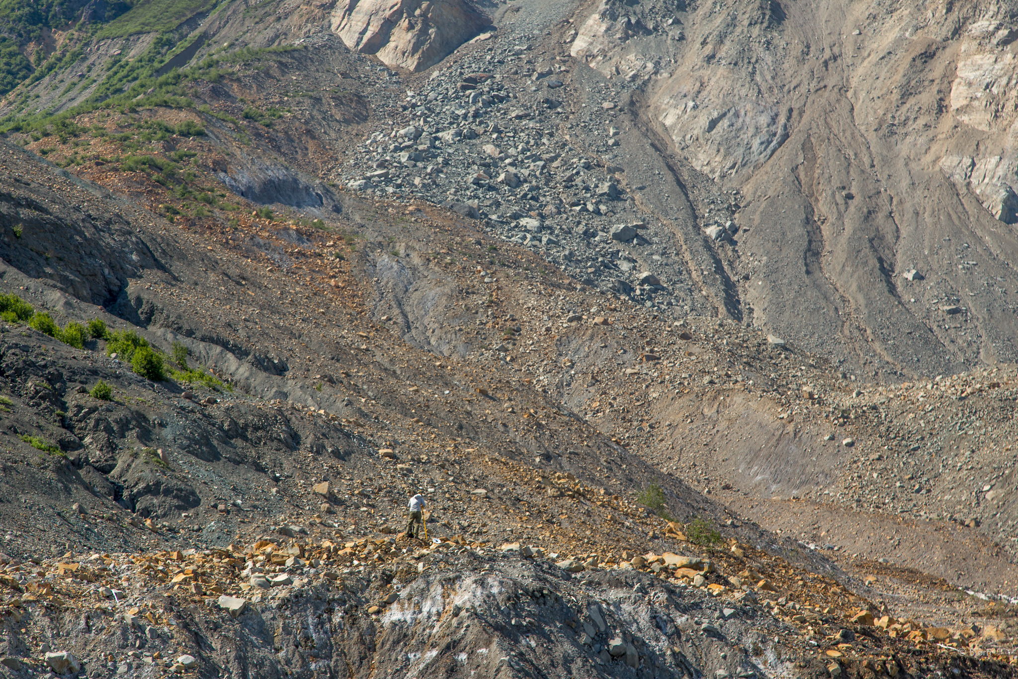
After gaining 600 feet of elevation in our mile-long hike, I take off my backpack and drink a long slug of water. The day is warm and we’ve all sweat under our loads.  We are standing at the trim-line where the rush of water scoured the brush and left only bare rock. The team looks for evidence of broken branches or out of place sediment above the line – trying to locate the absolute highest run-up. They finally make the call – 187 meters, or 613 feet.

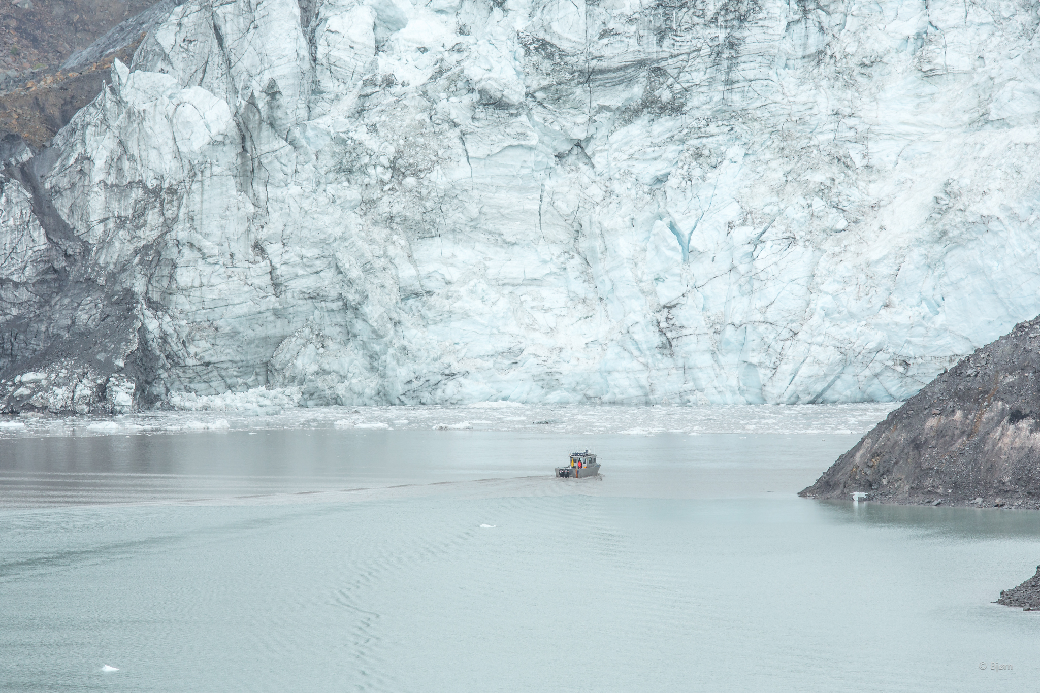
I turn around and face the fjord. The charter boat, anchored in the middle, is now a tiny dot below us. Directly behind the boat is the cleaved mountain. I try to imagine the force, the violence, and I come up short. Geology may not always be slow; thankfully it usually is.

Watch the film, Icy Bay Mega-Tsunami.

In Environment Tags Alaska, Icy Bay, Tsunami, Landslide, Climate Change
1 Comment

Landslide Generated Tsunami in Icy Bay

June 13, 2016 Bjørn Olson
Taan Glacier with landslide debris. 

Taan Glacier with landslide debris. 

In October of 2015 a massive landslide occurred in a remote area of coastal Alaska. Seismologists, who usually pick-up and decipher earthquakes, noted a unique low-frequency wave pattern on their instruments – the pattern looked like a landslide, and a big one. They sent the information along to a tsunami expert and within days it was determined that the event had occurred in Taan Fjord – an arm of Icy Bay.

Over the winter experts from around the world began reaching out to each other and eventually it was decided to put together an expedition funded by a National Science Foundation (NSF) grant. The goal was to get as many disciplines from the related fields of study into the field and uncover the mysteries of this fantastic event as soon as possible, before erosion, glacial retreat and other processes sullied the evidence.

I joined the team, as videographer and documentarian, with sedimentologists, tsunami modelers, surveyors, landslide specialists, engineers, and other earth researchers. Like the good burglar Bilbo Bagbins I was the lucky 14th member.

6O2C23679Bjørn Olson,_.jpg
6O2C23328Bjørn Olson,_.jpg
6O2C23157Bjørn Olson,_.jpg
6O2C22836Bjørn Olson,_.jpg
6O2C237610Bjørn Olson,_.jpg
6O2C22435Bjørn Olson,_.jpg
6O2C21704Bjørn Olson,_.jpg
6O2C21443Bjørn Olson,_.jpg
6O2C20772Bjørn Olson,_.jpg
6O2C20211Bjørn Olson,_.jpg
6O2C23679Bjørn Olson,_.jpg 6O2C23328Bjørn Olson,_.jpg 6O2C23157Bjørn Olson,_.jpg 6O2C22836Bjørn Olson,_.jpg 6O2C237610Bjørn Olson,_.jpg 6O2C22435Bjørn Olson,_.jpg 6O2C21704Bjørn Olson,_.jpg 6O2C21443Bjørn Olson,_.jpg 6O2C20772Bjørn Olson,_.jpg 6O2C20211Bjørn Olson,_.jpg

Better understanding of geo-hazards, landslides, and tsunamis leads to better public policy, city planning, engineering and other human-related developments. In this time of rapid de-glaciation and climate change it is very likely we’ll be seeing more of these types of landslides in coastal Alaska and other glacial regions around the world.

Many of the researchers on this expedition have studied earthquake-generated tsunamis in Indonesia, Japan and other places where loss of life and property was profound. To study a landslide generated tsunami in a remote fjord is not without challenges but it also provides a fantastic natural laboratory, where no loss of human life occurred.

Over the next few years, data generated from this expedition and another in August of this year will be crunched and models will be created. This tsunami was the largest (600 feet) anyone has yet to study so soon after the event and the instruments used are state of the art. It seems likely that what was uncovered from this expedition will be useful around the world for many decades to come. 

6O2C26111Bjørn Olson,_.jpg
IMG_94351Bjørn Olson,_.jpg
6O2C03484Bjørn Olson,_.jpg
6O2C03363Bjørn Olson,_.jpg
6O2C01862Bjørn Olson,_.jpg
6O2C01321Bjørn Olson,_.jpg
6O2C25282Bjørn Olson,_.jpg
6O2C25051Bjørn Olson,_.jpg
6O2C15612Bjørn Olson,_.jpg
6O2C15241Bjørn Olson,_.jpg
6O2C13242Bjørn Olson,_.jpg
6O2C12301Bjørn Olson,_.jpg
6O2C11735Bjørn Olson,_.jpg
6O2C11354Bjørn Olson,_.jpg
6O2C11313Bjørn Olson,_.jpg
6O2C10912Bjørn Olson,_.jpg
6O2C10001Bjørn Olson,_.jpg
6O2C09741Bjørn Olson,_.jpg
6O2C07113Bjørn Olson,_.jpg
6O2C05062Bjørn Olson,_.jpg
6O2C04511Bjørn Olson,_.jpg
6O2C31122Bjørn Olson,_.jpg
6O2C30711Bjørn Olson,_.jpg
6O2C26111Bjørn Olson,_.jpg IMG_94351Bjørn Olson,_.jpg 6O2C03484Bjørn Olson,_.jpg 6O2C03363Bjørn Olson,_.jpg 6O2C01862Bjørn Olson,_.jpg 6O2C01321Bjørn Olson,_.jpg 6O2C25282Bjørn Olson,_.jpg 6O2C25051Bjørn Olson,_.jpg 6O2C15612Bjørn Olson,_.jpg 6O2C15241Bjørn Olson,_.jpg 6O2C13242Bjørn Olson,_.jpg 6O2C12301Bjørn Olson,_.jpg 6O2C11735Bjørn Olson,_.jpg 6O2C11354Bjørn Olson,_.jpg 6O2C11313Bjørn Olson,_.jpg 6O2C10912Bjørn Olson,_.jpg 6O2C10001Bjørn Olson,_.jpg 6O2C09741Bjørn Olson,_.jpg 6O2C07113Bjørn Olson,_.jpg 6O2C05062Bjørn Olson,_.jpg 6O2C04511Bjørn Olson,_.jpg 6O2C31122Bjørn Olson,_.jpg 6O2C30711Bjørn Olson,_.jpg

Photo credit: Bjørn Olson, Ground Truth Trekking, and the National Park Service

Tags Ground Truth Trekking, Icy Bay, Climate Change, Landslide, Tsunami, NSF, Glacier
1 Comment

For professional photo shoots, stock photography, videography or filmmaking, please email bjorn@groundtruthtrekking.org for prices and quotes.

Powered by Squarespace